The organizing committee has been working away on various tasks for next September’s FOSS4G conference in Denver. We now have sponsorship details sorted out – you can download the brochure here (PDF). We are offering a 10% discount for any sponsors who commit by the end of January.
We also have a winner in our logo contest, which you can see at our new FOSS4G Denver 2011 web site. We had over 800 votes in total, thanks to everyone who voted! The logo design was an interesting process. Creating a logo is always tricky because you have as many different opinions as people involved in the process! We used a site called crowdspring, as you will know if you voted – multiple people compete to create your logo, which we found worked very well. And then they also have a voting process you can use if you like, which I found very helpful to choose a winner from the multiple good entries.
And as mentioned in passing above, our web site is now up and running - it will have a lot more content added to it over the coming weeks. But check out the timetable leading up to the conference – some significant items coming up are the call for workshops which will be out in mid January, and the call for papers which will be out at the beginning of February.
Tuesday, December 21, 2010
Sunday, December 12, 2010
ArcGIS for iPad: one small step for usability!
I just did an "upgrade all" on my iPad applications, and happened to notice that ArcGIS for iPad v1.5 includes the following enhancement:
We have simplified the experience of identifying locations on the map. A simple tap on the map replaces the Identify Location tool.This is nice to see, since I'd pointed out in a couple of my recent usability presentations that it took a minimum of six clicks, and more typically 9-10 clicks, to display feature information on ArcGIS for iPad, and suggested that perhaps a single tap on the map would be simpler. My voice has been heard!! Or maybe it was just a coincidence :), but either way a big usability improvement for the product, well done ESRI folks!
Don't make me think: Ignite Spatial NoCo 2 from Peter Batty on Vimeo.
Update: hmmm, I just tried it out briefly (rather than just reading the description), and looks as though it still takes 3 clicks to actually see the attributes of a feature, and still has some significant issues distinguishing between features that are close together. So some improvement but not as good as I had hoped.
Wednesday, December 8, 2010
Help us choose the logo for FOSS4G 2011!
As I've mentioned previously, I'm going to be the chair of the FOSS4G 2011 conference in Denver next September, and I wanted to ask for help in choosing our logo. We've been using a cool site called crowdspring, on which people compete to design your logo, with the winner getting a prize. I have been very impressed at the quality of entries. Please take a minute to have a quick look at these entries and vote for the ones you like (you can rate with up to 5 stars), and feel free to add any comments.
Thanks!
Wednesday, December 1, 2010
Ubisense myWorld featured on Google blogs
Today I had a guest post about Ubisense myWorld published on the Google Geo Developers and Google Enterprise blogs, check it out! Thanks to Mano Marks of Google for working with me on this.
Sunday, November 28, 2010
FOSS4G Denver 2011 venue preview
Now that wherecamp5280 is out of the way for this year, I'm getting excited about organizing FOSS4G 2011 here in Denver next September (in case you missed the news, I'll be the conference chair). This will be a rather larger event - we're expecting 1000 or so attendees.
I walked down to the Sheraton in downtown Denver the other day to take some pictures for marketing purposes (for the web site and brochures, etc), and I really think it's going to be a great venue for the conference. Here are some pics ...

All the conference sessions will be within the hotel itself, and a large new bar connected to the hotel lobby is nearing completion, which will have 130 different beers on tap (I will try to do my conference chair's duty and sample all of them once it opens, later in December!). So that should all be conducive to great socializing and networking. Right across the street there's an excellent assortment of reasonably priced "fast but fresh" food places, so loads of convenient food options very close by, though of course the conference will be well catered! Plus there are literally hundreds of bars and restaurants within walking distance - the location gets an outstanding score of 95 for walkability at walkscore:
All the conference sessions will be within the hotel itself, and a large new bar connected to the hotel lobby is nearing completion, which will have 130 different beers on tap (I will try to do my conference chair's duty and sample all of them once it opens, later in December!). So that should all be conducive to great socializing and networking. Right across the street there's an excellent assortment of reasonably priced "fast but fresh" food places, so loads of convenient food options very close by, though of course the conference will be well catered! Plus there are literally hundreds of bars and restaurants within walking distance - the location gets an outstanding score of 95 for walkability at walkscore:

On top of that, there are free shuttle buses that run continuously up and down 16th Street right outside the hotel, which makes it easy to get a little further afield around the downtown area.
I'll be sharing lots more about the conference plans over the next few months, stay tuned!
Wednesday, November 24, 2010
WhereCamp5280 review, and thoughts on unconferences
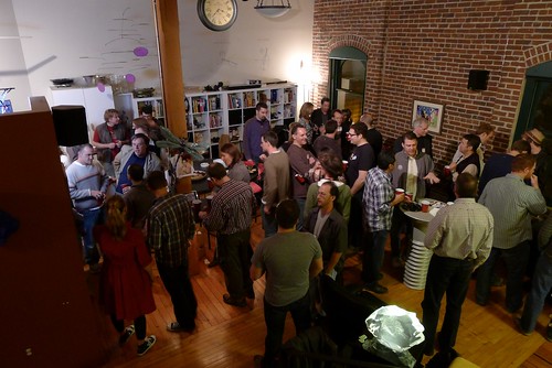
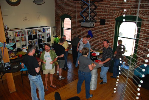
Last week we held the second annual wherecamp5280 unconference in Denver, and I think it was a great success again. The first one was organized by me, Eric Wolf and Ben Tuttle, and this year Steve Coast took the lead on organizing the main day while I did the social event, Chris Helm and Sean Gillies organized a hack day beforehand (aka hooky bobbing, courtesy of Sean, a new term to me I have to admit!), and Hurricane Coast took the lead on a follow up ski (and xylophone) mapping event. There have been several good reviews already from Andrei, James and Michael.
As those reviews mention, a couple of big hits in terms of topics were Google Fusion tables (unfortunately I missed Josh Livni's talk as I had to leave early to organize the party) and a lot of interesting discussion around HTML5, Polymaps and other items relating to handling vector graphics in browsers - Chris Helm did a great ad hoc talk on the latter topic which generated a lot of good discussion, and there was a lot of discussion at the hack day on this. I also enjoyed Eric Wolf's talk about the work that USGS has been doing with the OpenStreetMap software stack combined with USGS data, and Steve Davis's talk on how he created some really nice basemaps for City of Atlanta. I felt the overall event was a good integrated mix of "neo" and "paleo" topics and experiences, without using those labels or worrying about them (which is how it should be).
I felt, as did several others I talked to, that last year's event was excellent but this year's was even better. There were actually fewer people this year, 70-something versus 100ish, but a stronger set of sessions this year and more interaction, as well as more people at the party :) !! There was a great assortment of interesting geo-people, and a (pleasantly) surprising number who flew in from out of town. I go to a lot of conferences, and continue to think that the unconferences I've been to rank right up there with the best events I've been to. Steve wrote a post with his perspectives on organizing an unconference, and how it took 6 hours of his time (which excludes the party organization, by the way!). This raises the interesting question of whether all the time that people invest in traditional conferences is really worthwhile (especially since I'm chair of the upcoming FOSS4G event!), and for small events I think it really is a valid question, though I don't think the unconference model can scale up too much or it loses its informality and interaction, which are really the things that make it so good. The 75 people or so that we had this year felt like a good size.
This year we had less organization than last year. There was only one pre-arranged talk this year - Steve asked me to do a short 20 minute keynote to kick things off, and that was only fixed a week in advance, and wasn't publicized ahead of time (now everyone knows why Steve was busy beforehand). The previous year we did a little more to get a few speakers lined up ahead of time and we publicized them and potential talks. We felt we needed to do that in order to get reasonable attendance, and to persuade sponsors to support us, since it was the first time we were doing the event, and a lot of potential attendees really didn't know what an unconference was all about. Personally I don't think that those slight differences in "pre-organization" made a material difference to why this year was even better than last year. It's really down to how many people come ready to talk about interesting things, which more people did this year. And it's hard to manage that or predict it, but I think a lot of it has to do with it being the second year of the event, and we had such a great buzz this year that I'm sure that will contribute to another great event next year! Talking of which, there was some casual discussion afterwards about whether there would be a wherecamp5280 next year, since we have a geo-extravaganza of bigger conferences coming to town, and a lot of us who have been involved in organizing wherecamp5280 will be heavily involved in those. I think there was a sentiment that people would like to keep it going and not lose the momentum that we have. And that momentum should mean that it will take even less than 6 hours to organize next year :), so I think it's highly likely there will be another one in 2011, probably earlier in the summer.
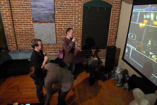
And last but not least those who stayed late at the party got to witness a quite extraordinary sequence of geo-karaoke duets from the legendary James Fee and Andrew Turner. I am still debating whether to release some video footage or whether to honor James' plea that "what happens at wherecamp5280 stays at wherecamp5280" :).
Thursday, October 21, 2010
Triple geo-conference goodness coming to Denver!!
Denver has always been known as a center for geospatial activity, and we have a great triple bill of events lined up, one in the near future and two back to back in September 2011.
The one coming up is WhereCamp5280 on November 19th. Eric Wolf, Ben Tuttle and I ran the inaugural one last year which was a great success, see James Fee's review. I hear a rumor that James will be back this year, so I guess he must have liked it! Eric and I have both been a bit swamped on other things recently, so Steve Coast has kindly taken up the organizing reins this year, thanks to Steve for that! Last year we were kindly hosted for free by Denver University (DU), this year we will be at University of Colorado Denver on their Auraria Campus, which has the advantage of being within easy walking distance of downtown. And this year we've decided to do one day rather than two. But two things that haven't changed since last year is that the event is FREE, and we'll be holding the social event on Friday evening at my loft, I expect there will be plenty of geo-beer from the Wynkoop Brewing Company downstairs and that may fuel some geo-karaoke later on. All this is thanks to our kind sponsors, who at the time of writing include Enspiria Solutions, ESRI, Google, MapQuest and Waze.
I'm expecting a great group of interesting attendees and presentations again this year, so highly encourage you to come along. And remember it's an unconference, so we are looking for as many people as possible to participate - prepare a short presentation or come prepared to lead a discussion on a topic that interests you!
Sign up for WhereCamp5280 here, and if you feel like sponsoring at anywhere from $16 to $1024 (can you tell that a techie geek set the sponsorship amounts?!) that would be great, but otherwise just sign up and enjoy the great free education, networking, and beer :).
So WhereCamp5280 is a great local event, but in September 2011 the global geo community will be converging on Denver for a fantastic double bill of FOSS4G and SotM.
For those who don't know, FOSS4G stands for Free and Open Source Software for Geospatial and is an annual international gathering organized by OSGeo. The last North American event was in 2007 in Victoria, BC, and since then it's been in Cape Town, Sydney and Barcelona, so we're delighted to have Denver join that list, and expecting a great turnout from around the world.
Eric Wolf and I led the bid to bring FOSS4G to Denver (which is one of the things we were busy on that was competing for time with WhereCamp5280). Eric was originally slated to be the conference chair, but unfortunately due to circumstances beyond his control he has had to stand down from that, and I have just taken over that role in the last week (well unless the OSGeo board fails to approve the change at their next meeting, but I'm assured that's not very likely!). I'd like to publicly thank Eric for all the work he did to bring the conference here - it was his idea initially, and definitely wouldn't have happened without all his efforts. We have the core of a great local organizing group set up already, but are still interested in recruiting a couple more folks, so if you'd like to help out please let me know. It's going to be a great event, and I'll be blogging plenty more about it over the coming months.
And on top of that it was announced today that Denver has also been selected to host State of the Map (SotM), the global OpenStreetMap conference, also in September 2011. I attended SotM in Amsterdam in 2009 and thought it was a fantastic event. Unfortunately I wasn't able to make it this year, but I will definitely be there next year :) ! The two events are distinct, but several people were involved in both bids, and we recognized that a lot of people would be interested in attending both, so the intent is for them to run back to back. The SotM date isn't fixed yet, but FOSS4G is locked in for September 12-16.
So if you're in the Denver area already, plan to be at WhereCamp5280 on Nov 19, and if you're not, make plans to be here in September 2011!
Thursday, September 16, 2010
Using Google Maps to broaden the reach of GIS: Ubisense myWorld
Readers of my blog will know that for several years I have been advocating that Google Maps and other "neogeography" systems have a strong role to play in more traditional GIS application areas. In recent months I've been quite busy working on making this a reality, and last week at the Smallworld User conference in Baltimore we announced a new product called Ubisense myWorld. I'm really excited about what we've come up with. Check out the video demo, and read on below for more information (demo video best viewed in full screen, HD, no scaling).
Ubisense myWorld demo from Peter Batty on Vimeo.
Our initial focus has been on using myWorld with GE Smallworld data (for those not familiar with GE Smallworld, that's where I used to work a few jobs back, and they are still the market leader for GIS in utilities and telecom). However, we are using the excellent Arc2Earth Cloud as the repository for our geospatial data in the cloud (running on Google App Engine), which has comprehensive support for uploading ESRI data, so we can integrate with ESRI too. And much of our functionality is quite applicable to other application areas. So if you might be interested in using myWorld outside a Smallworld environment, let me know!
We've had a really strong emphasis on usability - our aim is that people should be able to use the system with no training. We display all the asset data as raster tiles, which is essential for scalability - Smallworld data models tend to be among the most dense of any GIS applications, with very detailed network data, and tables often running into millions of records. But you can select anything with a single click on the map, which sends a query to the spatial database hosted in Arc2Earth (using a REST API, for those interested in that sort of thing) to get the relevant attribute information. We've found performance to be excellent with this approach.
We've implemented a very fast Google style single box search across the whole geospatial database (well, whichever tables and columns the administrator designates), so users don't need to know any technical details about table names, field names or query structures to find what they are interested in - they can just start typing a pole number, asset id, customer name, etc and we have an autocomplete capability that will show them a list of options to choose from. This uses Google's App Engine datastore, which is based on BigTable, the same technology that powers Google Search, so is obviously very fast and scalable.
Another cool feature, which I haven't seen elsewhere yet done in the same way that we've done it, is tight integration with Google Street View. When you click on an item on the map, like a pole or a customer, we calculate the best street view to show you what that looks like (where one exists - it doesn't in all cases, as not everywhere is covered by street view). So far in our testing, the data has matched up better than I thought it would, with the automatic calculation working well in most cases. However, in some cases there will be mismatches between the data in the GIS and the data in street view, so we make it easy to adjust the view and save it, so that next time you click on the same item it will remember the adjusted view. This street view capability is one of the main reasons we decided to use Google Maps rather than the various other options out there.
We also see a lot of potential for the idea of "enterprise mashups" - being able to easily pull data from other systems within an enterprise that also contain spatial data, like outage management, vehicle tracking, work management, and customer information systems, as well as data from external sources like traffic, weather and more.
Since the application is just based on JavaScript with no plug-ins, it also runs really nicely on the iPad, and on smart phones like the iPhone and Android (with a modified user interface for the phones, to accommodate the smaller screen size). We think that all of these devices have great potential for use in the field.
We are just scratching the surface with what we're showing so far - we have a long list of ideas for more things we want to do, while at the same time maintaining a very strong focus on keeping the user interface super simple. I'll post more in due course about some more detailed aspects of what we've been doing.
You also can see some of my broader perspectives behind what we're doing in the presentation I did at the Smallworld user conference in Baltimore last week:
Smallworld and Google: the best of both worlds from Peter Batty on Vimeo.
Wednesday, September 15, 2010
Recent presentations #2: "Don't make me think" talk at Ignite Spatial NoCo 2
Here's my 5 minute talk from Ignite Spatial NoCo (Northern Colorado) last night, on usability for geospatial applications. It was a fun event as usual. Thanks to Glenn Letham for the raw video, which I mixed with my slides to create this version.
Don't make me think: Ignite Spatial NoCo 2 from Peter Batty on Vimeo.
Recent presentations #1: "Geospatial Revolution" keynote talk at NSGIC
As mentioned previously, I've had a burst of conference presentations recently. Here's the video of my keynote talk at NSGIC, the latest iteration of my "geospatial revolution" talk. It includes a short demo of our new Ubisense myWorld product, more coming about that very shortly, and a fair bit of new material on topics like usability and the cloud.
Got some good feedback on twitter, here are a few samples to encourage you to watch :) !!
mapbutcher if you haven't watched @pmbatty then you must! http://vimeo.com/14949601
LearonDalby #gisrockies #GITR Glad yalll are getting to see that presentation. @pmbatty is a great guy and presentation was awesome, but you knew that.
DruidSmith Great talk by @pmbatty! Touched on many of my core areas of interest...
LearonDalby I am withdrawing my presentation from #nsgic after seeing @pmbatty keynote.
Thanks all! And thanks to NSGIC President Will Craig for the invitation to speak.
NSGIC keynote: The Geospatial Revolution from Peter Batty on Vimeo.
Wednesday, September 1, 2010
Hello again, and upcoming events!
As a few people have remarked to me recently, I haven't posted anything in a while ... have been otherwise occupied the past few months, between some interesting new work projects and some personal things. But I have quite a few talks coming up, and next week will be launching an exciting new product at the Smallworld User Conference in Baltimore, which is what I've been focused on the past few months, and I'll be blogging about a lot of interesting things relating to that in the near future.
So here's a list of upcoming events:
- I'll be talking on "Smallworld and Google: the best of both worlds" at the Smallworld conference, on Friday September 10 (there's a clue about in the title of the talk :) !!)
- The latest version of my "Geospatial Revolution" talk has a double outing the following week, with keynotes at the NSGIC conference in Minneapolis on Monday September 13, and at GIS in the Rockies in Loveland, CO on Wednesday September 15
- Sneaking in between the previous two on September 14 is the second Ignite Spatial NoCo (Northern Colorado), in Windsor, CO, where the title of my talk is "Don't make me think", after the excellent book of the same name by Steve Krug, which is all about usability, something I've been working on a lot recently. I guess that's kind of a busy stretch, with four presentations at four events in four consecutive working days, plus a product launch right before that :O !! There's a good lineup of speakers for the Ignite event, with Brian Timoney, David Cole, Kate Chapman, Matt Ball and Mano Marks among those I know.
- The week after that it's off to the UK for the Ubisense User Conference, where I'll be talking about Ubisense applications on September 22
- I plan to stay on in the UK for the one day W3G (un)conference in Stratford upon Avon - it being an unconference there's not a formal agenda, but I hope to do a slightly expanded version of the "Don't make me think" talk there, if they'll have me
- And for the benefit of our Danish readers, I'll be doing a keynote at the Geoforum.dk Kortdage in Århus on November 1-3 ... my mother is from Denmark so it's always nice to have an opportunity for a visit there.
In other news, Denver has been selected to host FOSS4G in 2011, the annual OSGeo conference which is being held this year in Barcelona, next week in fact. Congratulations to my friend Eric Wolf for leading the Denver bid, and I'll be one of the local committee supporting him in the organization of that.
I'm looking forward to catching up with old friends at the Smallworld conference next week, which will be the first I've been to since 2004, as I've been off roaming around other parts of the geo universe. Talking of which, I'd better get back to writing some code! Not to mention writing a presentation or two :O.
Wednesday, May 19, 2010
Google's approach to user generated map updates not working?
My friend Greg Johnson found this interesting story saying that Google is hiring 300 people for a year to work "to improve the accuracy of Google Maps", though the commentary is rather uninformed (IMHO!). It doesn't discuss the fact that Google ditched Tele Atlas in the US 7 months ago to use their own data, and were widely perceived as having taken quite a step back in terms of data quality, as reported by various people including me, James, Matt, and Maitri. Google's vision seemed to be that they would improve the data quality over time by allowing users to report errors, but I had questioned whether typical users would be motivated to submit error reports, when it was easier to just switch to using Bing or MapQuest or whoever, who used more proven data from Tele Atlas or NAVTEQ. And most people interested in doing their own mapping are more likely to use OpenStreetMap, so they and others can use the raw data they have created (Google's equivalent, Mapmaker, is only available in some countries, and only lets you use raster map tiles derived from the data you have created rather than the raw data, and only under the terms of the Google Maps API which has various restrictions).
The article says that Google is paying $14.50 an hour, so a back of the envelope calculation for 300 people for a year says that they will be spending around $8.5m on labor alone (excluding overheads), which is not a huge deal for Google, but not insignificant either. Perhaps there is some other grand new plan behind this, but I have to think that this indicates that Google has realized they have a lot of work to do to improve their map data.
The article says that Google is paying $14.50 an hour, so a back of the envelope calculation for 300 people for a year says that they will be spending around $8.5m on labor alone (excluding overheads), which is not a huge deal for Google, but not insignificant either. Perhaps there is some other grand new plan behind this, but I have to think that this indicates that Google has realized they have a lot of work to do to improve their map data.
Monday, May 10, 2010
Location based art: Audio Graffiti
One of the cool things about the Ubisense Real Time Location System (RTLS) is that customers come up with all sorts of interesting applications that we would never have thought of. We have had several artists doing cool things with the system - check out the video below showing "Audio Graffiti" by Zack Settel and Mike Wozniewski, powered by Ubisense. Users can "tag" or "spray" sounds at a location, and other users hear these as they move around the space. Click through on the video for more information.
Audio Graffiti no. 2 from Mike Wozniewski on Vimeo.
Saturday, May 8, 2010
Location and the Internet of Things
Last night I presented at Ignite Spatial NoCo (Northern Colorado) in Fort Collins. There was a great turnout of 200 people and some excellent 5 minute presentations (plus a few that I thought were a bit too much "corporate sales presentations" for an Ignite event). There was a fun map competition, in which teams had to create a relief map of Colorado using an assort of supplied materials like cardboard, egg cartons, cloth, cotton wool, pasta, etc - I was impressed at what everyone came up with! Congratulations to Brian Sullivan for organizing a great event. And thanks to Glenn Letham for videoing the presentations.
You can see my presentation below, which was on "Location and the Internet of Things". The Ignite format allows you 20 slides which advance every 15 seconds, for a total of 5 minutes - it's quite tricky to get the timing right. I will try to post with a few tips on doing Ignite presentations soon, this was my third go at this format.
Update: Glenn has now posted a better quality video of the presentation on youtube (original ustream video included below too, just in case):
And here is the ustream version as a backup (clicking the small play icon at the bottom of the window below seems to work better for me than the large play icon in the middle, an eccentricity of ustream :) !)
Friday, May 7, 2010
Video of GITA panel on geodata creation and sharing
As I had mentioned previously, I moderated a panel at the GITA conference in Phoenix last week called "Not your father's approach to geodata creation and sharing" with a distinguished cast of geo-characters: Steve Coast, founder of OpenStreetMap and Cloudmade, James Fee, blogger and evangelist at WeoGeo, Ron Lake, Chairman and CEO of Galdos, and Andrew Turner, CTO of FortiusOne.
We had a lot of interesting discussion, Joe Francica did a nice writeup, and Dale Lutz said the panel was "the buzz of the conference". So without further ado, here is the video, an hour and 45 minutes long :O !!
We had a lot of interesting discussion, Joe Francica did a nice writeup, and Dale Lutz said the panel was "the buzz of the conference". So without further ado, here is the video, an hour and 45 minutes long :O !!
GITA Panel: Not your father's approach to geodata creation and sharing from Peter Batty on Vimeo.
Maybe I'll try to do an edited highlights version at some point, but don't have time right now! I may also blog a bit on lessons learned from moderating a panel like this. There's a tricky balance between just letting it flow and trying to impose a bit of structure, or cut topics off when they go too long or get into too much detail. Overall I think it worked out pretty well but there are a few things I would do a little differently next time.Tuesday, April 20, 2010
Fantastic upcoming panel at GITA!!
I will be chairing a panel at the GITA conference in Phoenix next week, on Tuesday at 10:30am, and I am excited to have a diverse group of great participants. We will be talking about a broad range of issues relating to data creation and data sharing, and the state of the industry in general.
In alphabetical order the panelists will be :
I’m planning for the discussion to be very flexible and interactive, and I’ll take questions from the audience, but I do have a few topics and questions lined up. The following are some candidates:
In alphabetical order the panelists will be :
- Steve Coast, founder of OpenStreetMap and Cloudmade
- James Fee, best known for his widely read blog, and an evangelist at WeoGeo
- Ron Lake, the original author of GML, and Chairman and CEO of Galdos
- Andrew Turner, CTO at FortiusOne, who generally tries but fails to avoid conference promoters calling him “the father of neogeography”
I’m planning for the discussion to be very flexible and interactive, and I’ll take questions from the audience, but I do have a few topics and questions lined up. The following are some candidates:
- Can crowdsourcing give you good enough quality? What are its limitations?
- What does crowdsourcing do to the notion of “authoritative” data?
- Many OGC standards are based on a technical approach that is 10 years old and predates newer web standards and approaches. Do they have a future or do we need to start again, or significantly rework them?
- What are the limitations of the more lightweight data sharing standards like KML and GeoRSS?
- What are the factors that determine whether a standard becomes widely adopted or not?
- Will Google become the default way we find spatial data (or has it already)? Would this be a good thing or a bad thing?
- Do you think that the traditional GIS vendors will still be around in 5-10 years?
Sunday, April 18, 2010
Thomas the Tank Engine and precision indoor location tracking / RTLS
Apologies for not posting for a while, my new job at Ubisense has been keeping me busy! I spent the last few days at the RFID Journal Live show in Orlando, where we did a fun demo on the Ubisense booth using Thomas the Tank Engine and his sidekick Molly to show how we can do indoor location tracking to six inch (15cm) accuracy in 3D, using just two sensors (most other ultra wideband systems require four sensors to get a 3D location - we can do this because we use Angle of Arrival, AOA, in addition to Time Difference of Arrival, TDOA ... post coming soon to explain more about that).
But in the mean time I thought you might enjoy this rough video from my iPhone showing Thomas and Molly in action (higher quality video to come at some point!).
But in the mean time I thought you might enjoy this rough video from my iPhone showing Thomas and Molly in action (higher quality video to come at some point!).
Monday, February 15, 2010
Location Based Services in 2014 - Part 2
This is part 2 (of 2) of a paper I wrote for the AGI in the UK on the future of location based services, which I have been meaning to publish for a while! This was for their "Foresight Study" to look at where the geospatial industry will be in five years' time. Please read part 1 first!
Impact of changes upon the geospatial industry and upon customers
Based on all these assumptions, we will have the ability to know where more or less everyone is, all the time – but with individuals having control over which people and applications can know their location, at what time.
As with managing social network connections, users will be able to manage a common set of location sharing rules that are used by all applications. For example, work related applications may only be able to access a person’s location during working hours, certain applications or people may only be able to access an approximate location rather than a precise one, and so on. This will be integrated with the more general methods for managing sharing of information with groups of friends / business contacts (so for example you can set a location sharing policy with groups of people defined in other systems like Facebook or LinkedIn).
There will also be widespread mechanisms for determining where you are more precisely than can be done with a GPS (or in situations where GPS does not work well, for example indoors). As mentioned previously, a common one will be using one or more kinds of proximity sensor.
In general with most location services there is a requirement to provide them based on where you are now, but also in many cases based on where you will be in the future. I may want to find a restaurant to eat at right now, or I may want to find somewhere to make a reservation for dinner in the city I will be in tomorrow night. This can be done manually of course, but we will also see increasing integration with calendars, travel reservation systems, etc, to build a model of a user’s future location and enable applications around that.
Location aware phones will be a massive source of crowdsourced data, using both passive and active approaches. Passive approaches – automatic uploading of location data periodically – can be used for things like determining real time speed on roads (and footpaths, cycle paths, etc). Passively captured data can also be used to identify likely changes to road networks or other geospatial data – for example if lots of people are travelling at 30+ mph along a path where there is no recorded road in the database, that is probably a sign that there is a new road there. And conversely if a normally busy road suddenly has no traffic then it is probably closed. Active approaches to crowdsourced data will be discussed in the scenario section.
Scenario(s)
This section includes a few examples of potential usage of the technologies discussed previously.
Highly personalized “what to do” services
There will be widely available services to make suggestions to people on what to do in a given location – combining highly detailed location data with huge amounts of user created data on restaurants, bars, music venues, bands, and so on. Technologies like Amazon’s recommendation engine very much apply here, to look at what other “people like you” like in this area (based on explicit information you provide – “I like sushi” – or implicit information derived from other places you have been, or restaurants you have rated highly, etc).
Sophisticated social planning tools
Location based social planning tools will grow enormously in usage as smart phones and social network usage become pervasive. Currently there are a number of applications that show where your friends are now but they have relatively low adoption, which means that they are still more at the novelty stage rather than being genuinely useful for most people. This will change dramatically over the next 5 years.
Active crowdsourcing for data creation
Crowdsourced geodata creation has huge momentum at the moment, with OpenStreetMap being the most notable example. Easy to use tools on smartphones will make this even more prevalent, especially for simple items like points of interest. More active mappers will use tools that make requests proactively – for example they might get an alert that OpenStreetMap is not sure whether the street they are currently on (or are close to) is correctly named, so please could they validate it.
We will also see significant growth in real time crowdsourced data – for example current gas / petrol prices, how long is the wait for a table at a given restaurant, etc.
“Safe driver” insurance
Car insurance companies will offer discounts for users who participate in “safe driver” programs, where the driver agrees that if her car exceeds the speed limit, this information will be passed back to the insurance company, with penalties resulting when certain thresholds are exceeded (in terms of amount by which the speed limit is exceeded, number of incidents, etc).
This also raises interesting questions in terms of privacy policy and legal issues. Whether or not drivers have signed up for such a scheme, in the event of a multi-car accident it is quite likely that data will exist showing the speed and route of all vehicles prior to the accident. Should the police and insurance companies be allowed to have access to this data? There are valid arguments both ways, but this is an area where technology is possibly developing faster than policy, and this would be a good thing for the AGI to get some focus on. This question and other similar ones will come up with increasing frequency. Under what circumstances (if any) can law enforcement authorities issue a “search warrant” to look at a person’s location information that may be stored with a telecom company or IT service provider?
Enterprise location-based services
In the enterprise, we will see a huge growth in the use of location-based services, driven by their widespread adoption in the mainstream consumer world. Currently most enterprise applications involving location tracking tend to be specialised niche applications, often on specialised hardware like rugged tablet PCs. This is likely to change to make much greater use of mainstream devices like the iPhone, and using commercial services to store and display location information.
This is likely to impact the enterprise in two broad areas: one is that mobile / field based workers will have much better and simpler access to information, using the type of location-based services already mentioned. And the enterprise will have a real time picture of where all its employees are (as well as other resources and assets). Traditionally geospatial applications have been more about documenting and analysing the past, and planning for the future, but there will be significant growth in applications focused on real time information. This will also be driven by other sensor-based information. For example, utilities are seeing significant growth in intelligent sensors on their networks, especially in the electric industry where there is a strong focus on building the “smart grid”. A combination of sensors on the network and location tracking of employees, vehicles and assets will give electric utilities much greater visibility of their operations than they have today.
Summary of 5 key points
Impact of changes upon the geospatial industry and upon customers
Based on all these assumptions, we will have the ability to know where more or less everyone is, all the time – but with individuals having control over which people and applications can know their location, at what time.
As with managing social network connections, users will be able to manage a common set of location sharing rules that are used by all applications. For example, work related applications may only be able to access a person’s location during working hours, certain applications or people may only be able to access an approximate location rather than a precise one, and so on. This will be integrated with the more general methods for managing sharing of information with groups of friends / business contacts (so for example you can set a location sharing policy with groups of people defined in other systems like Facebook or LinkedIn).
There will also be widespread mechanisms for determining where you are more precisely than can be done with a GPS (or in situations where GPS does not work well, for example indoors). As mentioned previously, a common one will be using one or more kinds of proximity sensor.
Image processing will be significant also – for example it will be commonplace to point a phone’s camera at a building, identify the building in question and give the user relevant information about that building, such as businesses within it, etc. This is a fairly straightforward combination of current technology categories. The first category is “simple” augmented reality systems like Layar, which are based on knowing the location and orientation of a phone (and overlaying data on a video image produced by the phone). The second category is technologies like PhotoSynth and Google Streetview’s new user photo capabilities, which match items such as buildings from different images (as well as having a geo-referenced set of base images). Combining these two areas will result in much more accurate augmented reality capabilities.
In general with most location services there is a requirement to provide them based on where you are now, but also in many cases based on where you will be in the future. I may want to find a restaurant to eat at right now, or I may want to find somewhere to make a reservation for dinner in the city I will be in tomorrow night. This can be done manually of course, but we will also see increasing integration with calendars, travel reservation systems, etc, to build a model of a user’s future location and enable applications around that.
Location aware phones will be a massive source of crowdsourced data, using both passive and active approaches. Passive approaches – automatic uploading of location data periodically – can be used for things like determining real time speed on roads (and footpaths, cycle paths, etc). Passively captured data can also be used to identify likely changes to road networks or other geospatial data – for example if lots of people are travelling at 30+ mph along a path where there is no recorded road in the database, that is probably a sign that there is a new road there. And conversely if a normally busy road suddenly has no traffic then it is probably closed. Active approaches to crowdsourced data will be discussed in the scenario section.
Scenario(s)
This section includes a few examples of potential usage of the technologies discussed previously.
Highly personalized “what to do” services
There will be widely available services to make suggestions to people on what to do in a given location – combining highly detailed location data with huge amounts of user created data on restaurants, bars, music venues, bands, and so on. Technologies like Amazon’s recommendation engine very much apply here, to look at what other “people like you” like in this area (based on explicit information you provide – “I like sushi” – or implicit information derived from other places you have been, or restaurants you have rated highly, etc).
As mentioned previously, there is a requirement to provide this type of service not just based on where you are now, but where you will be in the future. This will also be a commonplace capability in 5 years – there will be many systems to help with planning trips in a very personalized and detailed fashion.
Sophisticated social planning tools
Location based social planning tools will grow enormously in usage as smart phones and social network usage become pervasive. Currently there are a number of applications that show where your friends are now but they have relatively low adoption, which means that they are still more at the novelty stage rather than being genuinely useful for most people. This will change dramatically over the next 5 years.
Active crowdsourcing for data creation
Crowdsourced geodata creation has huge momentum at the moment, with OpenStreetMap being the most notable example. Easy to use tools on smartphones will make this even more prevalent, especially for simple items like points of interest. More active mappers will use tools that make requests proactively – for example they might get an alert that OpenStreetMap is not sure whether the street they are currently on (or are close to) is correctly named, so please could they validate it.
We will also see significant growth in real time crowdsourced data – for example current gas / petrol prices, how long is the wait for a table at a given restaurant, etc.
“Safe driver” insurance
Car insurance companies will offer discounts for users who participate in “safe driver” programs, where the driver agrees that if her car exceeds the speed limit, this information will be passed back to the insurance company, with penalties resulting when certain thresholds are exceeded (in terms of amount by which the speed limit is exceeded, number of incidents, etc).
This also raises interesting questions in terms of privacy policy and legal issues. Whether or not drivers have signed up for such a scheme, in the event of a multi-car accident it is quite likely that data will exist showing the speed and route of all vehicles prior to the accident. Should the police and insurance companies be allowed to have access to this data? There are valid arguments both ways, but this is an area where technology is possibly developing faster than policy, and this would be a good thing for the AGI to get some focus on. This question and other similar ones will come up with increasing frequency. Under what circumstances (if any) can law enforcement authorities issue a “search warrant” to look at a person’s location information that may be stored with a telecom company or IT service provider?
Enterprise location-based services
In the enterprise, we will see a huge growth in the use of location-based services, driven by their widespread adoption in the mainstream consumer world. Currently most enterprise applications involving location tracking tend to be specialised niche applications, often on specialised hardware like rugged tablet PCs. This is likely to change to make much greater use of mainstream devices like the iPhone, and using commercial services to store and display location information.
This is likely to impact the enterprise in two broad areas: one is that mobile / field based workers will have much better and simpler access to information, using the type of location-based services already mentioned. And the enterprise will have a real time picture of where all its employees are (as well as other resources and assets). Traditionally geospatial applications have been more about documenting and analysing the past, and planning for the future, but there will be significant growth in applications focused on real time information. This will also be driven by other sensor-based information. For example, utilities are seeing significant growth in intelligent sensors on their networks, especially in the electric industry where there is a strong focus on building the “smart grid”. A combination of sensors on the network and location tracking of employees, vehicles and assets will give electric utilities much greater visibility of their operations than they have today.
Summary of 5 key points
- Location tracking will be pervasive in 2014 – all mobile phones will have location tracking, and current limitations like inability to run applications in the background will have been addressed. Compasses and cameras will be fused with GPS to provide much greater context around the user’s location (and orientation). We will have the ability to know where everyone is all the time (with appropriate ways for people to limit access to their location in various ways).
- Location aware smartphones will create an enormous amount of free and accurate crowdsourced data, both relatively static (road networks, points of interest) and very dynamic (traffic speeds, gas prices, restaurant waiting times).
- Mainstream consumer-focused location aware smartphones and related location based services will make significant inroads into the enterprise, significantly reducing the cost and effort required for many mobile applications. This will provide better tools for mobile / field workers, and an increased emphasis on real time geospatial applications for many enterprises.
- While current location is extremely useful for many applications, future location is also very useful, and there will be an infrastructure in place for applications based on future location in addition to current location .
- An important area of focus should be developing appropriate policies and laws around sharing of an individual’s location information. We cannot just stop the advance of technology, and there is a danger that the technology is advancing much faster than policy in this area. This would be a good area for the AGI to add value, by initiating / encouraging work on policy and legal issues.
Sunday, February 14, 2010
OpenStreetMap in Haiti - video
I am sure most readers of this blog have heard about how there has been a huge effort to map Haiti using OpenStreetMap - Harry Wood gave a good summary of efforts a few weeks ago. Currently Schuyler Erle and Tom Buckley are down in Haiti helping out with mapping for the relief efforts on ground - Schuyler's blog has really interesting accounts of what they've been doing. Schuyler tweeted today that he and Tom were "starting to post raw, iffy quality, unedited audio and video - please feel free to edit/remix/repost". So here's my quick edit of what they've posted so far - I'll try to do something similar if they post more in the coming days. The video features people from UNOSAT and UN OCHA explaining how useful OpenStreetMap data was to them - and also some clips from a prayer march. Click through on the video to see a larger version (and choose 480p).
Update: some quotes from the video ...
Catherine from OCHA (the UN Office for the Coordination of Humanitarian Affairs): "Basically it's the best source of transportation information that we have for Haiti ... it's the most comprehensive one, and the most up to date, of course. This is information that everyone is using here. There is a big GIS group here for this humanitarian response, and everybody is using OpenStreetMap."
Schuyler: "OpenstreetMap was used for the UNOSAT building damage assessment ..."
Olivier from UNOSAT (UN Operational Satellite Applications Programme): "Of course we used OpenStreetMap on a daily basis ... every day it was possible to improve our maps ... with new information. Usually it is impossible to get this information ... so thanks to this volunteer platform, it has been fantastic for us, that's for sure."
Friday, February 12, 2010
OpenStreetMap meetup in Denver next Wednesday
On Wednesday next week, there will be an informal meetup at the Wynkoop Brewing Company in downtown Denver, to drink beer and discuss OpenStreetMap. Steve Coast, the founder of OpenStreetMap, will be there, and it should be an interesting group of local geo folks. We'll be there from 5:30pm until 9ish or later!
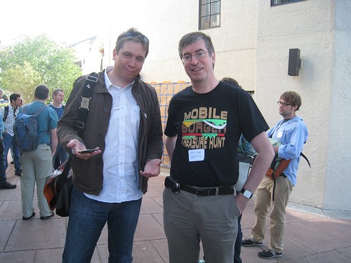
If you’re already involved with OpenStreetMap, this is a chance to get together with other contributors and discuss ideas – I would love to see us having more coordinated initiatives in the Denver area than we’ve had so far. And if you haven’t been involved but are curious about OpenStreetMap, this is a great opportunity to learn more. Hope to see a good turnout – please sign up here! That's Steve and me in the photo above by the way, to help you track us down if you don't know us!
Wednesday, January 27, 2010
Exciting job news: I am rejoining Ubisense
I am excited to announce that I have decided to rejoin my friends at Ubisense, where I worked from 2002 until I went to be CTO at Intergraph in 2005. I was a co-founder of Ten Sails, the company that provided early stage funding to and later merged with Ubisense.
There are two main parts to the business: Precise Real Time Location Systems (RTLS), and geospatial consulting. I’ll be involved with both sides of the business.
The RTLS technology tracks objects to an accuracy of a foot or so, using local sensors. Many, but not all, the applications are indoors, where it is especially hard to track location accurately. The difficulty is that whatever type of sensing technology you use, signals tend to reflect off walls, floors and ceilings, and direct signals are frequently blocked by furniture, people or other obstacles. This means it is very easy to get false readings that can result in serious errors in location calculation. Ubisense uses a technology called ultrawideband (UWB), enabling many interesting applications that can’t be implemented with less accurate sensing technologies.
There are potential applications in many different industries: right now we have good traction in several, including manufacturing, transit, military training, plant safety, and logistics. And many people’s favorite “unexpected” application seems to be cow tracking! The technology has really matured since I was last at Ubisense. I’ll talk in much more detail about the technology and applications in future posts.
On the geospatial consulting side of the business, Ubisense is primarily focused on implementation services to GE Smallworld customers (Smallworld continues to be the leading geospatial software platform in utilities, according to Daratech). As readers of my blog know, I am enthused about the potential of applying the new generation of geospatial technologies to more traditional GIS application areas. So I’m excited about the opportunity to work with Smallworld customers on a geospatial strategy that enhances the strengths of their existing system for complex applications by adding in newer, simpler geospatial technologies to help broaden the use of their geospatial data.
Since this is a full time role, I won’t be continuing in my role as Chief Technology Advisor at Enspiria, where I was previously spending a week a month or so. I very much enjoyed my time working at Enspiria and wish them all the best. But I will continue with my two advisory board positions, at FortiusOne and PublicEarth.
Tuesday, January 19, 2010
The GIS Certification emperor has no clothes
Today there has been a flurry of discussion about the GISP certification on twitter. I thought I would repost an article that I originally had published in Geospatial Solutions magazine in November 2003 (!!), which I can no longer find online (except in obscure archives). I think that everything there is still relevant (the "grandfathering" provision I refer to is no longer available, but it is still relevant in that many people received their GISP this way). I know and like various people involved with the program, and believe that they have good intentions, but continue to feel that it is misguided for the reasons I outline below. I have no issue with the code of ethics part of the program. And I also have no issue with a certification program that actually attempts to measure competency or skills in some specific way (for example ESRI has announced a more specific program that will evaluate skills with their products, which makes more sense to me). But I still don't see how GISP in any way evaluates a person's competency. Anyway, here's the old article, unchanged from 2003 ... (also, the FAQs on the GISCI site that I reference haven't changed since then!)
The Certification Emperor Has No Clothes
Peter Batty, Nov 1, 2003
Geospatial Solutions Magazine
The GIS certification process recently rolled out by URISA and others aims to "recommend a formal system to evaluate the competency of professionals whose primary job responsibility involves the design and use of geographic information systems" (see www.gisci.org). But a major argument against GIS certification is stated in the frequently asked questions (FAQ) at the certification site.
In answer to the question "Why not test an individual's knowledge of GIS skills to certify competence as other professions do?" the FAQ responds: "It is felt that general agreement on the skills needed for the GIS profession has not yet been achieved, given that there are so many different professions that use GIS technology . . . it is very difficult to design a single examination that can fairly evaluate the basic skills needed". After "not yet been" I would add "and will never be". The range of spatial applications and technologies, and skills needed, continues to diversify rapidly and promises to do so well into the future.
The problem of creating an exam is swept under the carpet by requiring formal GIS education in order to be certified. The obvious issue with this is that the great majority of GIS professionals do not have any formal GIS education. To overcome this objection, there is a grandfathering provision, which allows anyone with eight years of technical experience in the industry to become certified. How this evaluates anyone's competency is a mystery.
Furthermore, a five-year recertification process requires one to do a certain amount of GIS-related education. The problem with this is that the most appropriate development path for many GIS professionals may not be to take academic GIS study. It may instead be to learn more about XML, or environmental policies, or relational database tuning, or utility network design. To insist that someone has to do education within a very narrowly defined set of GIS courses or conferences would do the industry a major disservice. This is not to say that a continuing GIS education is bad. It may be a great option for some people. But it is just one of many valid options to help people do their GIS-related jobs better.
In 2008, the grandfathering option goes away, which means that a prerequisite to being certified is to have obtained a degree in GIS. If anyone took certification seriously, this would massively reduce the talent available to the spatial industry as the 99.9 percent of people who have degrees in other subjects would be excluded. Obviously I don't think that will happen, but again it begs the question of why bother with the certification process?
Does certification pass the test?
Many of the reasons advanced for certification do not stand up to scrutiny. One is helping employers with recruitment. But a glance at someone's resume will give much greater insight into whether someone is appropriately qualified for a position than certification does. Another is that "it is felt that the nation's taxpayers deserve assurance that competent and ethical GIS professionals are being hired with their public tax dollars". I smile at the thought of millions of taxpayers lying awake at night worrying about the competence of their government's GIS professionals. Personally, I'd prefer that the GIS professionals my tax dollars are funding be doing their jobs rather than spending time applying for a certificate that bears no relation to their competence. It is even claimed that GIS certification will improve the lives of citizens, which seems like a particularly desperate attempt at justification.
As spatial technology expands into the mainstream, a hugely diverse range of skills is required to implement systems and move the industry forward. The space is so broad that it makes no sense to try to have a certification process. To implement a consistent process, the certification criteria need to be either so broad that they're meaningless (as with grandfathering) or so narrow that they apply to a tiny fraction of relevant people, and would greatly hamper the industry if anyone took certification seriously.
We should not be trying to hide spatial technology in the back room and restrict who can use it. Instead, we should be promoting usage by everyone.
Monday, January 18, 2010
Great co-founder opportunity in web geo startup
A friend of mine has put together a really interesting business plan for a web-based geo startup and he's looking for a technical co-founder. I've been seriously contemplating doing it myself but have some other plans that I think will prevent me from doing so (more on that soon!). He has excellent experience as a CEO and in business development and fund-raising in this space. And he has some great investors lined up, so will be able to pay a reasonable salary from the beginning. He's looking for someone with experience building large scalable database apps, web and geo experience highly desirable. Location would be Denver/Boulder, or possibly the bay area as a second choice. Drop me an email if you're interested in finding out more.
Thoughts on the upcoming Apple Tablet
Much of the tech world has been obsessing over the rumored upcoming Apple tablet, which is expected to be unveiled to the world on January 27. So I hesitate to add more to that, but there are so many rumors out there that it's hard to wade through them, so I thought I would throw in a high level perspective on what we are likely to see, and include links to some of the more interesting articles I've come across.
I think the announcement is particularly interesting as Steve Jobs is said to have stopped Apple tablet projects before - according to the New York Times:
So I think (not based on any inside info, just on filtering all the rumors and thinking about what makes sense from an Apple perspective) that there will be two big ground-breaking things about the Apple tablet.
First, it is widely predicted that the tablet will be Apple's attempt to redefine the world of printed media (like the iPod redefined the music recording industry and the iPhone redefined the mobile phone).
 This certainly makes sense. The Kindle and other eReader devices have made an interesting start in that space, but as I said in my initial review of the Kindle, it is good for sequential reading of text, but not good for more random browsing, like reading newspapers and magazines. And indeed the Kindle is only good for text, not for other kinds of media. With the Apple tablet I would assume that of course you will be able to browse arbitrary web sites, but imagine that it is also highly likely that there may be a simplified full screen user interface, which would provide a great platform for magazines, newspapers, book publishers etc to create compelling multi-media content including text, photos, video, audio, etc. Available content would presumably include a mix of free and paid, like the current app store / iTunes models (and this would give the struggling traditional news media industry another potential business model for the future). One interesting potential screen technology for such a device comes from Pixel Qi, who have been linked with the Apple tablet in some posts. Obviously it would also be a good device for watching movies, TV shows, youtube and other video content.
However, I think that doing that alone is probably not enough to hit the size of market that Apple would want. The tablet clearly won't replace an iPhone, as it won't fit in your pocket. So the question would be how many people, if they already have a smart phone and a laptop, would buy another device in between those two (in size and cost), with a lot of overlap in functionality. This is partly a cost question, and partly one of convenience - would traveling techies, even devout Apple fan boys like me, want to carry three devices everywhere: iPhone, Tablet and MacBook? I think not. So I believe that the second big thing is that the device has to be a good replacement for a laptop too, and again there are plenty of rumors that support that.
For this to be the case, obviously there needs to be a mechanism for text entry that is a good alternative to typing on a physical keyboard. A simple on screen touch keyboard probably isn't going to be good enough to persuade people to give up laptops in large volumes. So I think Apple must have more up its sleeve here. One of the more intriguing rumor threads that has appeared in various places is that the new device will have a "steep learning curve", and that the way that you interact with it is "unexpected". Obviously having a steep learning curve is not something that you would expect in general from an Apple device, especially one aimed at the mass market, unless there is a compelling reason for this. So I think that this has to be around a new mechanism for text entry, and more broadly interaction with the device. Apple acquired a company called Fingerworks in 2005, which had a lot of interesting technology in the areas of multi-touch interaction, gestures, and text entry, and Apple also owns a lot of patents in this area - these are discussed in various places including AppleInsider (who also discuss a tactile touch keyboard) and gizmodo. The old Fingerworks web site was recently taken down, which has increased speculation that their technology is involved. One of the more intriguing aspects of this is the use of "chords", which means that you can trigger different actions by pressing different combinations of fingers (for example, your thumb and third finger versus your thumb and fourth finger) - this video at CrunchGear gives some examples. Another is an approach to user interaction where the keyboard and pointing device are integrated, you don't have to move your hands from one place to another as you do with a touchpad or mouse.
So in summary, the two key things that I am looking forward to seeing are a big focus on updating printed media (magazines, newspapers, books), and something intriguing and new in terms of user interaction, covering text entry and new ways of using multi-touch surfaces. The latter could make the tablet another major step forward for computing in general (as the iPhone was in many ways ... I am amazed at how much of my "computing" I do on my iPhone these days).
One final comment is that to meet its aims as a news reading device, you will need the ability to be connected to the Internet all the time, but most people will not want to pay for two separate wireless data plans for their iPhone and Tablet, so it will be interesting to see how they will address that. Obviously I would assume they would support WiFi, but I would also assume that some or all models would also have 3G wireless built in. Will there be an option for simple tethering with an iPhone I wonder (if Fake Steve Jobs' rant - bad language warning! - has been enough to make AT&T finally get their act together!)? Or will there at least be some sort of package deal on a data plan if you have both an iPhone and an Apple Tablet?
I'm looking forward to the announcement on January 27 :) !!
I think the announcement is particularly interesting as Steve Jobs is said to have stopped Apple tablet projects before - according to the New York Times:
Another former Apple executive who was there at the time said the tablets kept getting shelved at Apple because Mr. Jobs, whose incisive critiques are often memorable, asked, in essence, what they were good for besides surfing the Web in the bathroom.So if they are announcing this (and you buy this quote, which is plausible), there has to be something substantial about the tablet beyond just being a MacBook without a keyboard or a larger iPhone.
So I think (not based on any inside info, just on filtering all the rumors and thinking about what makes sense from an Apple perspective) that there will be two big ground-breaking things about the Apple tablet.
First, it is widely predicted that the tablet will be Apple's attempt to redefine the world of printed media (like the iPod redefined the music recording industry and the iPhone redefined the mobile phone).
This certainly makes sense. The Kindle and other eReader devices have made an interesting start in that space, but as I said in my initial review of the Kindle, it is good for sequential reading of text, but not good for more random browsing, like reading newspapers and magazines. And indeed the Kindle is only good for text, not for other kinds of media. With the Apple tablet I would assume that of course you will be able to browse arbitrary web sites, but imagine that it is also highly likely that there may be a simplified full screen user interface, which would provide a great platform for magazines, newspapers, book publishers etc to create compelling multi-media content including text, photos, video, audio, etc. Available content would presumably include a mix of free and paid, like the current app store / iTunes models (and this would give the struggling traditional news media industry another potential business model for the future). One interesting potential screen technology for such a device comes from Pixel Qi, who have been linked with the Apple tablet in some posts. Obviously it would also be a good device for watching movies, TV shows, youtube and other video content.However, I think that doing that alone is probably not enough to hit the size of market that Apple would want. The tablet clearly won't replace an iPhone, as it won't fit in your pocket. So the question would be how many people, if they already have a smart phone and a laptop, would buy another device in between those two (in size and cost), with a lot of overlap in functionality. This is partly a cost question, and partly one of convenience - would traveling techies, even devout Apple fan boys like me, want to carry three devices everywhere: iPhone, Tablet and MacBook? I think not. So I believe that the second big thing is that the device has to be a good replacement for a laptop too, and again there are plenty of rumors that support that.
For this to be the case, obviously there needs to be a mechanism for text entry that is a good alternative to typing on a physical keyboard. A simple on screen touch keyboard probably isn't going to be good enough to persuade people to give up laptops in large volumes. So I think Apple must have more up its sleeve here. One of the more intriguing rumor threads that has appeared in various places is that the new device will have a "steep learning curve", and that the way that you interact with it is "unexpected". Obviously having a steep learning curve is not something that you would expect in general from an Apple device, especially one aimed at the mass market, unless there is a compelling reason for this. So I think that this has to be around a new mechanism for text entry, and more broadly interaction with the device. Apple acquired a company called Fingerworks in 2005, which had a lot of interesting technology in the areas of multi-touch interaction, gestures, and text entry, and Apple also owns a lot of patents in this area - these are discussed in various places including AppleInsider (who also discuss a tactile touch keyboard) and gizmodo. The old Fingerworks web site was recently taken down, which has increased speculation that their technology is involved. One of the more intriguing aspects of this is the use of "chords", which means that you can trigger different actions by pressing different combinations of fingers (for example, your thumb and third finger versus your thumb and fourth finger) - this video at CrunchGear gives some examples. Another is an approach to user interaction where the keyboard and pointing device are integrated, you don't have to move your hands from one place to another as you do with a touchpad or mouse.
So in summary, the two key things that I am looking forward to seeing are a big focus on updating printed media (magazines, newspapers, books), and something intriguing and new in terms of user interaction, covering text entry and new ways of using multi-touch surfaces. The latter could make the tablet another major step forward for computing in general (as the iPhone was in many ways ... I am amazed at how much of my "computing" I do on my iPhone these days).
One final comment is that to meet its aims as a news reading device, you will need the ability to be connected to the Internet all the time, but most people will not want to pay for two separate wireless data plans for their iPhone and Tablet, so it will be interesting to see how they will address that. Obviously I would assume they would support WiFi, but I would also assume that some or all models would also have 3G wireless built in. Will there be an option for simple tethering with an iPhone I wonder (if Fake Steve Jobs' rant - bad language warning! - has been enough to make AT&T finally get their act together!)? Or will there at least be some sort of package deal on a data plan if you have both an iPhone and an Apple Tablet?
I'm looking forward to the announcement on January 27 :) !!
Subscribe to:
Posts (Atom)