Showing posts with label blackberry. Show all posts
Showing posts with label blackberry. Show all posts
Monday, July 2, 2007
Issues with Google local search are on other platforms too
I played around with the local search capabilities on Google Maps Mobile on my BlackBerry 8800, and found that it also has the same issues that I discussed with local search on the iPhone. I guess I just hadn't used local search much with Google on my BlackBerry, as I'd been using Telenav which has richer functionality (in particular voice driving directions using the GPS).

Sunday, July 1, 2007
Google Maps local search on the iPhone really has some serious flaws
Yesterday I posted my main review of Google Maps on the iPhone, as well as my general impressions of the iPhone. To say some positive things first, I really think that while I've commented on a few areas for improvement, I really think the iPhone is great - it's definitely a jump forward in terms of user interfaces, and I think introduces a lot of ideas in this regard which will become much more widely used. It's just a lot of fun to use. On Google Maps specifically, I talked about a lot of things I liked yesterday, and one other nice feature I have discovered is that the Bookmark page also has a "Recents" tab which saves all your recent searches, routes, etc, and will restore those with all the context - this is especially nice for retrieving routes. Oh, and the built in camera, which I had low expectations of, actually isn't too bad - here are a few sample snapshots in case you're interested.
However, I expressed some reservations about the way that local search was implemented yesterday, and having played around with this some more I really feel that there are some serious issues that need addressing here. There are two main issues: one is the way that the functionality has been implemented, and the other is the quality of the data for points of interest.
Let's take the functionality first. Frankly, Google seems to have lost track of the basic user scenario for local search. I suspect that probably a (conscious or unconscious) contributor to this was the desire to include establishments which paid for placement higher in the list of results, as I commented on yesterday, without it being too obvious that they are doing this. But anyway, the basic scenario for local search is that you identify a location, which might either be where you are now (the most common scenario), or perhaps an address where you plan on being in the future, or where a friend is located. You then search for something close to that place - this might fairly specific, like "tattered cover" (a bookstore I used in my example yesterday) or might be more generic, like "coffee". In either case, knowing how far away each of the search results are from the specified location is a really crucial piece of information in deciding whether that search result is of interest to you. Sorting the results by distance, and knowing that the closest (or the closest 3, or 5, or whatever) results have been shown to you are fundamental requirements. And then if you decide that one of the search results is of interest to you, by far the most common follow up action is that you want to figure out how to navigate from the point you first specified to the search result you have selected.
Most other local search implementations I have used meet these requirements pretty well, but local search on the iPhone fails pretty badly. Using the TeleNav software on my BlackBerry 8800, I choose "Find business" and the first thing it asks me for is the search point, and I have six options for specifying this: current location (which it knows from the GPS, which is of course its big advantage over the iPhone), recent addresses, favorites, key in an address, near airport, or contacts. You then specify the search term, and are immediately given a list of results sorted in order of distance from the search point, and showing how far away each result is. You click on a result and it shows more information including the address, and gives you the option to drive to it, save it, map it, or call it. The one feature which TeleNav does not provide which the iPhone does is the ability to display multiple results on a map at the same time - but it meets the main user scenario much better.
Google Maps online also addresses this user scenario well. You type in the address of the point you are interested in, and hit "Search maps". Then you choose "Find businesses" and you now have two text boxes, one containing the address of the search point, and one for your search term. You hit search and get an ordered list back, by distance, with the distance from the search point displayed for each result. If you click on a search result and ask for directions, the start point is already filled in with the address of the original search point.
But all this goes by the board in Google Maps on the iPhone. You will typically precede a search by centering the screen on a location, most often by typing an address (or retrieving a bookmark). But that point is not explicitly used by the search on the iPhone. Instead, you just get back any ten results which satisfy your search term and which are somewhere within the bounds of the current screen display - except that it's not just any ten, it seems that there is a ranking order which is presumably determined by how much establishments have paid for placement. There is no guarantee that the closest (or closest 3, or 5, etc) are returned. There is no easy way to find out how far away a given search result is from the point you were interested in (the only way I have found is to select a result, display its details, choose "directions to here", and then you have to fill in the start address, which you can do by selecting a bookmark or recent search address, and then calculate a route - and you have to repeat this for every item whose distance you want to know).
I tested a couple of scenarios where there were fewer than ten results in the original map display window, and in this case the map window stays the same and displays pins for the results which are in that area, but you still get a list of ten items (not sure if these are guaranteed to be the ten closest in this situation or not). A bad thing in this scenario is that if you select an item from the list which was not in the original map window, it pans you to that location, but now you have no idea how that relates geographically to your original search point (beyond re-entering the original point and calculating a route).
If there are no search results in the original map window, the map window zooms out so that it fits in all the results (at least in the cases I tried). However, there is no symbol on the map showing where your original point was, so you risk losing your orientation in this situation if it's an area you don't know well, unless you calculate a route from your original point again.
So functionality wise I really think someone lost the plot here. Yes, if you are zoomed in close (i.e. at the default scale which is displayed which you search for an address), the system will find you some results that are "sort of close" to the address you typed, and you get a nice pretty display with animated flying pins. But there appears to be no guarantee that the closest result will definitely be returned (though it probably will in most cases, especially if you are zoomed in close), there's no easy way of determining how far away any given result is (you have to calculate routes individually), there is no way at all of sorting results in order of distance, and in order to calculate a route to a search result you have to re-enter the original search point again (which you can admittedly do via a bookmark or recent result, but this still adds at least two or three clicks which shouldn't be necessary). One other thing I noticed while thinking about distances in this context is that there is no scale bar on the map, so you can't even estimate graphically. I know it's not a big screen, but all in car navigation systems I have used have some nice compact scale bar, so I think this should be added in there too.
So anyway, that's the functionality rant, sorry about that :) !! Now for the data rant!
These issues are exacerbated by the fact that Google's point of interest data really seems to have a lot of issues. I mentioned some examples in yesterday's post, but categories of error that I have found in more than half of my test cases so far include incomplete addresses (either no street number, or no street), establishments which have closed, and incorrect categorization (examples below). I tested Google Maps online and it had the same errors (which is at least consistent - you would hope that they use the same data). For comparison, I went to try MapQuest (online) and it did MUCH better. Here are just a few example searches I tried, centered on 1792 Wynkoop St, Denver, CO:
So anyway, to finish on a not entirely negative note, let's reiterate a few good things. Overall, the iPhone rocks! Google Maps on the iPhone has a lot of great features - the quality of the map display is great, panning and zooming using the touch screen is really fast and intuitive, routing works well and the way that it saves the full state of complex operations including routing and searches in "Recents" is really nice. BUT, the local search really doesn't match up to the high standards that we all expect from Google. Yes, it will give you what you want in many cases, but is missing key functionality like displaying and sorting by distance, common workflows like navigating to the point of interest you want to go are much more complex than they should be, and in my tests I have encountered way too many data errors to be comfortable relying on it. The good news is that fixing the functionality really shouldn't be difficult technically, though I think it will need Google to accept that sponsored results should be displayed separately somehow (as they are with regular Google search). Fixing the data problems may be a bigger effort, but others have done it as the MapQuest comparison shows.
Fixing local search on Google Maps for the iPhone is now top of my wish list, but I also still think that auto-correction of typing and rotation of the map are high priorities, as I mentioned yesterday. That's enough iPhone reviewing for this weekend I think :) !!
However, I expressed some reservations about the way that local search was implemented yesterday, and having played around with this some more I really feel that there are some serious issues that need addressing here. There are two main issues: one is the way that the functionality has been implemented, and the other is the quality of the data for points of interest.
Let's take the functionality first. Frankly, Google seems to have lost track of the basic user scenario for local search. I suspect that probably a (conscious or unconscious) contributor to this was the desire to include establishments which paid for placement higher in the list of results, as I commented on yesterday, without it being too obvious that they are doing this. But anyway, the basic scenario for local search is that you identify a location, which might either be where you are now (the most common scenario), or perhaps an address where you plan on being in the future, or where a friend is located. You then search for something close to that place - this might fairly specific, like "tattered cover" (a bookstore I used in my example yesterday) or might be more generic, like "coffee". In either case, knowing how far away each of the search results are from the specified location is a really crucial piece of information in deciding whether that search result is of interest to you. Sorting the results by distance, and knowing that the closest (or the closest 3, or 5, or whatever) results have been shown to you are fundamental requirements. And then if you decide that one of the search results is of interest to you, by far the most common follow up action is that you want to figure out how to navigate from the point you first specified to the search result you have selected.
Most other local search implementations I have used meet these requirements pretty well, but local search on the iPhone fails pretty badly. Using the TeleNav software on my BlackBerry 8800, I choose "Find business" and the first thing it asks me for is the search point, and I have six options for specifying this: current location (which it knows from the GPS, which is of course its big advantage over the iPhone), recent addresses, favorites, key in an address, near airport, or contacts. You then specify the search term, and are immediately given a list of results sorted in order of distance from the search point, and showing how far away each result is. You click on a result and it shows more information including the address, and gives you the option to drive to it, save it, map it, or call it. The one feature which TeleNav does not provide which the iPhone does is the ability to display multiple results on a map at the same time - but it meets the main user scenario much better.
Google Maps online also addresses this user scenario well. You type in the address of the point you are interested in, and hit "Search maps". Then you choose "Find businesses" and you now have two text boxes, one containing the address of the search point, and one for your search term. You hit search and get an ordered list back, by distance, with the distance from the search point displayed for each result. If you click on a search result and ask for directions, the start point is already filled in with the address of the original search point.
But all this goes by the board in Google Maps on the iPhone. You will typically precede a search by centering the screen on a location, most often by typing an address (or retrieving a bookmark). But that point is not explicitly used by the search on the iPhone. Instead, you just get back any ten results which satisfy your search term and which are somewhere within the bounds of the current screen display - except that it's not just any ten, it seems that there is a ranking order which is presumably determined by how much establishments have paid for placement. There is no guarantee that the closest (or closest 3, or 5, etc) are returned. There is no easy way to find out how far away a given search result is from the point you were interested in (the only way I have found is to select a result, display its details, choose "directions to here", and then you have to fill in the start address, which you can do by selecting a bookmark or recent search address, and then calculate a route - and you have to repeat this for every item whose distance you want to know).
I tested a couple of scenarios where there were fewer than ten results in the original map display window, and in this case the map window stays the same and displays pins for the results which are in that area, but you still get a list of ten items (not sure if these are guaranteed to be the ten closest in this situation or not). A bad thing in this scenario is that if you select an item from the list which was not in the original map window, it pans you to that location, but now you have no idea how that relates geographically to your original search point (beyond re-entering the original point and calculating a route).
If there are no search results in the original map window, the map window zooms out so that it fits in all the results (at least in the cases I tried). However, there is no symbol on the map showing where your original point was, so you risk losing your orientation in this situation if it's an area you don't know well, unless you calculate a route from your original point again.
So functionality wise I really think someone lost the plot here. Yes, if you are zoomed in close (i.e. at the default scale which is displayed which you search for an address), the system will find you some results that are "sort of close" to the address you typed, and you get a nice pretty display with animated flying pins. But there appears to be no guarantee that the closest result will definitely be returned (though it probably will in most cases, especially if you are zoomed in close), there's no easy way of determining how far away any given result is (you have to calculate routes individually), there is no way at all of sorting results in order of distance, and in order to calculate a route to a search result you have to re-enter the original search point again (which you can admittedly do via a bookmark or recent result, but this still adds at least two or three clicks which shouldn't be necessary). One other thing I noticed while thinking about distances in this context is that there is no scale bar on the map, so you can't even estimate graphically. I know it's not a big screen, but all in car navigation systems I have used have some nice compact scale bar, so I think this should be added in there too.
So anyway, that's the functionality rant, sorry about that :) !! Now for the data rant!
These issues are exacerbated by the fact that Google's point of interest data really seems to have a lot of issues. I mentioned some examples in yesterday's post, but categories of error that I have found in more than half of my test cases so far include incomplete addresses (either no street number, or no street), establishments which have closed, and incorrect categorization (examples below). I tested Google Maps online and it had the same errors (which is at least consistent - you would hope that they use the same data). For comparison, I went to try MapQuest (online) and it did MUCH better. Here are just a few example searches I tried, centered on 1792 Wynkoop St, Denver, CO:
- King Soopers (a local supermarket chain): in the top 10 on Google, there were three entries with an incomplete address (just Denver, CO), all of which show as being closer than the closest real King Soopers, and one entry which says in Google Maps online that it is an "unverified listing" (at 1150 Stout St) - but on the iPhone this just appears in the list without any indication that it is unverified (this one does not appear in MapQuest and I am pretty sure that it is not a real location). So 4 out of 10 results are wrong (non-existent), therefore you would have a 40% chance of ending up somewhere with no King Soopers. On MapQuest, 10 legitimate addresses are returned, though in some cases they appear to have multiple addresses for the same store (e.g. entry points on two different streets) - but this is not a serious error as you would still find a King Soopers.
- Tattered Cover (a well known Denver book store with 3 locations, which I mentioned in my post yesterday). MapQuest returns just 3 results, all correct. Google Maps online returns 8 entries in its initial list, of which two have incomplete addresses (duplicates of entries which do have complete addresses, but they show up at entirely different locations on the map), one is a store which closed a year ago, one says it is unverified and is in Boulder (where there is no Tattered Cover), and one is a duplicate of a correct store. The same 8 entries appear on the iPhone, again with no indication that the Boulder one is unverified - so in this case you have a 50% chance of not showing up at a Tattered Cover.
- Searches for Office Depot and Home Depot were more successful, with no obvious errors - hooray :) !!
- Searching for grocery in Google Maps online returned Market 41, a nightclub which closed a year ago, and four entries with incomplete addresses (two King Soopers which we saw before, and two Safeways). The iPhone returned a different list in this case, but included Market 41, two entries with incomplete addresses (one the same, one different), and Lemon Sisters market, which was a small grocery store but closed several years ago. So a 40% chance of going to the wrong place in this case. The same search on MapQuest did not return Market 41 and had 10 complete addresses, all of which looked legitimate.
So anyway, to finish on a not entirely negative note, let's reiterate a few good things. Overall, the iPhone rocks! Google Maps on the iPhone has a lot of great features - the quality of the map display is great, panning and zooming using the touch screen is really fast and intuitive, routing works well and the way that it saves the full state of complex operations including routing and searches in "Recents" is really nice. BUT, the local search really doesn't match up to the high standards that we all expect from Google. Yes, it will give you what you want in many cases, but is missing key functionality like displaying and sorting by distance, common workflows like navigating to the point of interest you want to go are much more complex than they should be, and in my tests I have encountered way too many data errors to be comfortable relying on it. The good news is that fixing the functionality really shouldn't be difficult technically, though I think it will need Google to accept that sponsored results should be displayed separately somehow (as they are with regular Google search). Fixing the data problems may be a bigger effort, but others have done it as the MapQuest comparison shows.
Fixing local search on Google Maps for the iPhone is now top of my wish list, but I also still think that auto-correction of typing and rotation of the map are high priorities, as I mentioned yesterday. That's enough iPhone reviewing for this weekend I think :) !!
Tuesday, June 5, 2007
Another update on BlackBerry 8800 GPS / Mapping software
A few more updates on mapping and GPS software for the BlackBerry 8800, following on from my previous posts on this topic. I plan to pull all my experiences in this area together into a more detailed review shortly.
I have become more impressed with BlackBerry Maps over time. While it lacks the step by step directions capabilities of TeleNav and WisePilot, and its maps aren't as detailed or nice looking as either of these or Google Maps Mobile, it does have some advantages. One which I became acutely aware of while I was in Europe and on a data plan where I had to pay by the kB (as opposed to getting unlimited data in the US), is that it requires much less data to be downloaded. I have used it for probably several hours altogether, and it tells me that it has only downloaded around 300kB of data during that time. In contrast, a single map screen is often around 100kB or more in Google Maps Mobile. If you just want to track on a map where you are going in a moving vehicle (like a car, taxi or train), as opposed to following a route, then BlackBerry maps is probably the most effective for that. Aside from the cost issue, I found that Google Maps would struggle to keep up with tracking in a reasonably fast moving car, just because it needed to download another 100kB plus of data every few seconds, whereas the more compact data stream needed for BlackBerry Maps meant that it had no problem keeping up. Another interesting little technical snippet is that I realized that the annotation on BlackBerry Maps is vector based and is dynamically rendered on the client, which means that they can do things like having a "heading up" orientation to the map, so the map dynamically rotates with the direction that you are heading in always being at the top, and the annotation always stays the right way up. In contrast, Google Maps only offers a "North up" orientation. BlackBerry Maps also tells you your current speed and travel direction, which Google doesn't.
I continue to like Google Mobile Maps for the quality of both the street maps and imagery, and the addition of support for the internal GPS is a great feature.
I recently downloaded WisePilot, which is more focused on navigation, with turn by turn routing capabilities and voice directions, so it's similar to Telenav. As I mentioned previously, Telenav only works in the US and Canada, whereas WisePilot supports almost all European countries in addition. I like both applications - they are both well designed and do a good job. WisePilot has a nice clean screen layout and a few features which TeleNav doesn't, like showing you your current heading and speed in addition to giving you directions. One drawback with WisePilot is that I found that its geocoding often seemed to work just at the street level, it couldn't determine the correct location on a street - this happened to me both in Europe and the US. If I give it my home address of 1792 Wynkoop St, zip code 80202, it comes back with a section of Wynkoop St in zip code 80216, a couple of miles away. If you search for points of interest it seems to do a better job finding the correct location. For this reason, Telenav still ranks as my first choice of navigation software for the BlackBerry 8800 in the US, but WisePilot is definitely worth a look. One other nice feature is that they have a web site where you can log in and create locations, save favorites, etc, which automatically download to your BlackBerry.
I bought MobileTracker for BlackBerry from Skylab Mobilesystems (who also develop Spot), which records tracklogs in the background, which is something I was looking for, to let me geocode photos. Unfortunately it is no use for this purpose, as it just saves a KML file with a list of coordinates, but does not include and timestamps. It would be much more useful if it exported GPX format, which is the standard for GPS tracklogs, which includes both coordinates and timestamps. I also found that running in the background wasn't very reliable - twice I just set it running at the beginning of the day, and in one case it collected a couple of minutes worth of data, in the other case none at all, even though it appeared to be running at the end of the day. You can open up a simple user interface screen while it is running, but there is no indication as to whether it is running correctly or how many points it has captured, just a button you can press to stop recording and save a file. So I'm rather disappointed with this one so far I'm afraid, it would need GPX support and improved reliability and usability for me to recommend it.
There's been quite a bit of hype over the mapping software on the iPhone recently, and I certainly like the look of a lot of aspects of the iPhone, but I think that for mapping applications, lack of a GPS is going to be a big negative versus other devices which do have this, like the Blackberry 8800.
I have become more impressed with BlackBerry Maps over time. While it lacks the step by step directions capabilities of TeleNav and WisePilot, and its maps aren't as detailed or nice looking as either of these or Google Maps Mobile, it does have some advantages. One which I became acutely aware of while I was in Europe and on a data plan where I had to pay by the kB (as opposed to getting unlimited data in the US), is that it requires much less data to be downloaded. I have used it for probably several hours altogether, and it tells me that it has only downloaded around 300kB of data during that time. In contrast, a single map screen is often around 100kB or more in Google Maps Mobile. If you just want to track on a map where you are going in a moving vehicle (like a car, taxi or train), as opposed to following a route, then BlackBerry maps is probably the most effective for that. Aside from the cost issue, I found that Google Maps would struggle to keep up with tracking in a reasonably fast moving car, just because it needed to download another 100kB plus of data every few seconds, whereas the more compact data stream needed for BlackBerry Maps meant that it had no problem keeping up. Another interesting little technical snippet is that I realized that the annotation on BlackBerry Maps is vector based and is dynamically rendered on the client, which means that they can do things like having a "heading up" orientation to the map, so the map dynamically rotates with the direction that you are heading in always being at the top, and the annotation always stays the right way up. In contrast, Google Maps only offers a "North up" orientation. BlackBerry Maps also tells you your current speed and travel direction, which Google doesn't.
I continue to like Google Mobile Maps for the quality of both the street maps and imagery, and the addition of support for the internal GPS is a great feature.
I recently downloaded WisePilot, which is more focused on navigation, with turn by turn routing capabilities and voice directions, so it's similar to Telenav. As I mentioned previously, Telenav only works in the US and Canada, whereas WisePilot supports almost all European countries in addition. I like both applications - they are both well designed and do a good job. WisePilot has a nice clean screen layout and a few features which TeleNav doesn't, like showing you your current heading and speed in addition to giving you directions. One drawback with WisePilot is that I found that its geocoding often seemed to work just at the street level, it couldn't determine the correct location on a street - this happened to me both in Europe and the US. If I give it my home address of 1792 Wynkoop St, zip code 80202, it comes back with a section of Wynkoop St in zip code 80216, a couple of miles away. If you search for points of interest it seems to do a better job finding the correct location. For this reason, Telenav still ranks as my first choice of navigation software for the BlackBerry 8800 in the US, but WisePilot is definitely worth a look. One other nice feature is that they have a web site where you can log in and create locations, save favorites, etc, which automatically download to your BlackBerry.
I bought MobileTracker for BlackBerry from Skylab Mobilesystems (who also develop Spot), which records tracklogs in the background, which is something I was looking for, to let me geocode photos. Unfortunately it is no use for this purpose, as it just saves a KML file with a list of coordinates, but does not include and timestamps. It would be much more useful if it exported GPX format, which is the standard for GPS tracklogs, which includes both coordinates and timestamps. I also found that running in the background wasn't very reliable - twice I just set it running at the beginning of the day, and in one case it collected a couple of minutes worth of data, in the other case none at all, even though it appeared to be running at the end of the day. You can open up a simple user interface screen while it is running, but there is no indication as to whether it is running correctly or how many points it has captured, just a button you can press to stop recording and save a file. So I'm rather disappointed with this one so far I'm afraid, it would need GPX support and improved reliability and usability for me to recommend it.
There's been quite a bit of hype over the mapping software on the iPhone recently, and I certainly like the look of a lot of aspects of the iPhone, but I think that for mapping applications, lack of a GPS is going to be a big negative versus other devices which do have this, like the Blackberry 8800.
Thursday, May 24, 2007
Google gets it right
You have to hand it to Google, they do a lot of things very well. I am in the UK and was just testing my various BlackBerry 8800 mapping applications as I took a short train ride. BlackBerry Maps actually did best this time - I have found that it has a pretty nice real time tracking mode, which shows you your speed and bearing as well as a dynamically scrolling map. Telenav gave me a lat-long but never managed to download any map data, just gave a "loading" message (while great in North America, it hasn't been any use to me in the UK so far). Spot didn't manage to download a map either, MGMaps still isn't recognizing my internal GPS and Google Maps didn't support GPS when I was on the train.
However, I am just waiting for someone to collect me from the station and thought I'd quickly surf the web on my BlackBerry. My home page is Google Mobile. Right there on the front page, with just a handful of other links, is a link saying "download google maps mobile with GPS support". I click on that, and have a page which says "download google maps with GPS for the BlackBerry 8800" (so it obviously recognized my device automatically). It told me that it was a 200k download in advance, so I know it wouldn't break the bank despite the fact that I'm paying by the kB here. It takes about a minute or so to download, and now I have a very nice Google Map (either a street map or a satellite image) centered on my current location, accurate to 3m. And I can blog about it while I'm still waiting to be collected!
I wish that all my software installations and upgrades were that simple! (Though now I think about it, I'm a little surprised my existing Google Maps Mobile didn't tell me that there was an update available - so still room for improvement!) I'm still planning to provide more details on various new BlackBerry location applications shortly, as mentioned in previous posts.
Sent via BlackBerry from Cingular Wireless
However, I am just waiting for someone to collect me from the station and thought I'd quickly surf the web on my BlackBerry. My home page is Google Mobile. Right there on the front page, with just a handful of other links, is a link saying "download google maps mobile with GPS support". I click on that, and have a page which says "download google maps with GPS for the BlackBerry 8800" (so it obviously recognized my device automatically). It told me that it was a 200k download in advance, so I know it wouldn't break the bank despite the fact that I'm paying by the kB here. It takes about a minute or so to download, and now I have a very nice Google Map (either a street map or a satellite image) centered on my current location, accurate to 3m. And I can blog about it while I'm still waiting to be collected!
I wish that all my software installations and upgrades were that simple! (Though now I think about it, I'm a little surprised my existing Google Maps Mobile didn't tell me that there was an update available - so still room for improvement!) I'm still planning to provide more details on various new BlackBerry location applications shortly, as mentioned in previous posts.
Sent via BlackBerry from Cingular Wireless
Monday, May 21, 2007
Short update on BlackBerry 8800 GPS software
I have multiple connection challenges at the moment - am in England and only have access to a PC with dial up connection, and a slow GPRS connection on my BlackBerry (compared to EDGE back home) which I have to pay for by the kB rather than having unlimited bandwidth. So just a short update on my previous BlackBerry 8800 posts for now. I have found out that Telenav, the navigation software which I really like as I've said previously, only does road navigation in the US and Canada. At the same time I had a comment on my earlier posting which suggested I should also try Wisepilot, and they happen to offer a 5 day free trial with European data, so I'll give that a try later this week and report back. In addition to navigation capabilities, they also offer functionality which warns you when you are approaching a speed camera (in Europe) ... not that I will have any need to use that, I hasten to add, in case there are any traffic police reading this!
The second piece of news is that Skylab Mobilesystems, who produce the Spot for BlackBerry software which I reviewed previously, have announced a new product called MobileTracker for BlackBerry, which creates GPS tracklogs in the background, which was one of the top things I was after. It saves these in KML so you can directly display them in Google Earth and Maps (and elsewhere). The software I have been using to geocode photos, RoboGeo, expects a GPX file as input rather than a KML file I think, so may need to mess around a little bit to overcome that, but I'm sure I can work around that.
And finally for now, the technical support team at Mobile GMaps, which I also mentioned in my previous post, tell me that they have an update which they think will enable the use of the BlackBerry 8800 GPS, which didn't work for me before - again, haven't had a chance to try that yet but will do so soon. Also, I did try the "phone positioning" used by the underlying Navizon software, which uses some sort of signal triangulation, on my travels, and that did locate me in Chicago airport, though not in Calgary or in the UK.
So some promising indications, will report back as I am able to try each of these out.
The second piece of news is that Skylab Mobilesystems, who produce the Spot for BlackBerry software which I reviewed previously, have announced a new product called MobileTracker for BlackBerry, which creates GPS tracklogs in the background, which was one of the top things I was after. It saves these in KML so you can directly display them in Google Earth and Maps (and elsewhere). The software I have been using to geocode photos, RoboGeo, expects a GPX file as input rather than a KML file I think, so may need to mess around a little bit to overcome that, but I'm sure I can work around that.
And finally for now, the technical support team at Mobile GMaps, which I also mentioned in my previous post, tell me that they have an update which they think will enable the use of the BlackBerry 8800 GPS, which didn't work for me before - again, haven't had a chance to try that yet but will do so soon. Also, I did try the "phone positioning" used by the underlying Navizon software, which uses some sort of signal triangulation, on my travels, and that did locate me in Chicago airport, though not in Calgary or in the UK.
So some promising indications, will report back as I am able to try each of these out.
Tuesday, May 15, 2007
More on BlackBerry 8800, and Nokia N95
Stefan at Ogle Earth has a great post about his experiences in Whale Valley in Egypt with his Nokia N95, which was very interesting both from a technology and a more general perspective. The Nokia N95 is one of the main alternatives to the BlackBerry 8800, as a smart phone with built in GPS. He talks about several applications which I would like but haven't seen yet on the BlackBerry, as discussed in my previous post on this topic. One is Mobile GMaps, and the associated GMap-Track, which lets you track your location in near real time and upload it to a web site and display it on top of Google Maps. I downloaded this application, and while the mapping application ran, sadly it didn't recognize the internal GPS on my BlackBerry 8800, so I couldn't get at the cool features I was after. MGMaps uses a technology called Navizon for the positioning, which says it supports positioning using either GPS or triangulation of cellular and/or WiFi signals - but when I tried to configure this to use GPS, it wanted me to pair with an external GPS receiver, so no luck. It couldn't work out a position based on phone signals either - I'm in Calgary at the moment, am not sure if this is dependent on where in the world you are, I will try it when I get back to Denver. Hopefully Navizon and/or MGMaps will add GPS support for the BlackBerry soon.
Stefan also talks about an application called ShoZu (at shozu.com), which lets you directly upload photos from the your cell phone (the Nokia N95 has a 5 megapixel camera, which is another advantage over the BlackBerry 8800, which has no camera) to flickr and other sites - and on phones with a GPS, it will geocode the photo so it can be displayed in the right location on a map. I have been talking about this possibility for a while, it's great to see that it is a reality now. As this type of technology becomes more universally available over the next few years, it will have great application in various ways - such as leveraging "the power of crowds" to get a near real time view of the aftermath of a natural or man-made emergency, which could be incredibly useful to emergency responders or utility repair crews.
Finally, I'll just mention a couple more differences between the Nokia N95 and the BlackBerry 8800 - I was just comparing notes with Ed Parsons after our panel at the GeoTec conference today, he has the former and I have the latter. In addition to the features I already mentioned (camera and software), the Nokia supports WiFi connections, which the BlackBerry doesn't. Strengths of the BlackBerry are that it has a QWERTY keyboard, whereas the Nokia just has a regular phone keypad, so you need to use SMS-style text entry, so this is a plus for the BlackBerry if you want to do a lot of email or other typing. And of course the BlackBerry has its usual email, contacts and calendar software which are all very good. Ed said that he thinks that the nicest implementation of Google Maps Mobile currently is on the BlackBerry. And as I mentioned in my previous post, I am very impressed with the TeleNav navigation software which is available on the BlackBerry (it is supported on other platforms too, but from a quick Google search I couldn't find confirmation that it is available on the N95, so it may not be yet - but I'm not sure on that). The Nokia is quite a bit more expensive than the BlackBerry, in the US at least - currently around $800 on Amazon for an unlocked phone, while they currently have the BlackBerry on special offer for $99 with a service plan commitment (so not an apples to apples comparison, but nevertheless quite a difference). I paid $299 (with a service plan) for my BlackBerry recently, too bad :( !! The BlackBerry is slimmer than the Nokia but a little wider.
So there are pros and cons to both, but the Nokia certainly has some nice additional features, with the camera, WiFi and some extra software capabilities (at the moment).
Stefan also talks about an application called ShoZu (at shozu.com), which lets you directly upload photos from the your cell phone (the Nokia N95 has a 5 megapixel camera, which is another advantage over the BlackBerry 8800, which has no camera) to flickr and other sites - and on phones with a GPS, it will geocode the photo so it can be displayed in the right location on a map. I have been talking about this possibility for a while, it's great to see that it is a reality now. As this type of technology becomes more universally available over the next few years, it will have great application in various ways - such as leveraging "the power of crowds" to get a near real time view of the aftermath of a natural or man-made emergency, which could be incredibly useful to emergency responders or utility repair crews.
Finally, I'll just mention a couple more differences between the Nokia N95 and the BlackBerry 8800 - I was just comparing notes with Ed Parsons after our panel at the GeoTec conference today, he has the former and I have the latter. In addition to the features I already mentioned (camera and software), the Nokia supports WiFi connections, which the BlackBerry doesn't. Strengths of the BlackBerry are that it has a QWERTY keyboard, whereas the Nokia just has a regular phone keypad, so you need to use SMS-style text entry, so this is a plus for the BlackBerry if you want to do a lot of email or other typing. And of course the BlackBerry has its usual email, contacts and calendar software which are all very good. Ed said that he thinks that the nicest implementation of Google Maps Mobile currently is on the BlackBerry. And as I mentioned in my previous post, I am very impressed with the TeleNav navigation software which is available on the BlackBerry (it is supported on other platforms too, but from a quick Google search I couldn't find confirmation that it is available on the N95, so it may not be yet - but I'm not sure on that). The Nokia is quite a bit more expensive than the BlackBerry, in the US at least - currently around $800 on Amazon for an unlocked phone, while they currently have the BlackBerry on special offer for $99 with a service plan commitment (so not an apples to apples comparison, but nevertheless quite a difference). I paid $299 (with a service plan) for my BlackBerry recently, too bad :( !! The BlackBerry is slimmer than the Nokia but a little wider.
So there are pros and cons to both, but the Nokia certainly has some nice additional features, with the camera, WiFi and some extra software capabilities (at the moment).
Saturday, May 12, 2007
Mapping software for the BlackBerry 8800
Ed Parsons just posted about actionable location intelligence on mobile devices, and talked about recent enhancements Google has made to its mobile service in the UK. I think Google Maps Mobile is great, but I think it's still a good bit behind the Telenav software which runs on the BlackBerry (and also the navigation system in my Toyota Prius! - I posted about both of these previously - see also my short photo-based review of both of these on flickr).
The two key features which Telenav provides which Google Maps Mobile doesn't yet are integration with the built in GPS (or any other location determination capability), and the ability to give directions which are safely usable while you're driving - i.e. a combination of spoken instructions and large turn graphics. A third feature which is helpful too is integration with contacts on the BlackBerry - the ability to type a contact's name and use their address as a destination (TeleNav has an advantage here in developing their application specifically for the BlackBerry, it is harder to do this if you're supporting a broader range of devices).
I currently have four different pieces of mapping/geospatial software on my BlackBerry 8800. Here is the very short review on them (I will try to do a longer one at some point), in order of ranking from most favorite to least favorite:
Telenav - a really outstanding piece of software, I have been extremely impressed. The user interface has been very well thought out, it fully takes advantage of the built in GPS, either to give you a map of your current location or to do real time route guidance, and it has excellent spoken directions with clear turn graphics in either 2D or 3D styles. The business finder works very well both on categories and business names, and appears to be very up to date (I tried one example of a business which had moved about three months ago and it found the correct address). Its maps are pretty nice but it has no imagery capabilities, just street maps. There is a charge of $9.99 a month for this service.
Google Maps Mobile - my previous favorite until I got Telenav. As noted above, the main things it is lacking are integration with the GPS and lack of spoken driving directions. However, the step by step directions capabilities are still very usable - especially if you have a copilot while driving, or if you are walking to your destination. But the map quality and performance are great, and it supports imagery which Telenav doesn't. The quality of the "Satellite View" images on the BlackBerry 8800 are really impressive. You can scroll around the map in all directions using the "pearl" trackball, which is another nice feature. There's also a "show traffic" option which is cool - if I'm not mistaken, this appeared on the mobile version before the standard Google Maps. It shows traffic congestion on freeways, with a green / yellow / red coloring scheme. This is a free offering.
BlackBerry Maps - I haven't used this too much, to be honest. The maps look clunky compared to both of the previous two. It has pretty basic GPS integration - you can center the map on your current location. The directions capability is rudimentary - it gives you a text-based list of turns, or an overview map, there is not a step by step turn capability as with Google and Telenav. I just found that there is a "Send Location" capability, which is a cool idea - you can send your current location to someone via email, SMS or MMS, which includes a link with your latitude and longitude and the ability to display a map. However, what is less cool is that the link only works on a BlackBerry with BlackBerry Maps installed. But this is a great idea for someone to implement in a more generic way. This is also free software.
Spot for BlackBerry - frankly I have been disappointed in this, it doesn't seem ready for prime time. It touts some interesting features, like the ability to import and export GPX files. I was interested in this for geotagging photos using RoboGeo (which just cross-references to a GPS tracklog based on time, and so records the location of all the photos you have taken). However, after quite a lot of messing around, I found that while Spot apparently records a tracklog (you can see this on the map, if you look hard), the export GPX capability doesn't export this, it only exports waypoints which you have specifically logged. It has the ability to access any WMS map server, which is interesting, but the default maps it is set up with are not nearly as nice as the other three. I found the user interface very clunky compared to the other three. With some work, this could have some good capabilities, but it's not quite there yet. This costs $49 (a one time charge with no subscription).
So I'm still looking for some software for the BlackBerry 8800 which will be able to record a GPS tracklog of where I've been (just running in the background while I'm using other capabilities), and be able to export that to my PC. I'd also like something which can report my location regularly back to a server (TeleNav has a workforce management solution which includes this capability, but it's a bit more heavyweight than I need). This may be my opportunity to brush up on my Java coding :) !
The two key features which Telenav provides which Google Maps Mobile doesn't yet are integration with the built in GPS (or any other location determination capability), and the ability to give directions which are safely usable while you're driving - i.e. a combination of spoken instructions and large turn graphics. A third feature which is helpful too is integration with contacts on the BlackBerry - the ability to type a contact's name and use their address as a destination (TeleNav has an advantage here in developing their application specifically for the BlackBerry, it is harder to do this if you're supporting a broader range of devices).
I currently have four different pieces of mapping/geospatial software on my BlackBerry 8800. Here is the very short review on them (I will try to do a longer one at some point), in order of ranking from most favorite to least favorite:
Telenav - a really outstanding piece of software, I have been extremely impressed. The user interface has been very well thought out, it fully takes advantage of the built in GPS, either to give you a map of your current location or to do real time route guidance, and it has excellent spoken directions with clear turn graphics in either 2D or 3D styles. The business finder works very well both on categories and business names, and appears to be very up to date (I tried one example of a business which had moved about three months ago and it found the correct address). Its maps are pretty nice but it has no imagery capabilities, just street maps. There is a charge of $9.99 a month for this service.
Google Maps Mobile - my previous favorite until I got Telenav. As noted above, the main things it is lacking are integration with the GPS and lack of spoken driving directions. However, the step by step directions capabilities are still very usable - especially if you have a copilot while driving, or if you are walking to your destination. But the map quality and performance are great, and it supports imagery which Telenav doesn't. The quality of the "Satellite View" images on the BlackBerry 8800 are really impressive. You can scroll around the map in all directions using the "pearl" trackball, which is another nice feature. There's also a "show traffic" option which is cool - if I'm not mistaken, this appeared on the mobile version before the standard Google Maps. It shows traffic congestion on freeways, with a green / yellow / red coloring scheme. This is a free offering.
BlackBerry Maps - I haven't used this too much, to be honest. The maps look clunky compared to both of the previous two. It has pretty basic GPS integration - you can center the map on your current location. The directions capability is rudimentary - it gives you a text-based list of turns, or an overview map, there is not a step by step turn capability as with Google and Telenav. I just found that there is a "Send Location" capability, which is a cool idea - you can send your current location to someone via email, SMS or MMS, which includes a link with your latitude and longitude and the ability to display a map. However, what is less cool is that the link only works on a BlackBerry with BlackBerry Maps installed. But this is a great idea for someone to implement in a more generic way. This is also free software.
Spot for BlackBerry - frankly I have been disappointed in this, it doesn't seem ready for prime time. It touts some interesting features, like the ability to import and export GPX files. I was interested in this for geotagging photos using RoboGeo (which just cross-references to a GPS tracklog based on time, and so records the location of all the photos you have taken). However, after quite a lot of messing around, I found that while Spot apparently records a tracklog (you can see this on the map, if you look hard), the export GPX capability doesn't export this, it only exports waypoints which you have specifically logged. It has the ability to access any WMS map server, which is interesting, but the default maps it is set up with are not nearly as nice as the other three. I found the user interface very clunky compared to the other three. With some work, this could have some good capabilities, but it's not quite there yet. This costs $49 (a one time charge with no subscription).
So I'm still looking for some software for the BlackBerry 8800 which will be able to record a GPS tracklog of where I've been (just running in the background while I'm using other capabilities), and be able to export that to my PC. I'd also like something which can report my location regularly back to a server (TeleNav has a workforce management solution which includes this capability, but it's a bit more heavyweight than I need). This may be my opportunity to brush up on my Java coding :) !
Saturday, April 21, 2007
New navigation / LBS devices
I recently bought two new navigation / LBS (Location Based Service) devices, each with integrated GPS and wireless communications. One cost $299.99 (with a 2 year contract), a Blackberry 8800, and the other cost around $27,000, a Toyota Prius. In addition to its LBS capabilities, the Prius also provides functionality to transport you to your chosen location in an environmentally friendly way :).
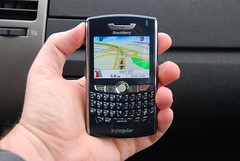
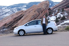
I have been very impressed with both. I have written in the past about the geotechnology in my previous car, an Infiniti FX35, and the navigation system in my Prius provides a significant jump in functionality and ease of use from the (three year old) one in my Infiniti. I'll probably write a more detailed review on this in future, but you can see a few photos of both the Prius and the BlackBerry in action to get an idea. Just like the BlackBerry, the Prius includes integration with a telephone, and the photos show an example where I used my car to track down the nearest Cingular store which had a BlackBerry 8800 in stock, using the integrated dialing features to call the stores in order of distance from my current location. And by the way, the Prius drives really nicely too, and does 45-50 mpg - I highly recommend it!
I have also been very impressed by the BlackBerry 8800 so far, and in particular by the telenav application which uses the built in GPS. It has rich functionality and a simple user interface. So far I have found the database of businesses to be very complete and up to date. Last week in Huntsville I was going to a baseball game with a group of people from work, and I just searched for "baseball" and it returned not only the Huntsville Stars stadium, which is where I wanted to go, but also the Huntsville Sports Academy (which is a baseball school but does not include baseball in the name), which moved to a new location just three months ago, and telenav showed it at the correct address. When you navigate a route, it automatically downloads information on the route in advance to ensure good performance - though I have found the EDGE wireless network performance to be very good in general. It gives you voice directions which are loud and clear and even says street names (e.g. "Turn left on 20th street"), which most navigation systems don't do. Telenav also offers Telenav Track, a very reasonably priced mobile workforce management system. I plan to look at that in more detail, but I think that this type of device and application could be very disruptive to traditional workforce management systems, which are typically fairly large and complex enterprise software systems.
Both the Prius and the BlackBerry are good examples of the continuing integration of sophisticated location based technology into mainstream devices. I see great potential for the BlackBerry and similar devices, and will write more about other location based applications for it in future posts, including BlackBerry Maps, Google Maps for Mobile, and Spot for BlackBerry, the last of which claims an impressive list of features, including the ability to record tracklogs (something I want in order to be able to geotag my photos using RoboGeo without needing a separate handheld GPS), and even the ability to read data from WMS servers! More to come ...
Subscribe to:
Posts (Atom)