Showing posts with label conference. Show all posts

Sunday, September 4, 2011

Crowdsourcing my State of the Map keynote talk

A couple of months ago I gave a talk at the monthly OpenStreetMap meetup in Denver and I decided to try crowdsourcing the content (in the best OpenStreetMap tradition), and it worked out very well. I received a good amount of interesting content from several folks (thanks everyone!). I rashly agreed to do a keynote at the upcoming State of the Map conference in Denver (rashly since I'm chairing the FOSS4G conference right after that, and am more than a little busy with that, not to mention my day job :O !!). So I thought I would do the same thing again and appeal for ideas on things I should include in a tour of what's new and cool in OpenStreetMap.

You can send me links to stories, slides if you have them, or anything else that you think would be useful. If you did a presentation on something cool and interesting at SotM EU but can't make it to Denver, I'd be happy to mention it over here. And even if you are presenting something over here, I'm happy to include a slide or two as a "trailer" for your talk. Of course I can't promise to include everything, depending on how much material I end up with (and I do have some of my own of course!), but will do my best.

In general I'm interested in hearing about things that you think are (reasonably) new and interesting in the OpenStreetMap world including:
  • Cool applications using OpenStreetMap data 
  • New (or improved) tools for creating / editing OpenStreetMap data 
  • Examples of businesses or government organizations using OpenStreetMap 
  • Anything else you think is interesting! 

Please just drop me an email, or comment below. I will give credit to all contributors, of course!

Sunday, August 7, 2011

How FOSS4G had a profound impact on my geospatial technology path

As some of you will know, the FOSS4G 2011 conference is coming up in Denver and I am the conference chair. I have only been to one previous FOSS4G, which was in Victoria in Canada in 2007. That event had a profound impact on my perspective on the geospatial industry, and on the software platforms I've chosen to implement geospatial applications on since then. And it has saved my companies a lot of money! So I wanted to share some perspectives about my experience at FOSS4G and what I've learned about open source software, to explain why you should come to FOSS4G, especially if you've never been before.

Back in 2007 I had just left my job as CTO of Intergraph and was weighing up what to do next, and looking at ideas for a geospatial startup company. I'd spent 20 years in the geospatial industry working with closed source products, and knew very little about open source geospatial products. Towards the end of my time at Intergraph, I'd been getting quite a few questions from sales guys, in Canada in particular, about the fact that their customers were showing interest in open source software, which was free, and how should they sell against that?  So I'd done a bit of research and had become interested in particular in PostGIS, the open source spatial database, as a possible platform for applications I was looking at in my new (yet to be created) startup, Spatial Networking. The fact that it was free was obviously attractive to a new startup owner, especially as I was looking at a system that (I hoped) would need to be deployed on many servers to cope with large numbers of users.

Open source software tends not to have such flashy marketing material as closed source software, so after a bit of digging around online and not finding all the information I was after, I got in touch with Paul Ramsey, who is one of the main people behind PostGIS. He suggested I should come up to FOSS4G to find out more. I did and was really impressed by the whole experience, both the event in general and what I found out about PostGIS - you can read my writeup at the time here. As I said in that writeup, there was much more energy and buzz than I had seen at other geospatial conferences I was used to attending.

I went ahead and used PostGIS at Spatial Networking and on other projects, including my current project Ubisense myWorld. I continue to be very impressed with PostGIS - it does all the core things you expect a spatial database to do (I had a lot of previous experience with Oracle Spatial and other systems), and it's FREE! I have never hit a bug during my time using it.

So what have I learned about open source geospatial software in those four years? First of all let me say that I have no strong predisposition to open or closed source development approaches, per se. I am happy to chose either open or closed source products depending on what I need in a given situation. What I do have s strong predisposition to is FREE. Obviously a product needs to meet your requirements, but assuming it does then free is rather attractive compared to having to pay for something. This is especially true in a cloud environment, where you may scale up to running many servers, and traditional per server licensing costs can really hurt you financially.

People in the closed source world often raise concerns about support in the open source world. My experience hasn't borne out this concern. With PostGIS, I've never needed support, it just works. With MapFish, another open source product we're using for myWorld, we needed a few enhancements. Some were addressed by the community within a month or two, others we were able to do ourselves as we had access to the product source code. I very much doubt that we could have got enhancements made in a mature closed source product in that timeframe. There are also more and more options in the open source geospatial world to pay people to do enhancements or fixes for you. Again it's a bit dangerous to make generalizations, you can get good support or poor support on different closed source products, and you can get good support or poor support on different open source products. But my experience with the open source products we've chosen has been very good.

I think that after price, perhaps the aspect of open source that I value most is longevity and predictability. Many times during my career, I have seen projects suffer because a vendor has decided to stop development of a product (or feature). I have also seen dramatic changes in terms of service or costs of online services. Google App Engine is one example of the latter - many people put significant effort into developing applications that were running for free, then Google changed the pricing model and people found themselves facing large costs they hadn't planned on. With an open source product that has a strong community behind it, there is much more long term stability. You know it's not going to go away tomorrow. Even if some developers leave, others are there to cover for them. And in the worst case you have access to the source code so could continue to maintain it yourself (though that's a very unlikely scenario as long as the community of developers has a certain critical mass). I have been moving more components of myWorld towards open source because of this predictability.

So anyway, if you are still paying for geospatial software you owe it to yourself and your company to come to FOSS4G and find out what all this open source software is about. There is a parallel universe out there with software products that have great capabilities and are FREE! It's also worth saying that in general there is good interoperability between open and closed source systems, so it's not an all or nothing proposition. In general open source web and database products are very strong, and they may well be able to complement your investment in existing applications.

This is the first time that FOSS4G has been in North America for 4 years, and it is not likely to be here again for another 3, so this is a rare opportunity if you are based here to meet a wide range of people developing and using these products. So I hope to see you in Denver in September at FOSS4G!

To finish up, check out this video featuring members of the organizing team talking about why you should be there:

FOSS4G 2011 Denver from Tyler Mitchell @ OSGeo on Vimeo.

Wednesday, April 13, 2011

So long to the GITA "annual conference" and thanks for the memories

I just wrapped up the closing panel at the 34th and last GITA "annual conference" (officially known as the geospatial solutions conference these days), which was quite a sad moment for me. I attended my first GITA (then AM/FM, Automated Mapping and Facilities Management) conference in 1992, and have only missed one since then. Especially back in the 1990s, and into the early 2000s, it was always the highlight of the year in the part of the geospatial industry that I worked in, focused on organizations managing infrastructure like gas and electric utilities, telcos, water and waste water and local government. I should say before going too far that this does not mean that GITA the organization is going away. They already do a lot more than just the annual conference, and are actively looking at various new opportunities - I'll come back to this below.


Above is a portion of the Smallworld team that attended the 1993 conference, which is where we launched Smallworld in the US, and I moved over here from the UK later that year. From left to right you see Sean Newell, Jay Cadman, Ali Newell and me. Somehow we retrieved various signs at the end of the conference, in order to illustrate our predictions for the GIS industry :). In the late 90s attendance would be over 3000 people I think. It was the place to go for organizations selecting new GIS products. I remember sometime in the late 90s we upped the ante at Smallworld by giving away a car at the show (a new Volkswagen beetle) ... will have to try to dig out some of the (pre-digital) pics of that! And I gave many presentations at GITA over the years.

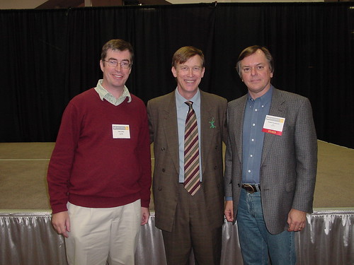
But since 2005 the GITA "annual conference" (under a couple of different names) has had declining attendance, and so GITA Executive Director Bob Samborski and the GITA Board, which I rejoined this year after a few years off it, reluctantly concluded that the right thing to do was to make this the last annual conference in its current form (a decision I agree with). Here's a picture of me and Bob with then Denver Mayor, now Colorado Governor, John Hickenlooper at the GIS in the Rockies conference in 2004...

GIS in the Rockies

GITA has always been associated with the annual conference which was historically its biggest event, but for quite some time now this has just been a part of its activities. It also runs the GIS for Oil and Gas conference, now in its 20th year, which remains strong and will continue. And international affiliates such as GITA Australia and New Zealand continue to be strong. This year it is also playing a leading role in organizing the FOSS4G conference, for which I am conference chair. It organizes a successful program called GECCo, Geospatially Enabling Community Collaboration, to encourage collaboration between infrastructure organizations, with a particular focus on emergency response. GITA recently received a grant from the Department of Homeland Security to expand the GECCo program and organize quarterly workshops over the next 3 years. GITA has an active network of regional chapters that organize local events, and those will likely receive more focus now. Also I think there will be a stronger focus on delivery of educational material via various online channels. And there are a number of other ideas under consideration for new events and alliances with other industry organizations.

So GITA will continue, but with a somewhat modified focus. Things are changing rapidly in the geospatial world and I agree it's the right decision, but it's still a bit sad for those of us who have had such a long association with the annual conference. Everyone involved can be proud of what the GITA conference has contributed to the growth of the industry over the last 34 years! (Yes, probably longer than a lot of you "neo" readers have been alive!).

Wednesday, February 23, 2011

GITA Geospatial Solutions Conference 2011

If you haven't already signed up for the GITA Geospatial Solutions Conference, which is coming up in Dallas (Grapevine) from April 10-13, you should check it out. There's a lot of great content in the program, including an open source track, which is a first for GITA. I'll be speaking on that track with my colleague Jason Sanford, about some of the latest developments we've been working on with our Ubisense myWorld product. Jason will also be talking in a workshop on geo in the cloud, and I'll be speaking in the opening session together with Geoff Zeiss. I'll also be chairing the closing panel. I'm just finalizing the participants, watch this space for details, but am aiming for something which will be as interesting as the panel I chaired at the GITA conference last year on the topic of "Not your father's approach to geospatial data creation and sharing" featuring Steve Coast, Andrew Turner, Ron Lake and James Fee. This year we'll be covering a broader range of topics across the geo-universe.

GITA Panel: Not your father's approach to geodata creation and sharing from Peter Batty on Vimeo.

I'm looking forward to the conference and hope to see you there!

Monday, January 24, 2011

Speaking at Boulder-Denver Geospatial Technologists meeting tomorrow

Just a quick post to say that I'll be speaking at the Boulder-Denver geospatial technologists meeting tomorrow, together with Chris Helm and Brian Timoney (and maybe Andrei Taraschuk, though he's doubtful because of other commitments). We'll be doing a pretty informal set of demos and discussions on geospatial in the cloud. Examples we'll cover will include Google Fusion Tables, GeoCommons, the OpenGeo stack (PostGIS, GeoServer, OpenLayers) running on Amazon, and Arc2Earth Cloud and Ubisense myWorld running on Google App Engine. It's at the Boulder Open Space and Mountain Parks Building at 6pm tomorrow, Jan 25.

Tuesday, December 21, 2010

FOSS4G update: sponsorship, logo, web site

The organizing committee has been working away on various tasks for next September’s FOSS4G conference in Denver. We now have sponsorship details sorted out – you can download the brochure here (PDF). We are offering a 10% discount for any sponsors who commit by the end of January.

We also have a winner in our logo contest, which you can see at our new FOSS4G Denver 2011 web site. We had over 800 votes in total, thanks to everyone who voted! The logo design was an interesting process. Creating a logo is always tricky because you have as many different opinions as people involved in the process! We used a site called crowdspring, as you will know if you voted – multiple people compete to create your logo, which we found worked very well. And then they also have a voting process you can use if you like, which I found very helpful to choose a winner from the multiple good entries.

And as mentioned in passing above, our web site is now up and running - it will have a lot more content added to it over the coming weeks. But check out the timetable leading up to the conference – some significant items coming up are the call for workshops which will be out in mid January, and the call for papers which will be out at the beginning of February.

Wednesday, December 8, 2010

Help us choose the logo for FOSS4G 2011!

As I've mentioned previously, I'm going to be the chair of the FOSS4G 2011 conference in Denver next September, and I wanted to ask for help in choosing our logo. We've been using a cool site called crowdspring, on which people compete to design your logo, with the winner getting a prize. I have been very impressed at the quality of entries. Please take a minute to have a quick look at these entries and vote for the ones you like (you can rate with up to 5 stars), and feel free to add any comments.

Thanks!

Sunday, November 28, 2010

FOSS4G Denver 2011 venue preview

Now that wherecamp5280 is out of the way for this year, I'm getting excited about organizing FOSS4G 2011 here in Denver next September (in case you missed the news, I'll be the conference chair). This will be a rather larger event - we're expecting 1000 or so attendees.

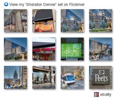
I walked down to the Sheraton in downtown Denver the other day to take some pictures for marketing purposes (for the web site and brochures, etc), and I really think it's going to be a great venue for the conference. Here are some pics ...
ebatty - View my 'Sheraton Denver' set on Flickriver
All the conference sessions will be within the hotel itself, and a large new bar connected to the hotel lobby is nearing completion, which will have 130 different beers on tap (I will try to do my conference chair's duty and sample all of them once it opens, later in December!). So that should all be conducive to great socializing and networking. Right across the street there's an excellent assortment of reasonably priced "fast but fresh" food places, so loads of convenient food options very close by, though of course the conference will be well catered! Plus there are literally hundreds of bars and restaurants within walking distance - the location gets an outstanding score of 95 for walkability at walkscore:

This hotel’s Walk Score:®

95 out of 100 — Walker’s Paradise

View on WalkScore.com

Walk Score House Icon Walk Score

On top of that, there are free shuttle buses that run continuously up and down 16th Street right outside the hotel, which makes it easy to get a little further afield around the downtown area.

I'll be sharing lots more about the conference plans over the next few months, stay tuned!

Wednesday, November 24, 2010

WhereCamp5280 review, and thoughts on unconferences

Last week we held the second annual wherecamp5280 unconference in Denver, and I think it was a great success again. The first one was organized by me, Eric Wolf and Ben Tuttle, and this year Steve Coast took the lead on organizing the main day while I did the social event, Chris Helm and Sean Gillies organized a hack day beforehand (aka hooky bobbing, courtesy of Sean, a new term to me I have to admit!), and Hurricane Coast took the lead on a follow up ski (and xylophone) mapping event. There have been several good reviews already from Andrei, James and Michael.

P1000349

As those reviews mention, a couple of big hits in terms of topics were Google Fusion tables (unfortunately I missed Josh Livni's talk as I had to leave early to organize the party) and a lot of interesting discussion around HTML5, Polymaps and other items relating to handling vector graphics in browsers - Chris Helm did a great ad hoc talk on the latter topic which generated a lot of good discussion, and there was a lot of discussion at the hack day on this. I also enjoyed Eric Wolf's talk about the work that USGS has been doing with the OpenStreetMap software stack combined with USGS data, and Steve Davis's talk on how he created some really nice basemaps for City of Atlanta. I felt the overall event was a good integrated mix of "neo" and "paleo" topics and experiences, without using those labels or worrying about them (which is how it should be).

I felt, as did several others I talked to, that last year's event was excellent but this year's was even better. There were actually fewer people this year, 70-something versus 100ish, but a stronger set of sessions this year and more interaction, as well as more people at the party :) !! There was a great assortment of interesting geo-people, and a (pleasantly) surprising number who flew in from out of town. I go to a lot of conferences, and continue to think that the unconferences I've been to rank right up there with the best events I've been to. Steve wrote a post with his perspectives on organizing an unconference, and how it took 6 hours of his time (which excludes the party organization, by the way!). This raises the interesting question of whether all the time that people invest in traditional conferences is really worthwhile (especially since I'm chair of the upcoming FOSS4G event!), and for small events I think it really is a valid question, though I don't think the unconference model can scale up too much or it loses its informality and interaction, which are really the things that make it so good. The 75 people or so that we had this year felt like a good size.

This year we had less organization than last year. There was only one pre-arranged talk this year - Steve asked me to do a short 20 minute keynote to kick things off, and that was only fixed a week in advance, and wasn't publicized ahead of time (now everyone knows why Steve was busy beforehand). The previous year we did a little more to get a few speakers lined up ahead of time and we publicized them and potential talks. We felt we needed to do that in order to get reasonable attendance, and to persuade sponsors to support us, since it was the first time we were doing the event, and a lot of potential attendees really didn't know what an unconference was all about. Personally I don't think that those slight differences in "pre-organization" made a material difference to why this year was even better than last year. It's really down to how many people come ready to talk about interesting things, which more people did this year. And it's hard to manage that or predict it, but I think a lot of it has to do with it being the second year of the event, and we had such a great buzz this year that I'm sure that will contribute to another great event next year! Talking of which, there was some casual discussion afterwards about whether there would be a wherecamp5280 next year, since we have a geo-extravaganza of bigger conferences coming to town, and a lot of us who have been involved in organizing wherecamp5280 will be heavily involved in those. I think there was a sentiment that people would like to keep it going and not lose the momentum that we have. And that momentum should mean that it will take even less than 6 hours to organize next year :), so I think it's highly likely there will be another one in 2011, probably earlier in the summer.

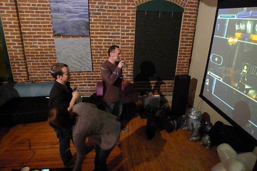
P1000374

And last but not least those who stayed late at the party got to witness a quite extraordinary sequence of geo-karaoke duets from the legendary James Fee and Andrew Turner. I am still debating whether to release some video footage or whether to honor James' plea that "what happens at wherecamp5280 stays at wherecamp5280" :).

Thursday, October 21, 2010

Triple geo-conference goodness coming to Denver!!

Denver has always been known as a center for geospatial activity, and we have a great triple bill of events lined up, one in the near future and two back to back in September 2011.

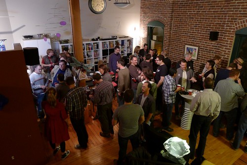
The one coming up is WhereCamp5280 on November 19th. Eric Wolf, Ben Tuttle and I ran the inaugural one last year which was a great success, see James Fee's review. I hear a rumor that James will be back this year, so I guess he must have liked it! Eric and I have both been a bit swamped on other things recently, so Steve Coast has kindly taken up the organizing reins this year, thanks to Steve for that! Last year we were kindly hosted for free by Denver University (DU), this year we will be at University of Colorado Denver on their Auraria Campus, which has the advantage of being within easy walking distance of downtown. And this year we've decided to do one day rather than two. But two things that haven't changed since last year is that the event is FREE, and we'll be holding the social event on Friday evening at my loft, I expect there will be plenty of geo-beer from the Wynkoop Brewing Company downstairs and that may fuel some geo-karaoke later on. All this is thanks to our kind sponsors, who at the time of writing include Enspiria Solutions, ESRI, Google, MapQuest and Waze.
WhereCamp5280 party
I'm expecting a great group of interesting attendees and presentations again this year, so highly encourage you to come along. And remember it's an unconference, so we are looking for as many people as possible to participate - prepare a short presentation or come prepared to lead a discussion on a topic that interests you!

Sign up for WhereCamp5280 here, and if you feel like sponsoring at anywhere from $16 to $1024 (can you tell that a techie geek set the sponsorship amounts?!) that would be great, but otherwise just sign up and enjoy the great free education, networking, and beer :).

So WhereCamp5280 is a great local event, but in September 2011 the global geo community will be converging on Denver for a fantastic double bill of FOSS4G and SotM.

For those who don't know, FOSS4G stands for Free and Open Source Software for Geospatial and is an annual international gathering organized by OSGeo. The last North American event was in 2007 in Victoria, BC, and since then it's been in Cape Town, Sydney and Barcelona, so we're delighted to have Denver join that list, and expecting a great turnout from around the world.

Eric Wolf and I led the bid to bring FOSS4G to Denver (which is one of the things we were busy on that was competing for time with WhereCamp5280). Eric was originally slated to be the conference chair, but unfortunately due to circumstances beyond his control he has had to stand down from that, and I have just taken over that role in the last week (well unless the OSGeo board fails to approve the change at their next meeting, but I'm assured that's not very likely!). I'd like to publicly thank Eric for all the work he did to bring the conference here - it was his idea initially, and definitely wouldn't have happened without all his efforts. We have the core of a great local organizing group set up already, but are still interested in recruiting a couple more folks, so if you'd like to help out please let me know. It's going to be a great event, and I'll be blogging plenty more about it over the coming months.

And on top of that it was announced today that Denver has also been selected to host State of the Map (SotM), the global OpenStreetMap conference, also in September 2011. I attended SotM in Amsterdam in 2009 and thought it was a fantastic event. Unfortunately I wasn't able to make it this year, but I will definitely be there next year :) ! The two events are distinct, but several people were involved in both bids, and we recognized that a lot of people would be interested in attending both, so the intent is for them to run back to back. The SotM date isn't fixed yet, but FOSS4G is locked in for September 12-16.

So if you're in the Denver area already, plan to be at WhereCamp5280 on Nov 19, and if you're not, make plans to be here in September 2011!

Wednesday, September 1, 2010

Hello again, and upcoming events!

As a few people have remarked to me recently, I haven't posted anything in a while ... have been otherwise occupied the past few months, between some interesting new work projects and some personal things. But I have quite a few talks coming up, and next week will be launching an exciting new product at the Smallworld User Conference in Baltimore, which is what I've been focused on the past few months, and I'll be blogging about a lot of interesting things relating to that in the near future.

So here's a list of upcoming events:
  • I'll be talking on "Smallworld and Google: the best of both worlds" at the Smallworld conference, on Friday September 10 (there's a clue about in the title of the talk :) !!)
  • The latest version of my "Geospatial Revolution" talk has a double outing the following week, with keynotes at the NSGIC conference in Minneapolis on Monday September 13, and at GIS in the Rockies in Loveland, CO on Wednesday September 15
  • Sneaking in between the previous two on September 14 is the second Ignite Spatial NoCo (Northern Colorado), in Windsor, CO, where the title of my talk is "Don't make me think", after the excellent book of the same name by Steve Krug, which is all about usability, something I've been working on a lot recently. I guess that's kind of a busy stretch, with four presentations at four events in four consecutive working days, plus a product launch right before that :O !! There's a good lineup of speakers for the Ignite event, with Brian Timoney, David Cole, Kate Chapman, Matt Ball and Mano Marks among those I know.
  • The week after that it's off to the UK for the Ubisense User Conference, where I'll be talking about Ubisense applications on September 22
  • I plan to stay on in the UK for the one day W3G (un)conference in Stratford upon Avon - it being an unconference there's not a formal agenda, but I hope to do a slightly expanded version of the "Don't make me think" talk there, if they'll have me
  • And for the benefit of our Danish readers, I'll be doing a keynote at the Geoforum.dk Kortdage in Ã…rhus on November 1-3 ... my mother is from Denmark so it's always nice to have an opportunity for a visit there.
In other news, Denver has been selected to host FOSS4G in 2011, the annual OSGeo conference which is being held this year in Barcelona, next week in fact. Congratulations to my friend Eric Wolf for leading the Denver bid, and I'll be one of the local committee supporting him in the organization of that.

I'm looking forward to catching up with old friends at the Smallworld conference next week, which will be the first I've been to since 2004, as I've been off roaming around other parts of the geo universe. Talking of which, I'd better get back to writing some code! Not to mention writing a presentation or two :O.

Saturday, May 8, 2010

Location and the Internet of Things

Last night I presented at Ignite Spatial NoCo (Northern Colorado) in Fort Collins. There was a great turnout of 200 people and some excellent 5 minute presentations (plus a few that I thought were a bit too much "corporate sales presentations" for an Ignite event). There was a fun map competition, in which teams had to create a relief map of Colorado using an assort of supplied materials like cardboard, egg cartons, cloth, cotton wool, pasta, etc - I was impressed at what everyone came up with! Congratulations to Brian Sullivan for organizing a great event. And thanks to Glenn Letham for videoing the presentations.

You can see my presentation below, which was on "Location and the Internet of Things". The Ignite format allows you 20 slides which advance every 15 seconds, for a total of 5 minutes - it's quite tricky to get the timing right. I will try to post with a few tips on doing Ignite presentations soon, this was my third go at this format.

Update: Glenn has now posted a better quality video of the presentation on youtube (original ustream video included below too, just in case):


And here is the ustream version as a backup (clicking the small play icon at the bottom of the window below seems to work better for me than the large play icon in the middle, an eccentricity of ustream :) !)

Sunday, November 1, 2009

Tips on videoing presentations using ScreenFlow

I talk at quite a few conferences, as regular readers will know, and have been experimenting with videoing some of my presentations for a little while now. I thought I would share some of my experience on techniques I've tried and how they've worked.

Basic Approaches
Of course a basic option is just to take a single digital video that includes the speaker and/or the slides. Options include setting this up yourself by putting a camera on a small tripod, or even a table, or getting someone else in the audience to do the filming. You can get reasonable results doing this - certainly better than not seeing the presentation at all! A recent example of this approach was my "cowboy georant" at AGI GeoCommunity.


That was just taken on a cheap Flip video camera and it gives a good idea of the presentation - but it misses out quite a bit too. You don't get to see most of the carefully crafted slides :) (though maybe the cowboy hat was more interesting in this case!). One way to enhance a basic video like this is to upload files to SlideShare, and then imbed the video and slides next to each other, like this.

One other scenario where it makes sense to use a simple approach like this is when doing live streaming. Dave Bouwman and Brian Noyle have done a good job in live streaming presentations from various events for geogeektv (some older recordings here). This is very easy to do - all you need is a webcam (an external one is probably most flexible in this scenario), and a free membership of one of various online streaming services like ustream. Most of these services have the ability to both stream live and record for later viewing.

Using ScreenFlow
But with just a little effort you can combine videos of the presenter and the slides so you get a good view of both. The software I use to do this is called ScreenFlow, which runs on Mac only. It can record everything happening on your screen (from basic slides to video and software demos), and also gives you the option to concurrently record video from an internal or external webcam on your computer. ScreenFlow gives you nice capabilities to position the two (or more) video streams within your final output. I have used this on quite a few occasions with my built in webcam and a "picture in picture" style. The following is an example of this:

GeoWeb 2009 presentation by Peter Batty from Peter Batty on Vimeo

This approach works pretty well. If you watch for a few minutes you will see that the small window showing me talking can be easily moved around the screen, to avoid overlapping with significant items on a slide. This adds a bit of work to run through the presentation file in ScreenFlow and move the video window as needed depending on the current slide, though it's straightforward to do this. If you designed your slides appropriately with this approach in mind, you could potentially avoid (or at least minimize) the need to move the video window ... though I have to confess I haven't been organized enough to do that yet! But this definitely works well and doesn't need any equipment other than a laptop with a webcam.

A couple of minor drawbacks with this approach include the fact that using the built in webcam gives a slightly odd angle looking up at the presenter, especially if you are tall as I am, and the video window showing the presenter is rather small. I recently bought a new HD video camera (a Lumix GH1), and decided to try a different approach for my recent presentation in Duluth. I set up the video camera on a separate tripod focused on the presentation podium. I could have recorded the slides while I presented (which would have been easiest), but actually I recorded them separately in ScreenFlow after the fact (following along with the video to get the timing right). This is a useful option to have if you don't record the slides at the time for some reason, but you have a video of the presenter.

Having the video of me presenting in a wide screen HD format (1280x720 pixels) gave me the idea of putting the slides and presenter video side by side as in the following (click through to see it in a larger format, including the HD version):

The Geospatial Revolution (Minnesota) from Peter Batty on Vimeo

ScreenFlow has this nice ability to rotate the videos in a 3D space, which makes them slightly narrower without losing any content, as well as giving an interesting perspective effect. Putting the slide video on top crops out one side of the presenter video (which is just static background) and the other side is cropped by the edge of the overall frame. Overall I really like this layout - it gives you a clearer view of the presenter, from a better angle than using the webcam, and you can also see the whole of all the slides. One other nice little graphical touch I added is to include a 50% reflection below both videos - another cool feature of ScreenFlow. I can provide more specific details on putting this together if anyone needs that.

Specific tips on using ScreenFlow
Make sure you have plenty of spare disk space - ScreenFlow stores video in high quality for the full screen resolution and the webcam, so a raw file can easily take up a few gigabytes (once you output the final presentation video it will be compressed and a lot smaller). Once I didn't have a lot of spare disk space on my laptop, and got into a long discussion after the presentation without turning recording off, then the disk filled up and I lost the whole recording (enhancement request to the ScreenFlow folks ... it would be great if you could recognize an impending full disk and stop recording cleanly before crashing!)

These days when presenting I usually use "presenter mode" where I can see speaker notes and other information such as elapsed time and the next slide on my laptop screen, while the projector displays just the current slide - both Apple Keynote and Microsoft PowerPoint have this feature. It's especially useful if you're using more of a "presentation zen" style where you have simple pictures on most slides and do away with bullet point lists (which I highly recommend!). Anyway, if you do that you need to make sure that ScreenFlow is recording what is happening on the external display rather than the built in display. It defaults to using the internal display so this is easy to miss, especially in the heat of the moment when you're just about to start presenting. An added complication is that if you don't get to plug in your laptop until immediately before the presentation, you can't select the external display until the last minute (once you are connected to the projector) - which increases the chance of messing up this step. I have done at least a couple of presentations where I accidentally recorded the presenter screen instead of the audience screen. That's not the end of the world as you can re-record the slides after the fact, but that takes extra time of course. So another enhancement request for the ScreenFlow folks is to either default to recording the external screen (or have a preference to specify this), or at least give a warning when starting recording if there are two screens connected.

I have mainly used the internal microphone on my Mac for recording, and that has generally worked pretty well, but on some occasions the sound has been a little quieter than I would like. So it is worth considering an external microphone - one that I have used is the Snowflake, which worked well for my presentation in Perth but unfortunately I left it on the floor afterwards and someone stepped on it :(!

Publishing your video
YouTube has an annoying 10 minute limit which makes it inconvenient for traditional conference presentation formats. I like to use vimeo, which doesn't have this limit and also handles high definition videos nicely (though youtube has upgraded its support in that area recently). Vimeo also gives you the option of letting users download the original video file, if you want to. I now have a geospatial presentation channel on vimeo.

How does this impact conferences?
Kirk Kuykendall commented on my recent video post and wondered how this type of video recording may impact conferences - is there a risk of reducing conference attendance? There might be a slight risk of that, but overall I think it is probably more likely to have the opposite effect and encourage people to attend. A lot of the value of attending conferences is in meeting people, and in the informal (or formal) discussions that happen there. Conferences like Where 2.0 already video their presentations and put them online. TED is another example of a conference that puts all its presentations online, but still charges $4500 for conference attendance and sells out. But hopefully it will help conference organizers focus on providing a good all round experience for attendees.

It also presents a similar dilemma for speakers like myself who talk at a number of conferences. Obviously you sometimes re-use some material, so publishing online increases the risk that some attendees have seen parts of your presentation before. But again I feel the benefits outweigh the risks - you get an additional audience for your presentation, it may encourage some additional people to come and see you speak live, and it also gives you an incentive you to keep refreshing your material!

Monday, October 26, 2009

Talk on "The Geospatial Revolution" in Minnesota

Here is a video of my recent keynote talk at the Minnesota GIS/LIS conference in Duluth, which was an excellent event. There were about 500 people there, which is great in the current economic climate. It was mainly a "traditional GIS" audience, and I got a lot of good feedback on the talk which was nice.

I talk about current trends in the industry in three main areas: moving to the mainstream (at last!); a real time, multimedia view of the world; and crowdsourcing. There's a lot of the same material that I presented in my talk with the same title at AGI GeoCommunity (which doesn't have an online video), but this one also has additional content (~50 minutes versus 30 minutes).

Click through to vimeo for a larger video, and if you click on "HD" you will get the full high definition version!! I used a different approach to produce this video compared to previous presentation videos, using a separate camera and a different layout for combining the slides and video. I like the way this came out - I'll do a separate blog post soon with some tips on how to video presentations, I think.

The Geospatial Revolution (Minnesota) from Peter Batty on Vimeo.

You can also view the slides here:

Tuesday, October 13, 2009

Speaking in Minnesota next week

Just a quick post to say that I will be doing the opening keynote talk next week (Thursday October 22nd) at the 19th annual Minnesota GIS/LIS conference, in Duluth. It should be a fun and interesting event, so if you're up in that part of the world I encourage you to stop by!

Sunday, September 6, 2009

Looking forward to the AGI GeoCommunity conference

I'm very much looking forward to the AGI GeoCommunity conference which is coming up in Stratford upon Avon in a couple of weeks. Apart from Stratford being the birthplace of Shakespeare and a great place to visit, it's also very close to Leamington Spa where I used to live when I worked at IBM UK many years ago, so it will be a chance for me to catch up with old friends. It will also be the first time I've presented at a major UK conference since moving to the US 16 years ago, so I'm looking forward to talking in my homeland!

More importantly, from a general rather than a personal perspective it looks as though it will be a really interesting and fun event. I think Steven Feldman has done a great job introducing some new ideas this year, including the addition of a strong neogeography/geoweb element which really hasn't been there in previous years (see Ed Parsons' thoughts on this year and last). There will be a really strong geoweb track organized by Chris Osborne, founder of #geomob. And Andrew Turner and myself are giving the opening keynote talks - I know that mine will include a strong "neo" element, and since Andrew's is titled "How neogeography killed GIS", I'm guessing that his just might too :). I think that some of the most interesting conferences I've been to recently have been those that combine both traditional GIS and "neogeo" elements - like GeoWeb in Vancouver and, on a smaller scale, the WhereCamp5280 event we held recently in Denver. So I'm hoping that we'll get a lot of interesting discussion about how to combine the old and new geo worlds. Chris is also offering discounted day passes on his blog, in case you need any further incentive to attend!

There is going to be a "soapbox" event with lightning "Ignite" style talks on contentious topics, with a beer-fueled crowd, which sounds like a lot of fun. To get in the spirit of things I have submitted a talk called "The grass is always greener ... in defence of the Ordnance Survey" (for those not familiar with the UK national mapping agency, they tend to be a favorite punchbag for everyone in the UK geo industry ...)

Ordnance Survey

So I'm slightly concerned that my talk may look like the famous "Rawhide" scene from the Blues Brothers - I hope they have the wire fence in place to protect the speakers :) !!


The conference party has a "black and white" theme and I think I have a prize-winning outfit lined up for that (actually I'm not sure if there are prizes or not, but I may try to wangle a bottle of Lagavulin out of Mr Feldman).

Ordnance Survey

So all in all I'm looking forward to what should be a really fun and interesting event ... I guess I'd better get working on wrapping those presentations up!

Monday, August 10, 2009

WhereCamp5280 is almost upon us!

As I have posted about previously, I'm helping to organize a cool, and FREE, "geo-unconference" in Denver called WhereCamp5280 (5280 = the altitude of Denver in feet, for those not from round here!), which is now almost upon us - it's this Friday and Saturday, August 14-15. We've been really pleased with the response - check out the list of likely attendees and potential talks (being an unconference, the schedule isn't fixed in advance - and there will be a lot more talks and discussion topics added "on the fly" during the event).

We initially thought it would just be a local event, but we have quite a lot of distinguished visitors from around the country, including founder of OpenStreetMap Steve Coast, uber-geoblogger James Fee, Executive Director of OSGeo Tyler Mitchell, ESRI product gurus Bern Szukalski and Victoria Koujoumjian from Redlands, and more. We have a lot of founders of local geo startups coming along, including Martin May of Brightkite, Andrei Taraschuk of UMapper, Duncan McCall of PublicEarth, Charlie Savage of Zerista, Tom Churchill of Churchill Navigation, and Brian Timoney of the Timoney Group. Oh and me :). We have geogeektv stars Dave Bouwman and Brian Noyle. And loads of local geospatial software users and developers who are doing lots of cool things with all kinds of technologies - and sorry to all the attendees I haven't mentioned by name ... I guess I really shouldn't have started this list, it will get me into trouble with someone! (The beer's on me at the social event if I missed you off the list!).

Talking of which, we've also had a great response from sponsors, which is really gratifying in the current economy - thanks a lot to our gold sponsor ESRI, silver sponsors Bohannan Huston, DTSAgile and PublicEarth, bronze sponsors Enspiria Solutions, A Mountain Top and UMapper, media sponsor AnyGeo / GISuser, and facilities sponsor GTAC at DU.

I'm looking forward to a really fun and interesting event. The sessions will be at University of Denver in Sturm Hall, and we'll have a fun social event on Friday night at my loft above the Wynkoop Brewing Company. There's still time to sign up - hope to see you there!

Tuesday, August 4, 2009

GeoWeb 2009 review

The GeoWeb 2009 conference was very good as usual. The presentations I attended were a bit of a mixed bag - some excellent, a few so so - but the networking and hallway conversations were great. James has done a good writeup. I'll just comment on a few things that I thought were interesting.

One trend was increasing acknowledgment that the traditional approach to SDI (Spatial Data Infrastructure) using OGC standards is really not working well in comparison to newer "geoweb" type mechanisms for sharing data that have come from the "neogeography" developments of recent years (I won't get back into the label debate just now!). This was most striking for me in the presentation by Clemens Portele, who is a highly respected member of the OGC community - he won the Gardels Award in 2007. Clemens gave an excellent and very frank talk on "The gap between SDIs and the GeoWeb". A couple of quotes that I noted were "So far the impact of SDIs on the integration of data as a ubiquitous component of the web seems low" and "There is not evidence that SDIs have increased the market volume of government data by a significant amount". He noted that OGC web services are based largely on an architecture and approach to web services developed around 10 years ago, well before many recent web innovations. Another interesting comment was on metadata - he observed that there is much more interest in user-centric and user-provided metadata – did others use the data? Who? What worked, what didn’t? - than in "traditional" metadata. This is not a new debate, but it was interesting to see someone who has invested so much in OGC and who is so well respected in OGC circles taking a very "neo" view of the world (for lack of a better short label!). My friend Carl Reed, CTO of OGC, was moderating the session and commented at the end that OGC was aware of the issues with not having a simpler API and were looking at them, but the solutions were complex.

Andrew Turner gave an excellent talk on geoweb standards which you can see at geogeektv (kudos to Dave Bouwman for broadcasting a number of presentations - we really should see a lot more live transmission and recording of presentations, all you need is a cheap webcam and and Internet connection). There were some interesting dynamics as the talk was introduced by Ron Lake, the father of GML, and Andrew discussed his views on shortcomings of GML pretty frankly! Andrew observed that we are lacking a "middle ground" in web standards between the simple (GeoRSS, KML) and the complex (GML, Shape).

Update: Ron responded via twitter (as I said recently, hardly anyone seems to comment on blogs any more!), and this is a summary of his points (in bullets of 140 characters or less :)
  • Good review. I also thought that there was a growing realization of limits/roles of things like KML, GeoRSS outside mapping.
  • I think GML already fills that middle ground although I agree that the spec is daunting!
  • It also does not reflect the fact that one can profile GML (take subsets) - can be small like lo-pidf proposed in ipv6!
  • Or a bit larger like geoRSS GML - which is only slightly more complex than geoRSS "simple"
  • That is one of the things that struck me also - the range of views on what constitutes the "web" stood out very clearly (this was in response to my comment that one of the interesting things about GeoWeb is bringing together a range of perspectives)
  • Many versions of the web to consider. The web of hyperlinked documents. The web of database access. The web of real time collaboration ..
Thanks for the comments Ron, definitely an interesting debate!

I think we have seen in this area and others that on the web especially (and probably in computing / life in general!), simple is good. We have repeatedly seen greater success in the technology space with an approach that says do something simple and useful that covers maybe 80% of what you want to do eventually, with 20% of the effort, get it out there and being used, and iterate from there. Versus an approach which tries to tackle all the complex cases up front, takes much longer to implement, and ends up being complex to use - which is not uncommon in a consensus based standards process. OpenStreetMap is another example of the "keep it simple" philosophy which has been very successful.

Another general trend was a lot of discussion on how the "geoweb" is not just about running geospatial applications on the web, but making applications and geospatial data fit in with key web concepts like search and linking. Jason Birch gave a good presentation on the work he is doing at Nanaimo, which is discussed on his blog and by James. To see an example, do a Google search for 2323 Rosstown Rd. A tweet I liked from Kevin Wiebe said "If a dataset available on the web is in a format that can't be indexed by Google, does it make a sound?". Clearly this approach to making geospatial data searchable is hugely useful, and there are places where making data linkable is very useful too. I think there is a question about how far the linking paradigm can go with geospatial data though - Mano Marks from Google has an interesting discussion on this (and other related topics). Another potential item for a future post!

In many ways the "geoweb" is not a good concept (as Sean Gillies and others have observed), except as a very broad label for geospatial activity on the web (let's not get back into terminology discussions again!). But there isn't a separate "geoweb", there's one web which handles many types of data, one of which is data that has a location / geo element to it. We don't talk about the "numeric web" or the "varchar web". Alex Miller from ESRI included in his presentation a picture of the web with lots of "GIS servers" and I always have an uncomfortable feeling about that. It is often said that 80-85% of data has a location component. Does that mean that 80-85% of servers on the Internet (or in your enterprise) should be "GIS servers"? No, of course not. But any general data server should be able to support location data types. Of course there may be some servers that are especially focused on certain kinds of geospatial processing, and maybe "GIS server" is a reasonable term for those. But I think it's important to understand that the great majority of location data we use will not be coming from those specialized "GIS servers".

Michael Jones of Google gave a very animated, entertaining and thought-provoking talk as always, which you can see (cut into 10 minute chunks) on youtube (hint to GeoWeb organizers: use Vimeo, where you aren't constrained to 10 minute videos!). His major themes were the pace of change in our world, something which was a common theme from other invited speakers too, and user created data. He said "the future is user created data" and talked a lot about Google Mapmaker. He also made a big deal about the fact that Google has an internal organization called the "Data Liberation Front", whose mission is to ensure that any data you put into Google, you can get out - you see this piece here. I thought it was curious that he made such a big deal of this, since one of the primary differences between Google Mapmaker and OpenStreetMap is that you can't get the raw data (vector data with attributes) that you have created out of Google Mapmaker, but you can get this back from OpenStreetMap. Google Mapmaker just lets you display a standard Google Map created from your data, but doesn't let you get the data itself. Ed Parsons argues that getting the underlying data is "an edge case". I would agree that most users don't want to access this data directly - but I think that most users would want the result of their efforts to be more broadly available. I haven't yet used any of the raw data I've contributed to OpenStreetMap directly, but I like the fact that a whole range of third party applications can use that data for innovative purposes - things that they couldn't do if they just had access to something like the Google Maps API. I asked Michael about this at the end of his presentation, and also about his thoughts on OpenStreetMap in general (see video). He said that he didn't think it was likely that the policy on making map data available would change (it is available to non-profits but nobody else) - though he did say "perhaps for non-commercial use", so maybe there is a glimmer of hope there :). In regard to OpenStreetMap he said that Google had had conversations with them for a year or so, but couldn't resolve some legal issues - with the key problem being that contributors of data retained the rights to that data, which opens up the possibility of Google being sued by contributors if they are using that data. He made the interesting comment that "if they [OpenStreetMap] had their legal act in order we would not ever have done anything on our own" (i.e. Google MapMaker). OpenStreetMap is in the process of changing its licensing in a way which will resolve this specific issue, so it will be interesting to see whether this re-opens the possibility of collaboration (which probably some people in the OSM community would like, and others wouldn't) - though there are other licensing complexities which may be obstacles too, and it may be that the two of them are too far down separate paths now.

One other interesting snippet mentioned by Michael was that Google Maps has had 470 versions in 4 years :O !!!! There is a new one every Tuesday, and additional ones if necessary to fix a problem. That certainly puts a whole new perspective on agile development. As he said, it's hard for companies who do a software release once every year or two to keep up with innovation these days.

Chris Helms (A fellow Denverite) from the National Renewable Energy Laboratory (NREL) gave an interesting talk on an application he has developed called IMBY (In My Back Yard), which lets you look at the potential effect of installing a solar photovoltaic (PV) array or wind turbine at your home or business.

Sean Gorman gave a good overview of his efforts at FortiusOne to demystify and democratize geospatial analysis, and empower end users who are not "GIS professionals". I very much agree with his philosophy - as he says, you don't need to do a training course in statistics to use a spreadsheet, or have a qualification in graphic design to use PowerPoint.

Dale Lutz of Safe Software talked about the new opportunities they see in 3D data and BIM (Building Information Modeling) - I think this is a great new opportunity for Safe, with much greater complexity than traditional (largely) 2D geospatial data. The growth in number of formats supported by FME is always an interesting chart in Dale and Don's presentations - it has now reached 238 and continues to show linear growth since they started - and Dale said if anything it is now trending slightly above linear growth (getting into 3D data may well contribute to that). He also said in passing that his mother can handle a 3D PDF, which I thought might explain something about Dale ;) !

Just as at Where 2.0, one of the coolest demos of the show was the automatically generated 3D models done by C3 - check out some of the videos on their site.

I think that had better do, I have other things to get to - apologies to those who did other interesting presentations that I didn't mention! And if you made it this far, I should mention that I haven't forgotten my "top 10" influential people list, that will be coming soon. Quite a few of them were at GeoWeb :). Thanks to the organizers including Ron Lake, Galdos, and GITA, for another excellent event.

Thursday, July 30, 2009

My GeoWeb 2009 presentation

Here's a video of my GeoWeb presentation on "Building a new location-aware infrastructure for calendaring and scheduling". Recorded and edited using ScreenFlow.

GeoWeb 2009 presentation by Peter Batty from Peter Batty on Vimeo.

I'll post more thoughts on GeoWeb soon - in the mean time you can check out my tweets and the geoweb stream on twitter. And there are some pics of the social event here.

Wednesday, July 15, 2009

WhereCamp5280 - cool event coming up in Denver!

We’ll be holding a fun, cool, educational and FREE geospatial event in Denver on August 14-15 – WhereCamp5280 (for those not from round here, 5280 is the elevation of Denver above sea level in feet – exactly one mile high!). If you’re already familiar with WhereCamp, you probably don’t need any more persuading to come along. The event is being organized by Eric Wolf, me, Ben Tuttle, and anyone else who would like to help out!

For those not familiar with WhereCamp, it’s an “unconference” on the subject of location, mapping and things "geo". An unconference is basically an informal conference which is organized on the fly by the participants. I’ve attended two unconferences now, both of which were excellent. The first was held by FRUGOS (Front Range Users of Geospatial Open Source), which you could also consider a predecessor to this event – though we intend for this to cover not just open source solutions (though that’s up to the participants, of course!). Here are a couple of reports on the FRUGOS unconference by me and Charlie Savage. The second was WhereCamp in San Jose this year, which I found really interesting and fun. I have to say that based on these two unconferences, the quality of presentations has been at least as good if not better than the “formal” conferences I have been to.

We have already had expressions of interest in attending from a wide variety of interesting geo-people, both locally and from out of town, so I’m sure there will be lots of great discussions. For an up to date list of people likely to attend check here.

If you are potentially interested in participating, please sign up to our Google Group and add your name to the likely attendee page. We encourage you to list topics that you would be interested in talking about or leading a discussion on, but this is definitely optional! While the agenda will certainly be flexible in unconference style, we plan to get some ideas together in advance to help us make the most of our time during the two days.

If you’re interested in helping out, please let me or Eric know. While DU has kindly donated the rooms for the event, we are aiming to get some modest sponsorship to be able to cover other costs including:
  • A fun social event on Friday evening (probably either at the Wynkoop Brewing Company, or my loft which is right above the Wynkoop)
  • Cost of projector rental from DU (which is not free) – if you have access to a projector(s) that we could use on Friday and/or Saturday, please let me know
  • Lunch on Friday and Saturday
Please see the Google Group for more info – your questions, suggestions and assistance are appreciated! We really hope to make this a good venue for exchanging ideas between the “neogeographers”, open source users, and users of traditional GIS (and some of us, like me, fit into all of those camps). If you work in the geo area in Denver, tell your manager that this is the best free education you can get on the latest developments in the space!