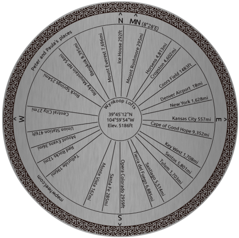
Yesterday I backed a Kickstarter project called Mapwheel, I think it’s a really cool idea. They let you design a custom “toposcope” or map wheel showing the direction and distance of places of interest from the location where you live (or any other location you choose). You can choose various materials (wood or metal) and customize the design in various ways.
Working on the design has been a surprisingly fun and interesting thing to do. Here’s my current design, which could still change before I order:
To get the full story on the mapwheel project and the reasoning behind my choice of places, check out this post on my new travel and photography blog.
Note: updated 3/25/2015 with links to presentation videos where available.
TL;DR
FOSS4G NA was awesome
There were way more female presenters than at previous events
Mapbox was everywhere
Boundless wasn’t
Lots of new developments on vector tiles, including several efforts from companies other than Mapbox – even some promised from Esri!
Progress towards Leaflet 1.0 but I’m a bit puzzled that Mapbox doesn’t have more focus on integrating the worlds of Leaflet and Mapbox GL
Cesium is a super cool JavaScript library for doing Google Earth like apps, and had the coolest demos I saw at FOSS4G – drive a monster milk truck!
OSRM (Open Source Routing Machine) does incredibly fast dynamic routing, and also shows how much OpenStreetMap data has improved for routing.
People are continuing to do cool stuff with D3 and other approaches to vector maps.
FOSS4G goes from strength to strength
By FOSS4G I mean both the conference and Free and Open Source Software for Geospatial in a broad sense. The conference, as with every FOSS4G I’ve been to, had a fantastic amount of energy and excitement. People were running birds of a feather sessions (BoFs) and other technical sessions until 9 or 10 in the evening. I am just super impressed and excited at the number of smart people doing great things with open source geospatial at the moment. This is clearly where the innovation is happening in the industry currently.
It happened that the Esri developer summit was happening the same week. I don’t pay much attention to that anyway, having never been an Esri person, and certainly didn’t have any spare bandwidth to do so last week. But here is a tweet comparing the two:
My feed this week is full of idealistic #FOSS4Gna tweets of neat new tools & sharing & drones & openness.
#devsummit: Legos.
— Mark Johnson (@Old_Man_Johnson) March 12, 2015
It is also notable how Mapbox is setting the pace and Esri is following in a number of areas. News from the dev summit was that Esri is going to adopt the Mapbox spec for vector tiles. It is good to see them adopting the emerging standard on this occasion rather than inventing their own incompatible approach which they have tended to do historically (for example with geoJSON).
More diversity
A number of people, myself included, remarked on the much greater presence of women at this FOSS4G compared to most geo tech events.
@pmbatty I hadn't really thought about it before your tweet, but it was 7 of 8 for me. Great presentations all around!
— Keith Jenkins (@kgjenkins) March 11, 2015
Credit to the organizing team for inviting a black woman, Denise Jacobs, to give the opening keynote. You would hope that this would be something that did not deserve comment, but in an industry so dominated by white men traditionally, this did stand out, and it set the tone for a much more diverse event.
Mapbox also deserves credit for the fact that 6 of their 10 speakers were female
I did a quick skim of the overall program and in total counted 22 female speakers and 56 male, so almost 30% female speakers. So still a way to go, but it felt like good progress.
More Mapbox
As noted above, Mapbox provided 10 speakers for the conference and they were everywhere. They received $10m in funding from Boulder based Foundry Group a year and a half ago, and have certainly moved aggressively since then, growing to 80 people and taking on a huge number of talented people. Mapbox is driving a lot of innovation in the industry at the moment. However, I’m rather perplexed at why they’re not doing more to integrate all their cool newer stuff with Leaflet. See the sections below on vector tiles, Leaflet and OSRM for more.
Less Boundless
When I chaired FOSS4G in Denver in 2011, one concern that came up from several directions was whether OpenGeo, now known as Boundless, had too many presentations at the conference (the same question people are now asking about Mapbox!). They were definitely the company that was seen as the leader in the open source geo world then. At this FOSS4G I counted one workshop and one presentation given by Boundless. In contrast to Mapbox, they have had a high profile array of talent leaving over the past year – including Eddie Pickle, Tim Schaub, Paul Ramsey, Alyssa Wright, Jeff Johnson, and Gretchen Peterson. There are still good people there of course, and I’ve heard they are doing well in the Federal market, but they were certainly less prominent here than at other FOSS4G events.
Vector Tiles
There continues to be huge interest around the development of vector map tiles, which is being driven by Mapbox but the spec is an open standard and others are contributing to developments in this space also, which is a significant step towards widespread adoption.
I talked a bit about vector tiles in my report from the last State of the Map US conference, and I won’t repeat that here. Dane Springmeyer’s talk on vector tiles was excellent as usual. He mentioned a post from Mike Migurski on “the liberty of postgreslessness” which is an interesting discussion on the original motivation for developing vector tiles, and is definitely worth a read (though Dane also emphasized – and I totally agree – how great PostGIS is too!).
Mapbox GL renders vector tiles in a browser using WebGL, and Mapbox Studio can both create and consume vector tiles. Vector tiles are useful both server side, where they can be used to create raster tiles in a fast and flexible way, and on the client side, where they can be used to create more interactive and flexible maps – but not in all browsers and at the cost of more computing power.
The primary Mapbox tool to create vector tiles is Mapbox Studio – it can also consume vector tiles. A couple of new tools to programmatically create vector tiles are geojson-vt, a library for efficiently slicing geoJSON into vector tiles on the fly, and tippecanoe, a command line tool that can convert very large geoJSON files to vector tiles.
Also SpatialDev has developed a Leaflet plugin for vector map tiles using HTML5 canvas. As they say, “though there is extensive use of MapboxVectorTiles in Mapnik PNG tile rendering as well as MapboxGL, there is a strange lacking of libraries that integrate these vector tiles directly into Leaflet”. There are various examples referenced on their web site. Spatialdev also has a very interesting looking tool called PGRestAPI which is written in node.js and provides a REST API for PostGIS that can serve data as vector or raster tiles, geoJSON, Esri JSON, and more. I plan to look at this further for work that I am doing.
As an aside, I find it interesting how much the vector tile spec reminds me of the “IFF” (Interface format file) that the IBM GFIS product used back in the 1980s, with its emphasis on compactness. They use a number of the same tricks, like dictionary encoding of attribute values, and relative encoding of coordinates. Just when I thought geoJSON was winning in the format wars with its simplicity and readability, along comes something at the other end of the spectrum with its focus on compactness and performance, but much more complex. Obviously both have their pros and cons, it’s not a case of one or the other, but I continue to find it entertaining how cyclical the computer industry is!
Leaflet
Vladimir Agafonkin gave his usual excellent presentation on “Leaflet, WebGL and the Future of Web Mapping”. He talked about progress towards Leaflet 1.0, which will feature things like flyover animation (similar to how Google Earth flies from one location to another), improved vector rendering, and a wide range of lower level improvements. And the code is slightly smaller than the previous version, something Vlad is always focused on! He hopes to have a beta version of 1.0 soon, but acknowledged that this has taken longer than he hoped.
His talk got quite personal as he talked about some of the challenges he’d experienced and how he had really been suffering from burnout over the past year. Aside from the difficulty of running a successful open source project and the challenges that come with that, which he articulated well, Vlad is living in a country with a war going on (Ukraine) and he and his wife had twin girls last year.
He talked about how he’d mitigated this by working on a number of other cool new projects like RBush, a high performance JavaScript library for spatial indexing of points and rectangles, which sounds great, and geojson-vt which I mentioned above. But the talk of his burnout did leave me somewhat concerned both for Vlad and for Leaflet. I hope for both of their sakes that between Vlad, the Mapbox team, and the broader community, they can figure out a way to spread the load a bit more so that not so much of the weight of moving Leaflet forward is on Vlad’s shoulders.
The other thing I should mention is that I was somewhat puzzled, as were several others I talked to, that Mapbox doesn’t seem to be doing more to integrate the worlds of Leaflet and Mapbox GL. Multiple Mapbox people in multiple presentations said that they were conceptually hugely different things, but I don’t really agree with that. Yes you can’t rotate maps in Leaflet, but as someone who has invested heavily in developing some serious enterprise applications on top of Leaflet, I really want to be able to plug in vector tile layers to my existing Leaflet applications – there are multiple advantages to this even if I don’t have the full interaction that I would have with a full MapBox GL application. Third parties seem to be doing more to integrate the two than Mapbox does, as mentioned above. There is a Mapbox GL Leaflet project, but this was only mentioned in passing, it didn't get much emphasis. Also someone asked about conversion scripts from CartoCSS styles to Mapbox GL, and the answer was that they were too different to do this. Again I didn't find this a very satisfactory answer – if you’ve defined large numbers of styles in CartoCSS you don’t want to recreate all of those completely manually. Sure some complicated cases might not translate, and you would have to make further changes to take advantage of new features of Mapbox GL, but a script that at least converted basic information like colors, linestyle, fill etc seems as though it would be useful.
It just seems to me that given the massive adoption of Leaflet, it would really help adoption of Mapbox GL with some closer integration between the two – I hope they will consider putting more effort into this.
Drones – and kites!
A hot theme at all the geo conferences I’ve been to in the past year has been the use of drones for mapping, and FOSS4G NA was no exception. I have been tempted to buy a drone for a while but hadn’t been considering building one, and I nearly skipped “Building Your Own Mapping Drone from Scratch using Open Source Hardware and Software” by Ragi Burhum. However, his infectious enthusiasm now has me seriously considering a drone building project ☺. Check out his presentation video, and there is lots of info at DIY Drones.
This was followed up by another good talk from Michele Tobias and Alex Mandel on kite photography, and a presentation in the afternoon (which I missed) on OpenDroneMap from Stephen Mather. Another good source of information is Aaron Racicot’s presentation from FOSS4G 2014 in Portland – see the video and slides. This whole area is definitely something I want to play with more.
Cesium
My vote for the coolest of the many cool demos at FOSS4G NA goes to the presentation on Cesium JS by Matt Amato. I really hadn’t been aware of Cesium up to this point, so this was one of the best discoveries of this conference for me. It’s a Google Earth like 3D globe application, but which runs in JavaScript and is much more customizable than Google Earth was. Its significance is even greater now that Google is deprecating the Google Earth API.
The most fun demo was this one which lets you drive a Monster Milk Truck around various impressive locations – you can leap into the Grand Canyon among other things (but don’t worry, the truck is indestructible and bounces nicely!). There are more demos on this page for Google Earth developers, and still more here. One application that I thought was really cool was doarama which lets you follow multiple GPS tracks over time, and look around from the point of view of any of them – shown to great effect in this example of a paragliding trip in the Alps.
OSRM
I was also super impressed with OSRM, the Open Source Routing Machine. This is an incredibly fast interactive routing library which can route all the way across the US in a fraction of a second, and you can dynamically drag intermediate points and it will reroute interactively.
Check out the presentation here and demo here – click a start and end point on the map, then drag either the end points or intermediate points around. This also shows how far OpenStreetMap data has come for routing – the main thing it is missing relative to Google now is good geocoding / address matching, and there are various efforts in progress to improve that (and also Street View, where there are also some open source initiatives, but matching that will be further away).
D3 and other vector stuff
There was less on D3 than at some other recent conferences, but Michael Bowman gave a very nice talk with a series of D3 examples that each built on the previous one. He had an entertaining quote on SVG:
SVG is “human readable … if you’re a certain kind of human” :) #foss4gna
— Peter Batty (@pmbatty) March 12, 2015
Check out his map examples - choose them from the pulldown at the top. Most of his presentation was reviewing code, and to me his examples seemed far less incomprehensible than most D3 code I've seen. I plan to look through them in more detail when I can. A useful link he shared lets you browse many more D3 geo examples at bl.ocksplorer. We have been doing some work with D3 recently and I think that people are just scratching the surface of the cool things that can be done with it in an interactive mapping context.
They didn't present at the conference, but I ran into Erez Cohen of Mapsense, who I had talked to remotely a few months ago but hadn't met in person before. They don't have any publicly available demos yet, but are working on some new vector mapping technology that has very impressive performance with large data volumes. Keep a lookout for interesting things coming up from them.
Design and usability
There were a number of good sessions on design and usability. Gretchen Peterson gave a good talk on "How to Win Friends and Use QGIS". One of her top tips was "Other people will like you instantly if you make pub maps" - which is what she proceeded to do. I have been meaning to play around with QGIS for a while but hadn't managed to find the time, but Gretchen's live demo was a great introduction to QGIS as well as having lots of good map design tips. I also learned what an inverted polygon shape burst fill looks like! Gretchen will be doing a hands on version of this talk at the upcoming Maptime Boulder on April 9.
I also enjoyed the talk "Think before you code" by Lizzi Slivinski, on the design of the Toledo Flood Hazard Visualizer, which covered various aspects of usability and user interface design. This application also used D3.
And more ...
I really need to end this post :), I'm sure I've missed some important things so I apologize in advance for that. But here's a quick list of other interesting things that came up at some point, either in presentations or conversation:
Boost is a C++ geometry library that is a potential alternative to GEOS. One reason this is important is that GEOS can't be used in iOS applications, as Apple doesn't allow use of LGPL licensed software, but Boost can be.
Torque and Windshaft from CartoDB both came up a couple of times in different presentations. Torque does really cool temporal animations. Andrew Hill showed a cool example analyzing the 1962 escape from Alcatraz. I continue to be impressed with what CartoDB is doing, and they recently acquired the services of Mr PostGIS, Paul Ramsey, which adds even more strength to their team.
AmigoCloud is another cool system I hadn't come across before - cloud hosted mapping including ability to make offline updates, and do two way sync of updates with an Esri system.
Cloudantpresented about the work they're doing with CouchDB and PouchDB, including offline sync, which sounds like another interesting thing to explore.
I missed the GDAL talks but heard there is lots of activity there with GDAL 2.0 coming soon, integration of GDAL and OGR (raster and vector), new geometry types including curves, and more.
I also missed out on most of the PostGIS talks this time but there was a whole PostGIS track and lots of discussion on topics like raster processing and spatial analysis. We use PostGIS extensively in large and demanding enterprise applications, and it's great.
One of my colleagues went to the workshop on PySAL, a python library for spatial analysis, and was very impressed with its capabilities.
I took a side trip with Jeff Johnson of Aero Glass, whose advisory board I'm on, to visit ODG in San Francisco, who are one of the leaders in augmented reality glasses. Their latest hardware is really impressive. It currently sells for around $5000 but they are planning to bring out a more consumer focused model this year which will be significantly less expensive.
The ODG side trip was great, but unfortunately it made me miss the keynote from Planet Labs, who are doing very cool things with tiny imaging satellites. Frank Warmerdam of GDAL and OSGeo fame is working there these days.
Linda Hecht who was formerly Chief Marketing Officer at Esri, and had worked there for 28 years, left them recently which I found interesting. She attended FOSS4G to find out more about the open source world, and left suitably impressed:
From an ex-Esri exec perspective....I had a great time! Such energy and innovation. Thanks for welcoming me.
— LindaHecht (@LindaHecht) March 13, 2015
Summary
So all in all, FOSS4G was another great brain-filling event, lots of interesting things to research further! All the presentations were recorded, so I encourage you to check those out, they are starting to appear on youtube. I think that the plan is that there will be links from the FOSS4G NA schedule pages too - click through on individual talks to see more details, and a number of those pages also have links to speakers' slides.
This is slightly off topic, but as a side project I have just put together a small web site which is a guide to all the cool new developments at Denver Union Station. If you live in (or are visiting) the Denver area and haven't checked out Union Station recently, you definitely should! And to make it not totally off topic, there will be an interactive map appearing on the site shortly, I just decided to get some basic content out there first. Have been dabbling with both CartoDB and Mapbox for this, or might do a custom Leaflet app, we'll see! So anyway, if you have any interest, please check out Union Station Guide!
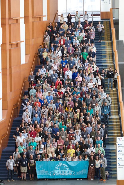
I spent the past weekend in Washington DC for State of the Map (SotM) US, the OpenStreetMap conference. It ended up selling out, with around 500 attendees, making it the largest OpenStreetMap event yet. As with previous SotM events I’ve attended (the last one being in Denver in 2011), I found it very enjoyable and interesting, and there was great energy about it as always, much more than at traditional GIS events. Many thanks to the organizing team for a great event!
Below I summarize a number of items that I thought were of interest. I should also say that I missed a number of interesting presentations - there were two tracks and much of the time I wished I could have been in both talks! Fortunately though all the talks were recorded so I will check out those I missed online, and recommend you do too! Actually most of the talks are already online - just click through on the online schedule. Well done to the SotM organizing team for getting this done so quickly and professionally!
I also got some nice pictures of cherry blossom, and saw my English football (soccer) team, Liverpool, win a hugely important and exciting game against Manchester City together with several other SotM attendees, at the Queen Vic pub, home of the DC Liverpool Supporters Club - thanks to Jeff Johnson of Boundless for being the ringleader on this outing!
Vector tiles
The most interesting and potentially significant announcement was that MapBox released the spec for their vector tiles format, which they have been talking about for a while, and have been using internally to generate dynamically styled raster tiles at mapbox.com. Dane Springmeyer talked about more technical aspects of it, and Nicki Dlugash from Mapbox and Mamata Akella of the National Park Service talked about using Tilemill 2, which can both consume and export vector tiles, from a user perspective.
One nice aspect of rendering vector tiles directly in the browser is that you can do very interactive zooms and nice transitions, as shown in this short demo from Nicki's presentation. Another advantage is that you can do very dynamic restyling, on the server or client. And thirdly there are attractions for offline use in terms of data volumes compared to raster tiles.
Vector tiles are not a panacea though, raster tiles continue to have their advantages too. A key one is being able to exactly match complex symbology from an existing GIS, which is important in a lot of the applications we work on at Ubisense - large utilities can have a hundred feature types, thousands of symbology rules and complex custom annotation, which is not easy to replicate. Also raster tiles give great interoperability between different systems, an advantage that many people underestimate. And they work well in older browsers, whereas most vector technologies require newer browsers and a lot of large enterprises are still stuck on older versions of Internet Explorer :(. This is less of an issue for mobile apps on tablets or smart phones though.
As an aside, I find it a bit ironic that when I started doing GIS in the 1980s, most products then stored their graphics in map tiles, which caused various problems with editing in particular, and managing features that were split between multiple tiles. The big focus of everyone in the industry at that time was to move away from tiles to a "continuous database" where you didn't have to split things across tile boundaries. But now tiles are cool again :) !! It's interesting how many computing problems oscillate in a similar way, moves between thin and fat clients being another example - mainframes to PCs to web browsers to smart phones, etc.
But caveats notwithstanding, these vector tiles definitely have a lot of potential and I certainly plan to be playing around with them in the near future!
Licensing
The elephant in the room with OpenStreetMap, unfortunately, continues to be licensing. I hesitate to even get into this topic, but will try to briefly summarize. There has been a long and painful process over the past several years to migrate the license for OpenStreetMap from Creative Commons to a new license called ODbL. Many smart people, many of whom are friends of mine, have put a huge amount of effort into creating this new license and managing the difficult process of steering the community through the change, all with great intentions. A key part of both the old and new licenses is the notion of "share alike" - roughly speaking that you can take a copy of the OpenStreetMap data, but if you make improvements to the data then you need to also make those freely available under the same license.
However, there was a very strong message from a range of organizations presenting at the conference that they were prevented from doing much of what they would like to do with OpenStreetMap because of the license - from government organizations like USGS, New York City and the National Park Service (NPS) to private companies like MapBox and Foursquare. Alex Barth did a presentation just on the licensing topic. I am not a lawyer, and I have also been steering pretty well clear of the license discussions in the last year or two, but I think there are two broad areas of concern. One is that if you use OpenStreetMap data in conjunction with your own private data, if there is sufficient interaction between the datasets then there is a risk that he license could oblige you to make your private data freely available also, which is obviously not acceptable in many situations. Some things are clearly fine, like just using OpenStreetMap tiles as a backdrop to your data. But when you get into editing the underlying data in some way then it's more complicated. A second category is that certain government organizations like USGS and NPS are mandated that the data they create and maintain has to be public domain. So they are unable to incorporate OpenStreetMap data as they would like to, because then at least some aspects if not all of their data cannot be released as public domain, it has to have the ODbL license which imposes additional conditions on the use of the data.
There seem to be two schools of thought on how to proceed, as articulated by Mikel Maron:
The first category of problems could arguably be mitigated by further clarifications on ODbL, for example detailing specific use cases that are or aren't acceptable. Part of the problem is that since ODBL is a new license, until there are some law suits involving it, there isn't a legal precedent for how certain things will be interpreted (again as I understand it, I am not a lawyer or overly close to this!). However, I personally don't see how the second category of problems can be resolved without dropping share alike, it's just fundamentally incompatible with mandates that these government agencies have.
From my non-legal and somewhat removed perspective, I would really like to see OpenStreetMap be public domain. I fully understand the rationale for why we started out with a share alike approach, but I think it's just run into a lot of problems now, as seen from the various user presentations I mentioned. But it's also difficult to see how to get from here to there - having just been through a very divisive and often vitriolic multi-year process, which drove many people (including me) to be less engaged with OpenStreetMap, I don't know if many people are going to have the appetite for another license change. But who knows, perhaps there are new people who have the energy for it! It just seems to me that if organizations have to pay lawyers huge sums of money to decide whether they can use the data as they would like to (and often get the answer "no" back), then we don't have the sort of free and open database that I think most of us want.
Anyway, enough of that, back to more fun stuff ...
Passive Crowdsourcing
I have thought for a while that one of the next big steps for OpenStreetMap, and other crowdsourced map initiatives, is to make more use of passive crowdsourcing to complement the active crowdsourcing that has been the focus so far. By this I mean things like gathering bulk GPS traces from phones or in car navigation systems, and from this you can deduce a lot, like whether there is a road that is missing from the map, as there are lots of cars going through empty space at 30mph, or whether a one way road is incorrectly tagged, etc. To some degree OpenStreetMap is at a disadvantage here compared to the likes of Google and Apple, who have more direct access to GPS tracking information from navigation applications running on many smart phones.
However, Telenav has been doing a lot with OpenStreetMap and Kristen Kam talked about their work. One thing they do is to identify potentially incorrectly tagged one way streets, by comparing the direction of GPS tracks versus the underlying OSM data. Currently these changes are pushed into MapRoulette, which presents a sequence of small fixes to a user for them to validate and either fix or not - Martijn Van Exel talked about this. I tested this out, and personally I found that most of the time (admittedly from a small sample), I couldn't tell whether it made sense to change a street to one way from the aerial imagery. I think potentially it would make more sense to make this particular type of edit as a direct batch update job - but nevertheless MapRoulette does work very well for many types of fix.
Another cool example of leveraging passively crowdsourced data came from Strava, who have an application that tracks runners and cyclists, and they have a very large number of GPS traces along trails, comprising billions of GPS points. Digitizing winding trails manually is quite time consuming, and Paul Mach presented a very cool solution called Slide, which has some pretty elaborate mathematics behind it, but basically would snap a very roughly digitized path to the "center of gravity" of the traces running along that path. You can try an interactive demo here, which I think is pretty cool! They also have a version of the same functionality that is integrated into (a fork of) the OpenStreetMap iD editor.
In general, it seems as though OpenStreetMap's routing capabilities have improved quite significantly, and there are a lot more applications using it for this purpose.
Geocoding
Apart from routing, another historical weakness with OpenStreetMap has been addressing / geocoding. There is also quite a lot of effort going into this area, but it would seem with not as much progress yet as we've seen with routing. Randy Meech gave an interesting presentation on Mapzen's work on an open source geocoder, including autocomplete capabilities. You can check out a live demo of their "Pelias" geocoder here. It has a knowledge of neighborhood names in many cases, but is more limited on individual house addresses (because of what's available in OpenStreetMap). If you drag the map around it also does reverse geocoding based on the location of the target, where possible.
David Blackman of Foursquare gave a very entertaining talk that touched on a range of topics, including the construction of neighborhood and other boundary data from OpenStreetMap plus some other sources. One of the outputs of this work is Quattroshapes, where you can download a variety of useful polygon data for free. This data is used by Pelias and some other gecoding initiatives, I believe. Tyler Bell also gave a good talk focused on reverse geocoding, and there were multiple talks on doing address imports from county GIS datasets.
And more ...
I'm running out of time and energy here, so just a quick bullet list of a few more miscellaneous things that I think are worth a mention:
An interesting presentation from Mike Skalnik on what github is doing with geoJSON - sort of cool for smaller simpler datasets, but with limitations for more complex applications
Jeff Johnson of Boundless talked about GeoGit, which is an ambitious initiative to manage distributed updates, and something I've been interested in exploring but haven't had a chance to get to (one thing we did a lot of work on at Smallworld back in the early 1990s was version management, which has a lot of parallels with this). Jeff talked about some interesting scenarios in how this could potentially be used to manage two way sync between OSM and a local government (or other) GIS (license constraints permitting!)
In the bar at the end of the conference I chatted to Morgan Herlocker, who is developing an open source library I hadn't come across called Turf, for geospatial processing in JavaScript (server or client side) - sort of like a GEOS or JTS, but independently developed. I haven't looked at it in detail, but it seemed like this could be useful for some things we are working on.
Mapillary is an interesting looking project that aims to create a crowdsourced Street View from stitched together photos taken by smart phones, something that I've been thinking for a while is a project that is needed. You can download their app for your smart phone and upload some pictures - I had a very quick play capturing some data near my home this afternoon and it came out fairly well, I will experiment more in due course.
John Firebaugh gave an excellent talk on "Implementing change in OpenStreetMap", with lots of great insights on managing community based projects. He had a lot of good one line pearls of wisdom, one that I liked in particular was that "perfect" is the enemy of "much better than we have today".
Lyzi Diamond gave a great talk on "Maptime" meetups, which I found especially interesting as one of the organizers of the Geospatial Amateurs meetup in Denver. They take a very hands on approach to helping people learn new things, and have developed quite a few lessons and tutorials that are available on github, and I certainly plan to look more at those.
OSM Tchoutchou is an entertainingly named site that maps French trains in near real time using OSM, which is quite cool to watch.
And there's much more too - sorry for those whose presentations I didn't get to (either physically or in this post), but I really am out of time for now, and want to get something posted. Thanks again to everyone involved for making it such a great and energizing event. And I encourage everyone to watch the recorded presentations.
Myself, Nate Irwin and Jason Sanford are starting a new monthly meetup in Denver called Geospatial Amateurs. We plan to have a few short talks each month and hang out for a few drinks and chat about interesting things that people are up to in the geo space. The first meeting is this Thursday at Galvanize, come along and say hi! Details here.
The past couple of days I've been at the js.geo event in Denver, which was a small informal conference focused on JavaScript and geospatial, organized by Chris Helm, Steve Citron-Pousty and Brian Timoney. I've been head down on customer projects and product development the past few months, so it was great to get out and see what's going on in the broader world. As usual with this type of event I was blown away by how much cool new stuff people are doing - it's definitely a tough job to keep up with everything that's going on these days! The attendees included a great cross-section of people involved with the major geospatial JavaScript projects. I've said this before, but increasingly I find that informal "unconference" style events, which are either free or very cheap (this one had a registration fee of $11.54!) provide an experience that is just as good as, if not better than, the larger, more expensive and more organized conferences.
My brain is overflowing at the end of the two days, and I have lots of things I want to look into more. This post is mainly a list of items I found interesting with some links. Apologies in advance to anyone / anything I missed out! Without further ado ...
D3
D3 is a very cool general purpose JavaScript interactive visualization library, developed by Mike Bostock, that includes some good (mainly vector) geospatial capabilities. This was probably the hottest topic at the conference, lots of people talking about it and incorporating it into demos. Here's a blog post from CartoDB with some examples. D3 supports a new format called TopoJSON, which is similar to geoJSON, but supports topology to eliminate redundancy. For polygon data this can reduce data volumes by around 80% (compared to regular geoJSON). It also lends itself to robust simplification of polygons.
Leaflet
Several presentations, including this one by Aaron Ogle, confirmed the impression I had that the Leaflet JavaScript mapping API has great momentum. Matt Priour in his presentation on OpenLayers acknowledged as much with his pitch that OpenLayers was "almost as convenient as Leaflet and twice as powerful". One of the key selling points of Leaflet is its simplicity. Matt said that in discussions about OpenLayers 3 there were proponents of just moving to adopt Leaflet instead of doing a major redevelopment of OpenLayers, but it was decided for various reasons that OpenLayers 3 was needed - you can see further discussion on its aims here. It's important to be aware that OpenLayers 3 will not be compatible with OpenLayers 2, it's going to be a fresh start. We are looking seriously at using Leaflet for a future version of our Ubisense myWorld application.
CartoDB
I continue to be very impressed with CartoDB. They first launched the product at FOSS4G in Denver in 2011, and released Version 2 in November 2012, with lots of cool new features. These include a new system called Torque which does beautiful spatio-temporal visualizations, and new density maps using either hexagons or squares. I definitely plan to work on including CartoDB in the solutions that we're offering. Check out Andrew Hill's presentation.
Mapstraction
Andrew Turner gave a lightning talk about Mapstraction, a library that provides an abstraction layer for the major mapping APIs. Last time I looked at this I had the impression it wasn't being very actively developed, but it seems I was misinformed! This is something I want to investigate further too. There's a nice sandbox demo site here.
MapBox
The folks at MapBox also continue to do a whole range of interesting things, from their TileMill map rendering product to a range of map sharing tools at Mapbox.com to their iPad application. A little while ago I did a simple demo with some utility data using various bits of MapBox infrastructure, borrowing heavily from this example (you'll probably need a browser other than Internet Explorer for these to work). As well as giving a workshop, Will White talked about their server side architecture which uses node.js (JavaScript on the server).
Ubisense myWorld
I did a short presentation and demo on what we're up to with Ubisense myWorld, building web applications for utilities and telecoms using Google Maps and various open source products. I'll do a longer post soon on what we've been up to recently, but we got some good interest in what we've done with Google Street View, including the overlay of linear objects like gas pipes, and also in work we did to help a customer with recovery efforts after Hurricane Sandy. Thanks to Steve Citron-Pousty for his summary:
WebGL
Brendan Kenny from Google gave an interesting talk on WebGL, which brings high performance 3D (and 2D) graphics to (most) web browsers (no prizes for guessing which one is the main exception!). He did a really impressive demo that involved displaying very large numbers of points in the browser with dynamic charts based on the current map window and dynamic filtering tools.
Miscellaneous other links
In no particular order ...
npm is "Node Packaged Modules" which was highly recommended by Will White for managing either server side or client side JavaScript Code.
Backbone.js and Marionette.js, which builds on top of Backbone, were highly recommended by Dave Bouwman as frameworks for building complex JavaScript applications. I definitely plan to look more at these for what we're doing. Ember.js was also mentioned as an alternative.
Max Ogden's geoJSON utilities got several mentions, a lightweight JavaScript library that supports some core spatial operations like point in polygon, distance and more on geoJSON data.
PhantomJS is a headless webkit browser that is useful for various things including browser screen capture and testing. This blog post talks about using it to implement a web map printing tool. Alfred Sawatzky talked about how he used this to capture periodic screen shots of his company iFactor's outage maps during the Hurricane Sandy recovery.
Rickshaw.js is a JavaScript toolkit for creating interactive time series graphs.
The ESRI CityEngine Web Viewer is a cool application for viewing 3D city models in a browser without any plugins. You can see various examples here, press the play button at the bottom left for an automated tour of a model. This one in Philadelphia is impressive.
Simtable are doing interesting things with projecting animated data onto 3D models.
MongoDB is a scalable open source NoSQL database that provides geospatial support - up until now just for points, but about to have support for any geoJSON geometry and operations like point in polygon etc. Steve Citron-Pousty ran a workshop on this which I would have liked to have gone to, but I went to the MapBox / CartoDB one instead.
Just a quick post to let you know that tomorrow I'll be doing a hangout with James Fee to talk about the future of GIS. If you watch live you can send in questions for either of us via chat. If you miss the live show, a recorded version will be posted shortly afterwards. Full details of this and James' other hangouts here.
Update: here's the recorded version of the hangout, we had an interesting chat and could have easily carried on for another hour I think!
As predicted by the entire world, Apple announced their new maps application today as part of iOS 6. You can see the keynote presentation of the video here, and Apple's summary information about the Maps app here. Overall my predictions from last week were pretty spot on :) ... they announced that it would have turn by turn directions with voice guidance, real time traffic information crowdsourced from other iPhones, and integration with Siri that would let you say you wanted to stop for gas (among other things). And then of course they showed 3D maps based on C3 technology that looked cool as everyone expected, but that was pitched as a cool extra rather than the main substance.
More detail on functionality
The basic 2D map display looked nice. It uses vector graphics so it allows for very smooth zooming and rotating, and labels rotate too. It includes a simple 3D mode, with basic gray buildings, similar to what Google Maps has.
They showed nice looking local search functionality. They said that they currently have about 100 million business listings. There was more detail for each listing than on the current Google Maps functionality, including Yelp reviews, photos and the ability to make restaurant reservations using OpenTable. Also when you zoom in close on the maps, you see points of interest displayed and can select them directly from the map.
The navigation functionality looked nice, and integrates with Siri as mentioned above. They also said that it will monitor traffic in real time and if the route ahead is congested it will tell you if it can identify a faster alternative route and give you the option to take that instead. With around 250 million iPhones sold, and no option to turn off the anonymous location tracking that contributes to the crowdsourced traffic information, Apple has a very rich source of data for its traffic information system, which is likely to be a strong advantage compared to its competitors. The navigation functionality continues to work on the lock screen when the phone is locked.
Another interesting development is that a good number of major car manufacturers have committed to adding a button on their steering wheel within the next 12 months that will activate Siri on your iOS device, which will make iOS devices even more attractive as in car devices.
The 3D views using the C3 technology indeed looked great and appeared to perform very well. They included functionality to rotate around a selected point of interest.
What it doesn't have
The most obvious thing missing from Apple Maps that Google Maps has is Street View. They also didn't mention anything about an offline mode, which Google announced last week. However, it's worth noting that in follow up conversations on Twitter, Ed Parsons said that there is no offline routing, which limits the usefulness of that (incidentally, I recently did a driving tour of southern Spain and used some software called iGo which has all its data stored offline, though with an option to connect to get traffic information, and I was impressed with how well it worked - this is just one of several third party apps that work offline). Another thing missing, which I use a lot on Google Maps on my iPhone, is routing using public transit. They said that they will have hooks for third parties to add transit apps into Maps, it will be interesting to see how that works and whether it provide a consistent user interface to transit information like Google does (I would guess not).
And of course, as expected, this is strictly an iOS application. For people developing web based mapping applications, like me, this won't impact what we're doing.
2D Street Data
One of the major questions among geo-geeks was what data source Apple would use for its maps. The street data is primarily from TomTom, as shown in this screen shot at Verge. This is as I predicted too - I'm a big fan of OpenStreetMap but it just isn't there yet in terms of completeness and quality for a global navigation focused application. TomTom and NAVTEQ (now part of Nokia) are the two established options and the only really viable ones for Apple to use for a direct replacement of Google Maps today.
There is quite a long list of other data sources they used here, which does include OpenStreetMap. As I mentioned in my previous post, this raises some interesting issues about licensing terms of OpenStreetMap data, in that if you enhance OpenStreetMap data the terms say you should make that data available under the original terms. Though on Twitter, Richard Fairhurst said:
@pmbatty Yes! My entirely personal opinion (FWIW) is that map share-alike on a "bulk aggregation" level is too complex => being ignored.
The list has quite a collection of other interesting data and sources too, including US parcel data from CoreLogic, satellite imagery from DigitalGlobe, Ordnance Survey and Royal Mail data from the UK, and data from Waze, Urban Mapping, Flickr, NGA, USGS and quite a few more - so quite a who's who of companies with interesting geospatial data.
Apple emphasized in its presentation that this was a worldwide initiative, and based on this list of data sources they should have pretty comprehensive global coverage for street data.
One interesting question is the nature of the relationship between Apple and TomTom. As I mentioned previously, Apple is anonymously tracking all iPhones, with no ability for people to opt out, so that is a hugely valuable resource for maintaining a street database. If you suddenly see lots of phones traveling at 30mph plus along a path that's not in your database, you know you need to make an update there. Or if the direction of traffic along a street isn't consistent with your "one way" data, you can see that immediately. So I would expect they have an agreement to feed this data back to TomTom (who have been using similar data fed back from their own navigation devices for some time). So this becomes quite a strategic relationship for both companies. One interesting question that has floated around on Twitter already is whether Apple might buy TomTom at some point. The market for dedicated navigation hardware will surely go away quite soon, with the capabilities of software that will run on phones and tablets. And there is also significant downward price pressure, especially now that both Apple on iOS and Google on Android provide navigation software for free. I would think that makes TomTom's longer term prospects questionable so you could certainly see a scenario where it might make sense for Apple to buy them.
3D data
One thing that Apple wasn't very specific about is the coverage for the cool looking 3D data. This will presumably start with a small number of cities and expand over time. In the demo they showed San Francisco and Sydney. In the bookmark pulldown that flashed up briefly, I saw the following cities listed:
Montreal, Canada
Seattle, WA
Copenhagen, Denmark
Miami, FL
Melbourne, Australia
Chicago, IL
Los Angeles, CA
Las Vegas, NV
No guarantee that all of these have 3D data of course, but seems like a reasonable bet that they all do.
Summary
Overall I think it looks like Apple has done a nice job with the new maps application. It's missing Street View and transit directions are being left to third parties so it remains to be seen how that will work out. But search for points of interest adds some nice features like Yelp and OpenTable integration, turn by turn directions with voice guidance and Siri integration is a huge plus for existing iPhone users, and the 3D view adds wow factor, if being of questionable usefulness. So overall I think that the great majority of the 250 million or so iPhone users will switch to using Apple Maps when iOS 6 comes out. It will be interesting to see if Google continues to offer Google Maps on the iPhone, and if so whether they will give it the same features as the Android version, in particular the turn by turn navigation features. It is hard to imagine that they wouldn't (assuming they continue to offer it), as otherwise it would be at a strong disadvantage to the Apple Maps app. In their event last week they did specifically talk about offering new features on iOS, so presumably they will. Some had speculated about whether Apple would allow them to continue, but there are already many third party mapping and navigation applications, so I think it is unlikely that they wouldn't.
I am currently upgrading my iPad to the beta version of iOS 6, so I hope to be able to do a hands on report fairly shortly. There is no going back to iOS 5 apparently, so fingers crossed that it will work out!
Today's Google Maps event pretty much confirmed all the speculation that has been going on about Apple announcing their own mapping product next week. As I discussed in a post earlier today, I was underwhelmed by Google's announcements, and the overwhelming message I took away was that Google was concerned about Apple's plans. In this post I'll get into some detail on some predictions about the Apple Maps product, and discuss some questions that I think are important.
Preamble
It's interesting to note that Apple has been working on this Maps application for a long time. They acquired PlaceBase in July 2009, three years ago, and with this got typical 2D mapping capabilities, similar to Google Maps. They acquired Poly9 two years ago, in July 2010 - there they got virtual globe technology, similar to Google Earth. The third piece of the puzzle was C3 Technologies who were acquired last year and brought very cool software for capturing photo-realistic 3D models.
If you haven't seen videos of C3, here are some examples:
This is an interesting one explaining some basics of how the original technology works (also similar to what Google showed today). C3 was originally part owned by SAAB, which is why this video has a SAAB label on it.
Predictions
This section is part prediction, and in some case perhaps more wish list!
3D is not necessarily the most important thing about this
Most of the speculation has focused on 3D capabilities, which will undoubtedly be "cool", based on what we already know about C3. But 3D really isn't relevant for the most common use cases for a consumer smart phone mapping application - like the proverbial find me the nearest bar / restaurant / coffee shop. Apple can't afford to boot out Google Maps unless they have the basic functionality covered that's in the current application. I think there will probably be other notable improvements beyond the 3D capabilities. I'll come back later to whether the 3D stuff will be useful as opposed to just "cool". With Apple's focus on user experience, it will be a surprise if they haven't made sure they have the basics covered very well.
Real time traffic information will be a big deal
After the iPhone "LocationGate" saga last year, Apple issued a response on what location data they did and didn't collect. One item that I thought would get a lot more attention than it did was point 8, which stated that "Apple is now collecting anonymous traffic data to build a crowd-sourced traffic database with the goal of providing iPhone users an improved traffic service in the next couple of years". There is no option to turn this off, which to me is a surprisingly aggressive approach. Apple has sold somewhere around 200 to 250 million iPhones. That's one heck of a sensor network, that has been anonymously tracking every iPhone user for over a year, quite possibly for quite a lot longer. Google has done this for a while too, but with an opt in approach, and also requires Google Maps to be running on the phone (so far as I know this is still the case). So Apple likely has access to a much larger database of both real time and historical location tracking information than anyone else. This should let them provide excellent very granular traffic information in their new application.
It is also likely that Apple has been using this location data to validate and refine their mapping data - I'll discuss more about data sources below.
Apple Maps will have turn by turn navigation with voice
I haven't seen this discussed much in most speculation, but currently Google offers turn by turn voice guidance in its Maps application on Android but not on iPhone. This is obviously one of the most important pieces of location functionality for most consumers, so addressing the lack of this "out of the box" will be a big plus for iPhone users. There are plenty of third party apps that provide this capability of course, but they cost money (in most cases), and the user has to hunt around to find and install those. The way that data licensing works from the traditional data vendors like NAVTEQ (now part of Nokia) and Tele Atlas (now part of TomTom) is that it costs a lot more money if you want to do turn by turn directions with it, so it will be interesting to see where Apple gets its data from (again, more on this shortly).
Navigation will have integration with Siri
Voice interaction with Siri would be a great enhancement to a standard navigation system, for two way conversation. The user could say "I want to stop for gas", or the navigation system might say to the user that traffic is congested ahead and offer them a choice of alternative routes that they could select by voice response. This would be another area where Apple could have capabilities ahead of what is available elsewhere.
So will this 3D stuff actually be useful?
Apple is making a major investment in this mapping application, and taking quite a risk to go head to head with Google, who have been doing this for ages (in Internet time). Would they put this big a bet on 3D for purely cosmetic reasons? One area where I think that 3D could be genuinely useful is for navigation, especially on foot. When you come out of a building or (especially) a subway / metro / underground station, it often takes a little while to orient yourself and confirm that you are heading in the right direction using a traditional 2D map. A photorealistic 3D model could help point you in the right direction in a more intuitive way. The same could be true, perhaps to a lesser degree, with in vehicle navigation - it could certainly be helpful to see a 3D model, correctly oriented, of where you make your next turn.
There might (or might not) be an interesting clue in a conversation I had with some of the C3 folks at a conference a while back (before they were acquired). One of them mentioned to me then that they were talking to someone who was very interested in applying their technology more to street level imagery than to aerial imagery (the latter is where we've mainly seen C3 used prior to their acquisition).
Having photorealistic 3D models could also be very helpful in the next generation of augmented reality applications, to supplement location and direction sensors on the phone with image recognition.
Questions
Where will the data come from (2D maps)?
One interesting question is where the 2D map data will come from. The simplest and probably lowest risk option for Apple would be to buy data from NAVTEQ (now part of Nokia) or Tele Atlas (part of TomTom). This is fairly expensive, but Apple is not short of money, and either are pretty well proven options. Google caused a big stir in the industry when they dropped Tele Atlas in the US in 2009, in favor of creating and maintaining their own data. There were a few initial glitches and plenty of folks in the geospatial industry speculated about whether Google had bitten off more than it could chew with this approach, but it seems to have worked out just fine for them.
Recently Apple switched to non-Google map data within iPhoto, which came from "OpenStreetMap and other sources". This obviously raises the question of whether they might use those same maps in their new application. However, while OpenStreetMap data is excellent in many places, and continues to improve rapidly, it's not quite there yet to provide a comprehensive and consistent global database, especially for address search and routing, both of which are very important for a Google Maps replacement. Apple could have been using its massive database of iPhone location traces to validate and improve routing information (similar to the approach that Waze uses). However, if Apple had enhanced OSM data using an approach like this, they would be obliged under the licensing terms to make the enhanced data freely available under the original terms. With their recent usage of OSM in iPhoto, it took some time for Apple to give the required credit to OSM, so either they didn't pay too much attention to the terms or thought they could just ignore them. If they have used OSM data for some element of their data and enhanced it, but not made it freely available, that would open up an interesting legal can of worms. The OSM foundation wouldn't have the resources to take on Apple in a legal battle, but Microsoft and/or Google might be motivated to sue Apple, either to get access to the data or just to cause disruption for Apple.
But overall with Apple's focus on user experience, it seems unlikely that they would use a dataset where there was any obvious step back from the current experience with Google Maps.
Where will the data come from (3D maps)?
Clearly C3 can do a great job of building high precision 3D models from imagery. But Apple needs to acquire the imagery from somewhere, whether aerial or street level or both. Unlike with 2D data, where comprehensive coverage is an absolute requirement to replace Google, they could start with coverage for a small number of cities and grow from there, just as Google did with Street View. Google emphasized the extent of their data coverage in their event today, so clearly they feel they will have an advantage here initially (and it's only reasonable to expect that with a new system like this). There has been talk of including building interiors in this 3D model also, which would be interesting.
Perhaps the most exciting possibility in the 3D data creation area though would be if users could contribute to a crowdsourced 3D dataset by taking pictures (or videos) with their iPhones. This is not beyond the bounds of possibility - look at existing applications like PhotoSynth and others. Even if Apple is not there yet, this is an intriguing possibility for the future. I talked about this sort of photo (and video) integration with geospatial data in my recent keynote talk at GeoAlberta (starting at around 32:30).
Beyond Apple Platforms?
Another important question is whether Apple Maps will be supported on non-iOS platforms. I suspect that the answer is probably not in the short term at least. This would seem like another effort by Apple to differentiate iOS. Both the iPhone and iPad are great platforms for mapping apps. So there will remain a significant space in the market for cross-platform web applications which Apple likely won't be addressing, in the short term at least.
Programming Interface / application platform?
Another key question is whether Apple Maps will just be a closed consumer focused application, like the current Google Maps for iOS, or will it have mechanisms for developing your own applications and incorporating your own data. This might or might not be there on day one, but given Apple's success with the app store, I would expect that there would at the very least be libraries of mapping functionality available to developers to incorporate into their own iOS applications. This would be a more heavyweight proposition than the sort of lightweight mashups that can be easily created with the Google Maps API and other similar JavaScript libraries, but would nevertheless create a large application development ecosystem, given the number of iOS app developers.
Summary
It will be very interesting to see exactly what Apple does announce next week. Apple has sold somewhere between 200 and 250 million iPhones, and around 70 million iPads. Unless Apple does a really horrible job with the new Maps app, this means around 250 to 300 million users will almost all switch from using Google Maps to Apple Maps when iOS 6 comes out (following the path of least resistance). Even if Apple doesn't provide any web based functionality (which I think is likely), if it does provide mapping libraries for iOS developers (which I also think is likely), this will very probably represent a substantial shift in how and where geospatial applications are developed. As I said in my previous post, this increased competition for Google should push them, Apple and others to develop even more innovative and interesting things in the future. Exciting times!
As mentioned earlier, Google held a press event this morning to talk about the "next dimension of Google Maps", with a timing that is clearly intended to pre-empt Apple's expected mapping announcement next week. The first part of the talk was given by Brian McLendon, and included both some interesting history and some very interesting information on how Google creates and maintains its map data. That confirmed a number of things I'd suspected but which I hadn't heard Google discuss openly before. There was a very interesting screen shot showing the amount of data of various types that they capture from their street view cameras. And there were a number of interesting statistics about the amount of data they have captured and how that has grown.
So far there doesn't seem to be a recorded version of the event on youtube, I will post a link if and when this appears. Update: at the moment the original (unlisted) live recording is here, it starts 30 minutes in (thanks to Rob Booth). Update 2: what seems to be the official post-event recording is now here (incidentally I checked and they edited out the bit where the Android application crashed in the live broadcast :) ... the clue is at 44:08 where he says "here we are again" and we hadn't been there before in this version!).
A key aim of this section was obviously to convey to non-geo-geeks how much work it is to create and maintain map data - to position people to ask some of the right questions of Apple about their data coverage, accuracy, etc when they launch next week. And it did a pretty good job of that.
However, when it came to the substance of the announcements, they were fairly slim, in my opinion - certainly not enough to justify the heavy hype ahead of time. There were three main announcements:
Google Maps for Android will work offline, letting you download a predefined area ahead of time. This is certainly a useful feature, but nothing new. There have been dozens of applications that have worked offline for years - OffMaps is a long time favorite of mine, which I reviewed on my blog back in July 2009. And a week or so ago when I was driving around the south of Spain on vacation, I used iGo on my iPad, which has offline navigable data for all of western Europe (and versions for other parts of the world). Even Google Maps for Android could download routes offline back in late 2010. So having Google Maps available offline is nice, but something where they're playing catchup.
The Google Street View camera can now be carried in a backpack weighing 40 pounds. So the hardware is getting smaller, well duh! It's still some way from being practical for consumers though. So really no big news. Now if somebody announced that you could contribute to a crowdsourced street-view-like model with just a smart phone, that would be interesting news! (I wonder who might be a good candidate to provide that?!)
Google showed a new capability to have cool looking 3D models of buildings, which will be available at some point in the future (later this year for some cities, but not much in the way of specifics). This was cool, but looked remarkably similar to technology that C3 had two years ago. C3 is one of the companies that Apple acquired, and which will presumably form a key element of what they announce next week. Here's a video of the C3 technology on an iPad at CES in January 2011:
You can compare this with a similar Google video posted today:
So all in all the Google announcements were just about them playing catch up with things that have been around for a couple of years. The pre-announcement of the 3D model capabilities is very obviously to defuse the expected Apple announcement. As I said on twitter right afterwards, I was rather underwhelmed in the end, and most of all left with the impression that Google is worried about what Apple is about to announce.
Tom MacWright put it more concisely on Twitter, saying:
Now don't get me wrong, Google is the market leader and Apple has everything to prove. As Google discussed in the first part of their event, and those of who have been in the geo industry for a while know only too well, there are some difficult challenges in creating and maintaining geospatial data, and it will be interesting to see how Apple has chosen to approach some of these challenges. Showing some sexy 3D models for one or two cities only scratches the surface. I also think it's unlikely that Apple will provide a web based platform for applications like Google has, so they're only addressing certain aspects of their market.
But nevertheless it's interesting to see the market leader in the space acting so scared. But I suppose I'd be concerned too even if I was the size of Google, if I knew I was about to lose 250 million users or so when iOS 6 comes out, and had somebody with more money than the US Treasury about to stomp into my market. We definitely live in interesting times in the geospatial industry, and the competition between Apple and Google will surely be good in pushing them both to do even better things.
Tomorrow I'll post some more detailed thoughts on what Apple is likely to offer, and some of the challenges they need to address. Update: see my predictions here.
The next week is going to be an interesting one for the geospatial industry. It's not every week that the world's most valuable company enters your industry with a fanfare, but next week at its worldwide developer conference, Apple is expected to announce its own mapping application to replace Google Maps as the primary mapping app on iPhones and iPads. This has been anticipated for quite some time, with Apple making a number of geospatial acquisitions over the last couple of years, including Placebase, Poly9 and C3. There was some detailed coverage about a new mapping product in iOS 6 "with incredible 3d mode" from 9 to 5 Mac a few weeks ago. And now there is a flurry of articles from the Wall Street Journal (subscription needed for full article), NPR, and many more.
Of course Google has been the dominant player in mapping applications for the past several years and they're not going to take this lying down. Today they are holding an invitation only event for press in Mountain View on the "next dimension of Google Maps", expected to talk about new 3D features in Google Maps. Ed Parsons of Google tweeted this morning that it will be a "big news day for Google Geo".
This should certainly make life even more interesting in the geospatial industry. Up to this point, Microsoft has been the main challenger to Google in the maps arena. They've occasionally come up with some significant innovation, like their 3D building models that came from the acquisition of Vexcel, but then faded away again, or PhotoSynth which is really cool technology with enormous potential for 3D mapping and augmented reality, but which hasn't yet really transitioned beyond a cool standalone application. But Microsoft has never really seemed to me to quite get its act together well enough on the mapping front to really have a good claim to challenge Google as the industry leader.
I think Apple will mount a much more serious challenge to Google on the consumer mapping front, and I'll write more about what I think they might bring in the next day or two (I think it will have significance in other areas beyond 3D). One thing that will be interesting to see though is how much of a platform for other applications the Apple offering will include. Google Maps of course has a well developed API for building other applications, which Ubisense uses extensively in our myWorld application. Stay tuned for what promises to be an interesting week!
I spent last week up in Calgary for the GeoAlberta conference, which was celebrating its tenth anniversary. It was a good event and I attended a number of good presentations. Dale Lutz of Safe Software gave an interesting review of the history of geospatial data, and my vintage 1990 paper on Exploiting Relational Database Technology in GIS got a mention in the section about moving into databases.
I gave the opening keynote talk on "Geospatial Everywhere", on trends in the industry. For those who've seen my presentations previously there will be some things you've seen before, but there's also a lot of new material in this version, including quite a bit on the multimedia trends that I wrote about in my previous post. You can see the talk on vimeo here:
I also participated in a panel discussion with Ed Parsons of Google and Chris Moore, CIO of the City of Edmonton. Chris gave an excellent keynote talk earlier that day - I was very impressed at what City of Edmonton is doing in its IT operation, it is definitely one of the most progressive local government organizations that I've come across. We covered a good range of topics on trends in the geospatial industry.
I have been absent from blogging for a while, working on various interesting new things behind the scenes! I am planning to make an effort to be posting here more regularly - yes I know everyone says that, we'll see if I can manage it!
To kick things off again, the post below is a document I was asked to write for the United Nations Programme on Global Geospatial Information Management (GGIM), which is an inter-governmental mechanism to consult on issues related to global geospatial information. Contributors were asked to write on how they saw future trends in their aspects of "geospatial information management"over the next 5 years, and also looking further out to 10 years. The summary document compiled from all the contributions is here.
It's quite interesting to try to think ten years out, and there's quite a bit of detail I had to cut out to get to 1000 words. I'll expand on some of these topics in future posts and in some of my upcoming talks (I'm doing keynotes at GeoAlberta in Calgary next week, and at GITA Australia in Melbourne in August).
Current trends
The following are important current trends that will have a significant impact on the state of the geospatial industry in 5-10 years:
Growth in use of “neogeography” and open source geospatial solutions
Increasing use of “multi-media” geospatial data - such as Google Street View, Microsoft Photosynth, and georeferenced photos and videos
Increasingly pervasive location tracking
Use of smart phones
Crowdsourcing for data creation and maintenance
Augmented reality
Heads up displays
The hardware landscape in 5-10 years
Moore’s law says that computing price-performance will increase by a factor of 10 in five years and 100 in 10 years. Increases in network bandwidth follow a similar but slightly slower trajectory. In ten years all mobile devices will have GPS, accelerometers and a compass, as most do today, and potentially other sensors that may help with indoor positioning, a problem that is not yet solved at the mass market level (see more below). Devices will also include multiple very high definition cameras.
Video data
In ten years time it is likely that all smart phones (or whatever replaces them) will be able to film 360 degree 3D video at incredibly high resolution by today’s standards, and wirelessly stream it in real time. In addition to this capability being available on mobile devices used by people, cameras like this will exist in a very small form factor at very low cost, so they could be deployed in very large numbers for various applications. It is likely they could easily be powered by small built in solar panels. There would likely be a mixture of public and private video streams from these devices. Individuals might choose to share their streams publicly or with friends, at least some of the time – this is a logical extension of current social network behavior (publishing photos online). Such devices would likely be carried or worn by workers in situations where it would be useful for their colleagues (back at the office or in the field) to be able to see what they are seeing – for example police officers, firefighters, utility workers, etc. They would also be mounted in many vehicles, at street intersections, etc. This network of devices will provide data that can be merged in real time to give an immersive video view of the world, like a Google Street View or Microsoft Photosynth. The nature of this imagery will enable accurate 3d models to be built, at the very least at the point cloud level, but most likely at a much more structured “intelligent object” level. Of course all these feeds would be recorded, allowing viewing of both historical and real time data. This data can be easily correlated with real world objects that have location tracking devices (or with static objects with a known location), and objects can also easily be identified through markings like QR codes.
Augmented reality applications will be pervasive, with the ability to view a whole range of data overlays on top of the real world. In addition to using hand held devices like current smart phones, other likely form factors for AR applications include glasses or goggles, contact lenses and even direct projection into the eye.
Pervasive location and other sensors will provide extremely granular information from vehicle and foot traffic to restaurant occupancy, performance of utility networks and so on. All of this information will be available in real time as well as generating masses of historical data.
Software
The multimedia geospatial data described above will require quite different types of system from today’s geospatial applications and it is likely that new entrants into the market will become major players. Already in today’s geospatial market we are starting to see significant competition for the long established traditional GIS vendors from two, sometimes overlapping, directions: the first is from so-called “neogeography” systems such as Google and Bing Maps, and a host of startups, and the second is from open source geospatial software. Even in a five year timeframe we will see significantly more diversity in the geospatial market than we have had over the past couple of decades. We are likely to see much more influence from video games, in terms of dynamic graphics and 3D visualization – something that Google Earth (initially Keyhole) pioneered in the geospatial space. This will be another driver for a new generation of software to replace today’s incumbents.
Crowdsourcing
Crowdsourcing has already been well proven as a valuable tool for creating and maintaining geospatial data, both active crowdsourcing, of which the best known example is OpenStreetMap, and passive crowdsourcing – using data streamed from location sensors in phones (or elsewhere), both to generate traffic information and to identify changes to a road network or other data. Georeferenced photos and video help substantially with crowdsourcing, especially for data validation. It is hard to see how there will still be a market for datasets like those currently sold by NAVTEQ and Tele Atlas in 5 years time – they will have been superseded by crowdsourced datasets from OpenStreetMap or something similar to it (and using a combination of active and passive crowdsourcing). Availability of these types of datasets also raises difficult questions for national mapping agencies, who are likely to find their products used in increasingly niche areas, and find it difficult to justify the costs of traditional data maintenance mechanisms.
Indoor positioning
One problem that is surprisingly difficult to solve is that of accurate location tracking indoors. This is primarily because of multipath – sensor signals are easily reflected off walls, floors or ceilings, and so it is easy to get false readings. And also because it is hard for many types of external signal to reliably penetrate buildings. Different technology approaches have different strengths and weaknesses, and it is likely that multiple technologies will be needed to solve this problem with widespread coverage. Technologies that could play a role include ultrawideband, video, accelerometers and RFID. A reasonably pervasive solution is unlikely in five years, more likely in ten years.
Privacy and policy questions
Several of the trends mentioned here raise some difficult issues in regard to privacy – including both specific recording of location of individuals, and widespread recording of video. In general technology is running ahead of policy. Space prohibits a more detailed discussion of this topic here, but it is an important area for focus.