Sunday, February 14, 2010

OpenStreetMap in Haiti - video

I am sure most readers of this blog have heard about how there has been a huge effort to map Haiti using OpenStreetMap - Harry Wood gave a good summary of efforts a few weeks ago. Currently Schuyler Erle and Tom Buckley are down in Haiti helping out with mapping for the relief efforts on ground - Schuyler's blog has really interesting accounts of what they've been doing. Schuyler tweeted today that he and Tom were "starting to post raw, iffy quality, unedited audio and video - please feel free to edit/remix/repost". So here's my quick edit of what they've posted so far - I'll try to do something similar if they post more in the coming days. The video features people from UNOSAT and UN OCHA explaining how useful OpenStreetMap data was to them - and also some clips from a prayer march. Click through on the video to see a larger version (and choose 480p).

Update: some quotes from the video ...

Catherine from OCHA (the UN Office for the Coordination of Humanitarian Affairs): "Basically it's the best source of transportation information that we have for Haiti ... it's the most comprehensive one, and the most up to date, of course. This is information that everyone is using here. There is a big GIS group here for this humanitarian response, and everybody is using OpenStreetMap."

Schuyler: "OpenstreetMap was used for the UNOSAT building damage assessment ..."

Olivier from UNOSAT (UN Operational Satellite Applications Programme): "Of course we used OpenStreetMap on a daily basis ... every day it was possible to improve our maps ... with new information. Usually it is impossible to get this information ... so thanks to this volunteer platform, it has been fantastic for us, that's for sure."

Friday, February 12, 2010

OpenStreetMap meetup in Denver next Wednesday

On Wednesday next week, there will be an informal meetup at the Wynkoop Brewing Company in downtown Denver, to drink beer and discuss OpenStreetMap. Steve Coast, the founder of OpenStreetMap, will be there, and it should be an interesting group of local geo folks. We'll be there from 5:30pm until 9ish or later!
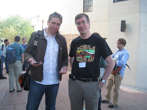
Steve Coast and Peter Batty
If you’re already involved with OpenStreetMap, this is a chance to get together with other contributors and discuss ideas – I would love to see us having more coordinated initiatives in the Denver area than we’ve had so far. And if you haven’t been involved but are curious about OpenStreetMap, this is a great opportunity to learn more. Hope to see a good turnout – please sign up here! That's Steve and me in the photo above by the way, to help you track us down if you don't know us!

Wednesday, January 27, 2010

Exciting job news: I am rejoining Ubisense

I am excited to announce that I have decided to rejoin my friends at Ubisense, where I worked from 2002 until I went to be CTO at Intergraph in 2005. I was a co-founder of Ten Sails, the company that provided early stage funding to and later merged with Ubisense.

There are two main parts to the business: Precise Real Time Location Systems (RTLS), and geospatial consulting. I’ll be involved with both sides of the business.

The RTLS technology tracks objects to an accuracy of a foot or so, using local sensors. Many, but not all, the applications are indoors, where it is especially hard to track location accurately. The difficulty is that whatever type of sensing technology you use, signals tend to reflect off walls, floors and ceilings, and direct signals are frequently blocked by furniture, people or other obstacles. This means it is very easy to get false readings that can result in serious errors in location calculation. Ubisense uses a technology called ultrawideband (UWB), enabling many interesting applications that can’t be implemented with less accurate sensing technologies.

There are potential applications in many different industries: right now we have good traction in several, including manufacturing, transit, military training, plant safety, and logistics. And many people’s favorite “unexpected” application seems to be cow tracking! The technology has really matured since I was last at Ubisense. I’ll talk in much more detail about the technology and applications in future posts.

On the geospatial consulting side of the business, Ubisense is primarily focused on implementation services to GE Smallworld customers (Smallworld continues to be the leading geospatial software platform in utilities, according to Daratech). As readers of my blog know, I am enthused about the potential of applying the new generation of geospatial technologies to more traditional GIS application areas. So I’m excited about the opportunity to work with Smallworld customers on a geospatial strategy that enhances the strengths of their existing system for complex applications by adding in newer, simpler geospatial technologies to help broaden the use of their geospatial data.

Since this is a full time role, I won’t be continuing in my role as Chief Technology Advisor at Enspiria, where I was previously spending a week a month or so. I very much enjoyed my time working at Enspiria and wish them all the best. But I will continue with my two advisory board positions, at FortiusOne and PublicEarth.

Tuesday, January 19, 2010

The GIS Certification emperor has no clothes

Today there has been a flurry of discussion about the GISP certification on twitter. I thought I would repost an article that I originally had published in Geospatial Solutions magazine in November 2003 (!!), which I can no longer find online (except in obscure archives). I think that everything there is still relevant (the "grandfathering" provision I refer to is no longer available, but it is still relevant in that many people received their GISP this way). I know and like various people involved with the program, and believe that they have good intentions, but continue to feel that it is misguided for the reasons I outline below. I have no issue with the code of ethics part of the program. And I also have no issue with a certification program that actually attempts to measure competency or skills in some specific way (for example ESRI has announced a more specific program that will evaluate skills with their products, which makes more sense to me). But I still don't see how GISP in any way evaluates a person's competency. Anyway, here's the old article, unchanged from 2003 ... (also, the FAQs on the GISCI site that I reference haven't changed since then!)

The Certification Emperor Has No Clothes
Peter Batty, Nov 1, 2003
Geospatial Solutions Magazine

The GIS certification process recently rolled out by URISA and others aims to "recommend a formal system to evaluate the competency of professionals whose primary job responsibility involves the design and use of geographic information systems" (see www.gisci.org). But a major argument against GIS certification is stated in the frequently asked questions (FAQ) at the certification site.

In answer to the question "Why not test an individual's knowledge of GIS skills to certify competence as other professions do?" the FAQ responds: "It is felt that general agreement on the skills needed for the GIS profession has not yet been achieved, given that there are so many different professions that use GIS technology . . . it is very difficult to design a single examination that can fairly evaluate the basic skills needed". After "not yet been" I would add "and will never be". The range of spatial applications and technologies, and skills needed, continues to diversify rapidly and promises to do so well into the future.

The problem of creating an exam is swept under the carpet by requiring formal GIS education in order to be certified. The obvious issue with this is that the great majority of GIS professionals do not have any formal GIS education. To overcome this objection, there is a grandfathering provision, which allows anyone with eight years of technical experience in the industry to become certified. How this evaluates anyone's competency is a mystery.

Furthermore, a five-year recertification process requires one to do a certain amount of GIS-related education. The problem with this is that the most appropriate development path for many GIS professionals may not be to take academic GIS study. It may instead be to learn more about XML, or environmental policies, or relational database tuning, or utility network design. To insist that someone has to do education within a very narrowly defined set of GIS courses or conferences would do the industry a major disservice. This is not to say that a continuing GIS education is bad. It may be a great option for some people. But it is just one of many valid options to help people do their GIS-related jobs better.

In 2008, the grandfathering option goes away, which means that a prerequisite to being certified is to have obtained a degree in GIS. If anyone took certification seriously, this would massively reduce the talent available to the spatial industry as the 99.9 percent of people who have degrees in other subjects would be excluded. Obviously I don't think that will happen, but again it begs the question of why bother with the certification process?

Does certification pass the test?
Many of the reasons advanced for certification do not stand up to scrutiny. One is helping employers with recruitment. But a glance at someone's resume will give much greater insight into whether someone is appropriately qualified for a position than certification does. Another is that "it is felt that the nation's taxpayers deserve assurance that competent and ethical GIS professionals are being hired with their public tax dollars". I smile at the thought of millions of taxpayers lying awake at night worrying about the competence of their government's GIS professionals. Personally, I'd prefer that the GIS professionals my tax dollars are funding be doing their jobs rather than spending time applying for a certificate that bears no relation to their competence. It is even claimed that GIS certification will improve the lives of citizens, which seems like a particularly desperate attempt at justification.

As spatial technology expands into the mainstream, a hugely diverse range of skills is required to implement systems and move the industry forward. The space is so broad that it makes no sense to try to have a certification process. To implement a consistent process, the certification criteria need to be either so broad that they're meaningless (as with grandfathering) or so narrow that they apply to a tiny fraction of relevant people, and would greatly hamper the industry if anyone took certification seriously.

We should not be trying to hide spatial technology in the back room and restrict who can use it. Instead, we should be promoting usage by everyone.

Monday, January 18, 2010

Great co-founder opportunity in web geo startup

A friend of mine has put together a really interesting business plan for a web-based geo startup and he's looking for a technical co-founder. I've been seriously contemplating doing it myself but have some other plans that I think will prevent me from doing so (more on that soon!). He has excellent experience as a CEO and in business development and fund-raising in this space. And he has some great investors lined up, so will be able to pay a reasonable salary from the beginning. He's looking for someone with experience building large scalable database apps, web and geo experience highly desirable. Location would be Denver/Boulder, or possibly the bay area as a second choice. Drop me an email if you're interested in finding out more.

Thoughts on the upcoming Apple Tablet

Much of the tech world has been obsessing over the rumored upcoming Apple tablet, which is expected to be unveiled to the world on January 27. So I hesitate to add more to that, but there are so many rumors out there that it's hard to wade through them, so I thought I would throw in a high level perspective on what we are likely to see, and include links to some of the more interesting articles I've come across.

I think the announcement is particularly interesting as Steve Jobs is said to have stopped Apple tablet projects before - according to the New York Times:
Another former Apple executive who was there at the time said the tablets kept getting shelved at Apple because Mr. Jobs, whose incisive critiques are often memorable, asked, in essence, what they were good for besides surfing the Web in the bathroom.
So if they are announcing this (and you buy this quote, which is plausible), there has to be something substantial about the tablet beyond just being a MacBook without a keyboard or a larger iPhone.

So I think (not based on any inside info, just on filtering all the rumors and thinking about what makes sense from an Apple perspective) that there will be two big ground-breaking things about the Apple tablet.

First, it is widely predicted that the tablet will be Apple's attempt to redefine the world of printed media (like the iPod redefined the music recording industry and the iPhone redefined the mobile phone).
This certainly makes sense. The Kindle and other eReader devices have made an interesting start in that space, but as I said in my initial review of the Kindle, it is good for sequential reading of text, but not good for more random browsing, like reading newspapers and magazines. And indeed the Kindle is only good for text, not for other kinds of media. With the Apple tablet I would assume that of course you will be able to browse arbitrary web sites, but imagine that it is also highly likely that there may be a simplified full screen user interface, which would provide a great platform for magazines, newspapers, book publishers etc to create compelling multi-media content including text, photos, video, audio, etc. Available content would presumably include a mix of free and paid, like the current app store / iTunes models (and this would give the struggling traditional news media industry another potential business model for the future). One interesting potential screen technology for such a device comes from Pixel Qi, who have been linked with the Apple tablet in some posts. Obviously it would also be a good device for watching movies, TV shows, youtube and other video content.

However, I think that doing that alone is probably not enough to hit the size of market that Apple would want. The tablet clearly won't replace an iPhone, as it won't fit in your pocket. So the question would be how many people, if they already have a smart phone and a laptop, would buy another device in between those two (in size and cost), with a lot of overlap in functionality. This is partly a cost question, and partly one of convenience - would traveling techies, even devout Apple fan boys like me, want to carry three devices everywhere: iPhone, Tablet and MacBook? I think not. So I believe that the second big thing is that the device has to be a good replacement for a laptop too, and again there are plenty of rumors that support that.

For this to be the case, obviously there needs to be a mechanism for text entry that is a good alternative to typing on a physical keyboard. A simple on screen touch keyboard probably isn't going to be good enough to persuade people to give up laptops in large volumes. So I think Apple must have more up its sleeve here. One of the more intriguing rumor threads that has appeared in various places is that the new device will have a "steep learning curve", and that the way that you interact with it is "unexpected". Obviously having a steep learning curve is not something that you would expect in general from an Apple device, especially one aimed at the mass market, unless there is a compelling reason for this. So I think that this has to be around a new mechanism for text entry, and more broadly interaction with the device. Apple acquired a company called Fingerworks in 2005, which had a lot of interesting technology in the areas of multi-touch interaction, gestures, and text entry, and Apple also owns a lot of patents in this area - these are discussed in various places including AppleInsider (who also discuss a tactile touch keyboard) and gizmodo. The old Fingerworks web site was recently taken down, which has increased speculation that their technology is involved. One of the more intriguing aspects of this is the use of "chords", which means that you can trigger different actions by pressing different combinations of fingers (for example, your thumb and third finger versus your thumb and fourth finger) - this video at CrunchGear gives some examples. Another is an approach to user interaction where the keyboard and pointing device are integrated, you don't have to move your hands from one place to another as you do with a touchpad or mouse.

So in summary, the two key things that I am looking forward to seeing are a big focus on updating printed media (magazines, newspapers, books), and something intriguing and new in terms of user interaction, covering text entry and new ways of using multi-touch surfaces. The latter could make the tablet another major step forward for computing in general (as the iPhone was in many ways ... I am amazed at how much of my "computing" I do on my iPhone these days).

One final comment is that to meet its aims as a news reading device, you will need the ability to be connected to the Internet all the time, but most people will not want to pay for two separate wireless data plans for their iPhone and Tablet, so it will be interesting to see how they will address that. Obviously I would assume they would support WiFi, but I would also assume that some or all models would also have 3G wireless built in. Will there be an option for simple tethering with an iPhone I wonder (if Fake Steve Jobs' rant - bad language warning! - has been enough to make AT&T finally get their act together!)? Or will there at least be some sort of package deal on a data plan if you have both an iPhone and an Apple Tablet?

I'm looking forward to the announcement on January 27 :) !!

Tuesday, December 8, 2009

The great OpenStreetMap license debate

If you are involved with OpenStreetMap, you may or may not be aware that a lot of work has been been going on to develop a new license. If you are signed up for any of the OpenStreetMap mailing lists, then you certainly know that this work has been going on, as there has been a torrent of emails containing very heated debate on the topic over the past week or so (although work in this area has been going on for a couple of years).

From the long and passionate emails of a small number of people, you might get the impression that the new license is some sort of subversive scheme to somehow take over or undermine OpenStreetMap.

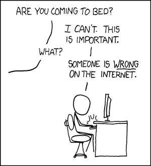
Duty Calls

Everyone is entitled to their opinion of course, but a few key points I would make are as follows:
  • I support the license change and encourage you to do so too.
  • A lot of very bright people who know way more about data licensing than I do have spent a huge amount of time working on the new license and I respect their knowledge and opinions very highly.
  • The License Working Group followed a very open and consultative process that allowed for lots of input from the community (you can see the minutes of over 50 meetings they have held this year alone).
  • The current license from Creative Commons has some significant shortcomings for databases - it is intended to apply to "creative works" and even Creative Commons says that it should not be used for databases.
  • The new license embodies very much the same spirit as the old license, but is much more enforceable, and better protects both the data and users of the data. So anyone who was comfortable contributing data to OpenStreetMap under the old license should be comfortable with the principles of the new license.
  • Switching from a "ShareAlike" license (which basically is more aggressive about ensuring that OpenStreetMap data remains open) to a "Public Domain" license (which has no restrictions), which is something that has been discussed, but would be a much bigger change than what is being proposed. This is worthy of further debate in the future but even if you support the Public Domain approach (which I lean towards but am undecided), I believe that the right short term approach is to get the project on a more solid legal footing than it is on currently (but without a major change to the original license philosophy).
  • There have been concerns expressed about the possibility of losing some data if existing contributors refuse to make their data available under the new license terms. There is a little risk here but I think it is overstated. The two licenses are so similar in their philosophy that it is hard for me to see a sensible reason why someone who was happy to contribute data under the old one would not do so under the new one. With data imports from larger organizations it may take a little time to work through some bureaucracy but I really think that should be doable, and various members of the community have volunteered to help out with this as needed.
This "human readable summary" does a good job of simply conveying the key principles of the new license.

If you would like to hear a longer discussion on these topics, you can listen to this 45 minute podcast which is a discussion on this topic including myself and various other more knowledgeable people, including several members of the License Working Group.

As I said in an email to one of the OpenStreetMap mailing lists, I think that the License Working Group has put in a huge amount of work on this effort, and I would like to sincerely thank them for that. As I said above, I think that this proposal would move OpenStreetMap onto a much stronger legal footing.

Finally, as I said at the end of the podcast and in an email to one of the lists, while the license is important, it is not the main aim of OpenStreetMap - that is to produce a great free and open map of the world. A lot of work has gone into the new license and big improvements have been made, but now is the time to vote and move on, and to let the community focus more of its energy on more important items like getting more people mapping, further improving the quality of the map data, and so on.