Sunday, November 28, 2010

FOSS4G Denver 2011 venue preview

Now that wherecamp5280 is out of the way for this year, I'm getting excited about organizing FOSS4G 2011 here in Denver next September (in case you missed the news, I'll be the conference chair). This will be a rather larger event - we're expecting 1000 or so attendees.

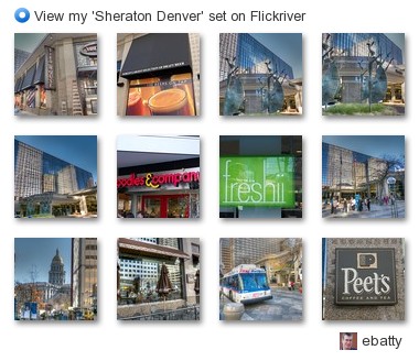
I walked down to the Sheraton in downtown Denver the other day to take some pictures for marketing purposes (for the web site and brochures, etc), and I really think it's going to be a great venue for the conference. Here are some pics ...
ebatty - View my 'Sheraton Denver' set on Flickriver
All the conference sessions will be within the hotel itself, and a large new bar connected to the hotel lobby is nearing completion, which will have 130 different beers on tap (I will try to do my conference chair's duty and sample all of them once it opens, later in December!). So that should all be conducive to great socializing and networking. Right across the street there's an excellent assortment of reasonably priced "fast but fresh" food places, so loads of convenient food options very close by, though of course the conference will be well catered! Plus there are literally hundreds of bars and restaurants within walking distance - the location gets an outstanding score of 95 for walkability at walkscore:

This hotel’s Walk Score:®

95 out of 100 — Walker’s Paradise

View on WalkScore.com

Walk Score House Icon Walk Score

On top of that, there are free shuttle buses that run continuously up and down 16th Street right outside the hotel, which makes it easy to get a little further afield around the downtown area.

I'll be sharing lots more about the conference plans over the next few months, stay tuned!

Wednesday, November 24, 2010

WhereCamp5280 review, and thoughts on unconferences

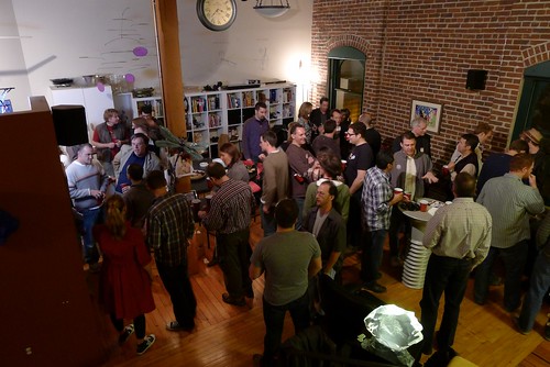
Last week we held the second annual wherecamp5280 unconference in Denver, and I think it was a great success again. The first one was organized by me, Eric Wolf and Ben Tuttle, and this year Steve Coast took the lead on organizing the main day while I did the social event, Chris Helm and Sean Gillies organized a hack day beforehand (aka hooky bobbing, courtesy of Sean, a new term to me I have to admit!), and Hurricane Coast took the lead on a follow up ski (and xylophone) mapping event. There have been several good reviews already from Andrei, James and Michael.

P1000349

As those reviews mention, a couple of big hits in terms of topics were Google Fusion tables (unfortunately I missed Josh Livni's talk as I had to leave early to organize the party) and a lot of interesting discussion around HTML5, Polymaps and other items relating to handling vector graphics in browsers - Chris Helm did a great ad hoc talk on the latter topic which generated a lot of good discussion, and there was a lot of discussion at the hack day on this. I also enjoyed Eric Wolf's talk about the work that USGS has been doing with the OpenStreetMap software stack combined with USGS data, and Steve Davis's talk on how he created some really nice basemaps for City of Atlanta. I felt the overall event was a good integrated mix of "neo" and "paleo" topics and experiences, without using those labels or worrying about them (which is how it should be).

I felt, as did several others I talked to, that last year's event was excellent but this year's was even better. There were actually fewer people this year, 70-something versus 100ish, but a stronger set of sessions this year and more interaction, as well as more people at the party :) !! There was a great assortment of interesting geo-people, and a (pleasantly) surprising number who flew in from out of town. I go to a lot of conferences, and continue to think that the unconferences I've been to rank right up there with the best events I've been to. Steve wrote a post with his perspectives on organizing an unconference, and how it took 6 hours of his time (which excludes the party organization, by the way!). This raises the interesting question of whether all the time that people invest in traditional conferences is really worthwhile (especially since I'm chair of the upcoming FOSS4G event!), and for small events I think it really is a valid question, though I don't think the unconference model can scale up too much or it loses its informality and interaction, which are really the things that make it so good. The 75 people or so that we had this year felt like a good size.

This year we had less organization than last year. There was only one pre-arranged talk this year - Steve asked me to do a short 20 minute keynote to kick things off, and that was only fixed a week in advance, and wasn't publicized ahead of time (now everyone knows why Steve was busy beforehand). The previous year we did a little more to get a few speakers lined up ahead of time and we publicized them and potential talks. We felt we needed to do that in order to get reasonable attendance, and to persuade sponsors to support us, since it was the first time we were doing the event, and a lot of potential attendees really didn't know what an unconference was all about. Personally I don't think that those slight differences in "pre-organization" made a material difference to why this year was even better than last year. It's really down to how many people come ready to talk about interesting things, which more people did this year. And it's hard to manage that or predict it, but I think a lot of it has to do with it being the second year of the event, and we had such a great buzz this year that I'm sure that will contribute to another great event next year! Talking of which, there was some casual discussion afterwards about whether there would be a wherecamp5280 next year, since we have a geo-extravaganza of bigger conferences coming to town, and a lot of us who have been involved in organizing wherecamp5280 will be heavily involved in those. I think there was a sentiment that people would like to keep it going and not lose the momentum that we have. And that momentum should mean that it will take even less than 6 hours to organize next year :), so I think it's highly likely there will be another one in 2011, probably earlier in the summer.

P1000374

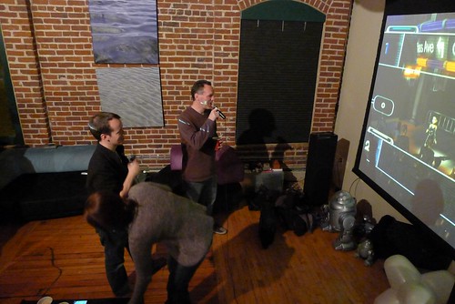
And last but not least those who stayed late at the party got to witness a quite extraordinary sequence of geo-karaoke duets from the legendary James Fee and Andrew Turner. I am still debating whether to release some video footage or whether to honor James' plea that "what happens at wherecamp5280 stays at wherecamp5280" :).

Thursday, October 21, 2010

Triple geo-conference goodness coming to Denver!!

Denver has always been known as a center for geospatial activity, and we have a great triple bill of events lined up, one in the near future and two back to back in September 2011.

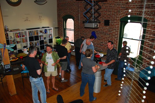
The one coming up is WhereCamp5280 on November 19th. Eric Wolf, Ben Tuttle and I ran the inaugural one last year which was a great success, see James Fee's review. I hear a rumor that James will be back this year, so I guess he must have liked it! Eric and I have both been a bit swamped on other things recently, so Steve Coast has kindly taken up the organizing reins this year, thanks to Steve for that! Last year we were kindly hosted for free by Denver University (DU), this year we will be at University of Colorado Denver on their Auraria Campus, which has the advantage of being within easy walking distance of downtown. And this year we've decided to do one day rather than two. But two things that haven't changed since last year is that the event is FREE, and we'll be holding the social event on Friday evening at my loft, I expect there will be plenty of geo-beer from the Wynkoop Brewing Company downstairs and that may fuel some geo-karaoke later on. All this is thanks to our kind sponsors, who at the time of writing include Enspiria Solutions, ESRI, Google, MapQuest and Waze.
WhereCamp5280 party
I'm expecting a great group of interesting attendees and presentations again this year, so highly encourage you to come along. And remember it's an unconference, so we are looking for as many people as possible to participate - prepare a short presentation or come prepared to lead a discussion on a topic that interests you!

Sign up for WhereCamp5280 here, and if you feel like sponsoring at anywhere from $16 to $1024 (can you tell that a techie geek set the sponsorship amounts?!) that would be great, but otherwise just sign up and enjoy the great free education, networking, and beer :).

So WhereCamp5280 is a great local event, but in September 2011 the global geo community will be converging on Denver for a fantastic double bill of FOSS4G and SotM.

For those who don't know, FOSS4G stands for Free and Open Source Software for Geospatial and is an annual international gathering organized by OSGeo. The last North American event was in 2007 in Victoria, BC, and since then it's been in Cape Town, Sydney and Barcelona, so we're delighted to have Denver join that list, and expecting a great turnout from around the world.

Eric Wolf and I led the bid to bring FOSS4G to Denver (which is one of the things we were busy on that was competing for time with WhereCamp5280). Eric was originally slated to be the conference chair, but unfortunately due to circumstances beyond his control he has had to stand down from that, and I have just taken over that role in the last week (well unless the OSGeo board fails to approve the change at their next meeting, but I'm assured that's not very likely!). I'd like to publicly thank Eric for all the work he did to bring the conference here - it was his idea initially, and definitely wouldn't have happened without all his efforts. We have the core of a great local organizing group set up already, but are still interested in recruiting a couple more folks, so if you'd like to help out please let me know. It's going to be a great event, and I'll be blogging plenty more about it over the coming months.

And on top of that it was announced today that Denver has also been selected to host State of the Map (SotM), the global OpenStreetMap conference, also in September 2011. I attended SotM in Amsterdam in 2009 and thought it was a fantastic event. Unfortunately I wasn't able to make it this year, but I will definitely be there next year :) ! The two events are distinct, but several people were involved in both bids, and we recognized that a lot of people would be interested in attending both, so the intent is for them to run back to back. The SotM date isn't fixed yet, but FOSS4G is locked in for September 12-16.

So if you're in the Denver area already, plan to be at WhereCamp5280 on Nov 19, and if you're not, make plans to be here in September 2011!
Thursday, September 16, 2010

Using Google Maps to broaden the reach of GIS: Ubisense myWorld

Readers of my blog will know that for several years I have been advocating that Google Maps and other "neogeography" systems have a strong role to play in more traditional GIS application areas. In recent months I've been quite busy working on making this a reality, and last week at the Smallworld User conference in Baltimore we announced a new product called Ubisense myWorld. I'm really excited about what we've come up with. Check out the video demo, and read on below for more information (demo video best viewed in full screen, HD, no scaling).
Our initial focus has been on using myWorld with GE Smallworld data (for those not familiar with GE Smallworld, that's where I used to work a few jobs back, and they are still the market leader for GIS in utilities and telecom). However, we are using the excellent Arc2Earth Cloud as the repository for our geospatial data in the cloud (running on Google App Engine), which has comprehensive support for uploading ESRI data, so we can integrate with ESRI too. And much of our functionality is quite applicable to other application areas. So if you might be interested in using myWorld outside a Smallworld environment, let me know!

We've had a really strong emphasis on usability - our aim is that people should be able to use the system with no training. We display all the asset data as raster tiles, which is essential for scalability - Smallworld data models tend to be among the most dense of any GIS applications, with very detailed network data, and tables often running into millions of records. But you can select anything with a single click on the map, which sends a query to the spatial database hosted in Arc2Earth (using a REST API, for those interested in that sort of thing) to get the relevant attribute information. We've found performance to be excellent with this approach.

We've implemented a very fast Google style single box search across the whole geospatial database (well, whichever tables and columns the administrator designates), so users don't need to know any technical details about table names, field names or query structures to find what they are interested in - they can just start typing a pole number, asset id, customer name, etc and we have an autocomplete capability that will show them a list of options to choose from. This uses Google's App Engine datastore, which is based on BigTable, the same technology that powers Google Search, so is obviously very fast and scalable.

Another cool feature, which I haven't seen elsewhere yet done in the same way that we've done it, is tight integration with Google Street View. When you click on an item on the map, like a pole or a customer, we calculate the best street view to show you what that looks like (where one exists - it doesn't in all cases, as not everywhere is covered by street view). So far in our testing, the data has matched up better than I thought it would, with the automatic calculation working well in most cases. However, in some cases there will be mismatches between the data in the GIS and the data in street view, so we make it easy to adjust the view and save it, so that next time you click on the same item it will remember the adjusted view. This street view capability is one of the main reasons we decided to use Google Maps rather than the various other options out there.

We also see a lot of potential for the idea of "enterprise mashups" - being able to easily pull data from other systems within an enterprise that also contain spatial data, like outage management, vehicle tracking, work management, and customer information systems, as well as data from external sources like traffic, weather and more.

Since the application is just based on JavaScript with no plug-ins, it also runs really nicely on the iPad, and on smart phones like the iPhone and Android (with a modified user interface for the phones, to accommodate the smaller screen size). We think that all of these devices have great potential for use in the field.

We are just scratching the surface with what we're showing so far - we have a long list of ideas for more things we want to do, while at the same time maintaining a very strong focus on keeping the user interface super simple. I'll post more in due course about some more detailed aspects of what we've been doing.

You also can see some of my broader perspectives behind what we're doing in the presentation I did at the Smallworld user conference in Baltimore last week:

Smallworld and Google: the best of both worlds from Peter Batty on Vimeo.

Wednesday, September 15, 2010

Recent presentations #2: "Don't make me think" talk at Ignite Spatial NoCo 2

Here's my 5 minute talk from Ignite Spatial NoCo (Northern Colorado) last night, on usability for geospatial applications. It was a fun event as usual. Thanks to Glenn Letham for the raw video, which I mixed with my slides to create this version.

Don't make me think: Ignite Spatial NoCo 2 from Peter Batty on Vimeo.

Recent presentations #1: "Geospatial Revolution" keynote talk at NSGIC

As mentioned previously, I've had a burst of conference presentations recently. Here's the video of my keynote talk at NSGIC, the latest iteration of my "geospatial revolution" talk. It includes a short demo of our new Ubisense myWorld product, more coming about that very shortly, and a fair bit of new material on topics like usability and the cloud.

Got some good feedback on twitter, here are a few samples to encourage you to watch :) !!

mapbutcher if you haven't watched @pmbatty then you must! http://vimeo.com/14949601
LearonDalby #gisrockies #GITR Glad yalll are getting to see that presentation. @pmbatty is a great guy and presentation was awesome, but you knew that.
DruidSmith Great talk by @pmbatty! Touched on many of my core areas of interest...
LearonDalby I am withdrawing my presentation from #nsgic after seeing @pmbatty keynote.

Thanks all! And thanks to NSGIC President Will Craig for the invitation to speak.

NSGIC keynote: The Geospatial Revolution from Peter Batty on Vimeo.

Wednesday, September 1, 2010

Hello again, and upcoming events!

As a few people have remarked to me recently, I haven't posted anything in a while ... have been otherwise occupied the past few months, between some interesting new work projects and some personal things. But I have quite a few talks coming up, and next week will be launching an exciting new product at the Smallworld User Conference in Baltimore, which is what I've been focused on the past few months, and I'll be blogging about a lot of interesting things relating to that in the near future.

So here's a list of upcoming events:
  • I'll be talking on "Smallworld and Google: the best of both worlds" at the Smallworld conference, on Friday September 10 (there's a clue about in the title of the talk :) !!)
  • The latest version of my "Geospatial Revolution" talk has a double outing the following week, with keynotes at the NSGIC conference in Minneapolis on Monday September 13, and at GIS in the Rockies in Loveland, CO on Wednesday September 15
  • Sneaking in between the previous two on September 14 is the second Ignite Spatial NoCo (Northern Colorado), in Windsor, CO, where the title of my talk is "Don't make me think", after the excellent book of the same name by Steve Krug, which is all about usability, something I've been working on a lot recently. I guess that's kind of a busy stretch, with four presentations at four events in four consecutive working days, plus a product launch right before that :O !! There's a good lineup of speakers for the Ignite event, with Brian Timoney, David Cole, Kate Chapman, Matt Ball and Mano Marks among those I know.
  • The week after that it's off to the UK for the Ubisense User Conference, where I'll be talking about Ubisense applications on September 22
  • I plan to stay on in the UK for the one day W3G (un)conference in Stratford upon Avon - it being an unconference there's not a formal agenda, but I hope to do a slightly expanded version of the "Don't make me think" talk there, if they'll have me
  • And for the benefit of our Danish readers, I'll be doing a keynote at the Geoforum.dk Kortdage in Ã…rhus on November 1-3 ... my mother is from Denmark so it's always nice to have an opportunity for a visit there.
In other news, Denver has been selected to host FOSS4G in 2011, the annual OSGeo conference which is being held this year in Barcelona, next week in fact. Congratulations to my friend Eric Wolf for leading the Denver bid, and I'll be one of the local committee supporting him in the organization of that.

I'm looking forward to catching up with old friends at the Smallworld conference next week, which will be the first I've been to since 2004, as I've been off roaming around other parts of the geo universe. Talking of which, I'd better get back to writing some code! Not to mention writing a presentation or two :O.